This recreation area is part of Broken Bow Lake
Directions
GPS Coordinates
Latitude 34° 9′ 55.6992″ N
Longitude 94° 43′ 28.3332″ W
This recreation area is part of Broken Bow Lake
Latitude 34° 9′ 55.6992″ N
Longitude 94° 43′ 28.3332″ W
This recreation area is part of Broken Bow Lake
Latitude 34° 10′ 52.0680″ N
Longitude 94° 43′ 41.0016″ W
This recreation area is part of Broken Bow Lake
Latitude 34° 8′ 19.7484″ N
Longitude 94° 41′ 55.0176″ W
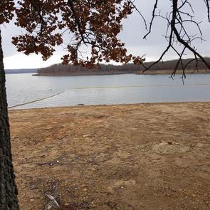
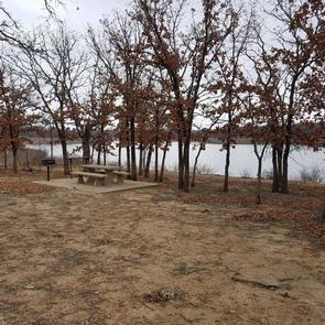
Twin Cove Point is a day-use area located at Birch Lake in Osage County, Oklahoma.
Cradled in valleys surrounded by rolling, forested hills, the lake is a perfect setting for nature lovers and other outdoor enthusiasts.
The lake is small yet scenic and offers several excellent outdoor recreational opportunities for year-round enjoyment, such as fishing, boating, swimming, horseback riding and picnicking.
Birch Lake is popular for fishing and hunting, as well as family fun and relaxation.
Fish species available for the angler include largemouth bass, walleye, spotted bass, smallmouth bass, hybrid striped bass, black and white crappie, channel and flathead catfish and sunfish.
Principal game species for hunting enthusiasts include bobwhite quail, mourning dove, fox squirrel, gray squirrel, cottontail rabbit and whitetail deer.
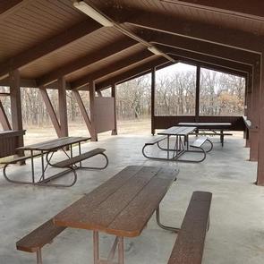
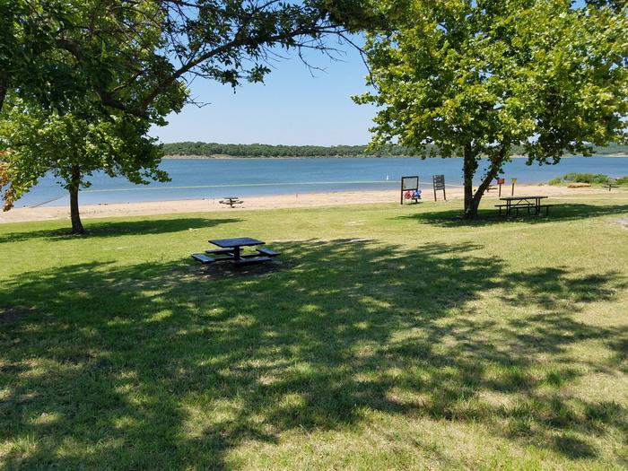
This day-use area offers three group picnic shelters that can accommodate up to 30 people. With a boat ramp, courtesy dock, playground, as well as a swim beach, Twin Cove Point has something for everyone. There are 11 primitive campsites which are not available for advanced reservations but available during the parks normal operating season and there are also 40 picnic sites available on a first-come, first-served basis.
Twin Cove Point is a diverse multipurpose area, and most sites have a mix of sun and shade. The 1,137-acre lake is part of Birch Creek, a tributary of Bird Creek.
The shoreline ranges from gentle to steep slopes with numerous rock outcrops. The hilltops and upper slopes are generously forested with small hardwood trees, primarily post oak, blackjack, other oaks, hickory, hackberry and elm.
Numerous species of grasses and wildflowers bloom in spring and fall. Forests, tallgrass prairie and shrub ecosystems surround the lake area.
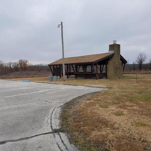
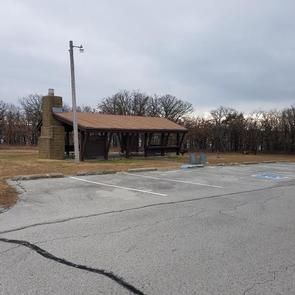
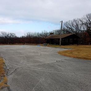
From Highway 11 in Barnsdall, Oklahoma, take a left onto West Chestnut Avenue and go 0.2 miles. Take a left on South Eighth Street and go 1.5 miles south. Take a right into the Twin Cove Point facility.
Latitude 36° 32′ 21.5999″ N
Longitude 96° 9′ 43.2900″ W
This recreation area is part of Birch Lake
Latitude 36° 32′ 5.1931″ N
Longitude 96° 10′ 12.2425″ W
Birch Cove is located at Birch Lake in Osage County, Oklahoma.
Cradled in valleys surrounded by rolling, forested hills, the lake is a perfect setting for nature lovers and other outdoor enthusiasts.
The lake is small yet scenic and offers several excellent outdoor recreational opportunities for year-round enjoyment, such as fishing, boating, swimming, horseback riding and picnicking.
Birch Lake is popular for fishing and hunting, as well as family fun and relaxation.
Fish species available for the angler include largemouth bass, walleye, spotted bass, smallmouth bass, hybrid striped bass, black and white crappie, channel and flathead catfish and sunfish.
Principal game species for hunting enthusiasts include bobwhite quail, mourning dove, fox squirrel, gray squirrel, cottontail rabbit and whitetail deer.
With a boat ramp, fishing dock and playground, as well as a swim beach, Birch Cove has something for everyone.
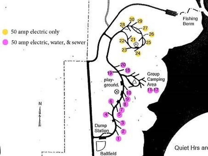
All 85 campsites are on the waterfront or within a short walk from the lake. There are also two group camping shelters that can be reserved; one shelter accommodates 6 rv/trailers, 100 people and 21 vehicles, and the other accommodates 4 rv/trailers, 60 people and 11 vehicles.
Birch Cove Campground is forested, and most sites have a mix of sun and shade. The 1,137-acre lake is part of Birch Creek, a tributary of Bird Creek.
The shoreline ranges from gentle to steep slopes with numerous rock outcrops. The hilltops and upper slopes are generously forested with small hardwood trees, primarily post oak, blackjack, other oaks, hickory, hackberry and elm.
Numerous species of grasses and wildflowers bloom in spring and fall. Forests, tallgrass prairie and shrub ecosystems surround the lake area.
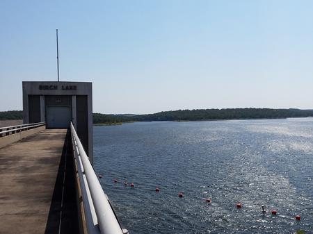
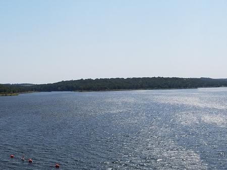

From Tulsa, take Highway 75 north to Hwy 20 west. First light in Skiatook turn right (north) on Hwy 11 to Barnsdall for 19 miles. Take a left on West Chestnut Avenue, then left on South Eighth Street at T. Travel 3 miles and Birch Cove entrance will be on the right.
Latitude 36° 32′ 3.9998″ N
Longitude 96° 9′ 43.9999″ W
This recreation area is part of Big Hill Lake
Latitude 37° 17′ 40.1380″ N
Longitude 95° 26′ 58.1513″ W
Cherryvale Park is located on the crystal clear Big Hill Lake in southeast Kansas.
The lake boasts three campgrounds, three equestrian trails and four day-use areas for the public to enjoy.
Camping, picnicking, horseback riding, hiking, swimming, fishing and other outdoor activities abound.
Campers can venture onto several hiking and equestrian trails including Big Hill Lake Horse Trail, a 17-mile trail with a variety of terrain for all ages to explore. The trail winds along a scenic hardwood ridge that offers gorgeous views all along the way.
Big Hill Lake is known as a trophy lake for fishing. Principal species of sport fish include largemouth bass, crappie, channel and flathead catfish, bluegill, walleye and smallmouth bass. The lake is also popular for fishing tournaments.
Almost all of the land around the lake is open to public hunting, except for parks and areas around the dam and control structures. Principal species hunted are whitetail deer, turkey and squirrel.
Families with kids will enjoy visiting the sand-covered beach nearby for cooling off from the summer heat and enjoying a picnic.
In addition to 23 individual campsites, the campground has one group camping area with a picnic shelter and seven campsites.
Other amenities include drinking water, restrooms, showers, a playground and a dump station.
The park is nestled in the rolling, wooded countryside that is referred to as the Little Ozarks.
With thick oak-hickory forests surrounded by prairie and farmland, the lake shore supplies a variety of habitats for birds and mammals.
Cherryvale Park offers a relaxing atmosphere with plenty of trees for shade, and the lake is only a short walk away from the campsites.
From Highway 169 in Cherryvale, Kansas, turn east onto Main Street. Continue through the town and turn right onto Olive Street. After half a block turn left onto County Route 5000. Continue 4.5 miles to the lake and follow signs to the park.
Latitude 37° 16′ 9.9998″ N
Longitude 95° 27′ 29.9999″ W
Overlook Park is located on the crystal clear Big Hill Lake in southeast Kansas.
The lake boasts three campgrounds, three equestrian trails and four day-use areas for the public to enjoy.
Camping, picnicking, horseback riding, hiking, swimming, fishing and other outdoor activities abound.
Overlook is used as a group picnic and fishing area. Nearby, visitors can venture onto several hiking and equestrian trails, including Big Hill Lake Horse Trail, a 17-mile trail with a variety of terrain for all ages to explore. There is also an interpretive trail within the park.
Big Hill Lake is known for being a trophy lake for fishing. Principal species of sport fish include largemouth bass, crappie, channel and flathead catfish, bluegill, walleye and smallmouth bass. The lake is also popular for fishing tournaments.
Almost all of the land around the lake is open to public hunting, except for parks and areas around the dam and control structures. Principal species hunted are whitetail deer, turkey and squirrel.
There are three reservable picnic shelters set along the water. Each can accommodate up to 100 people at a time. The facility also provides drinking water and flush toilets for convenience.
The park is nestled in the rolling, wooded countryside that is referred to as the Little Ozarks. Picnic shelters are forested and offer sweeping views of the lake.
With thick oak-hickory forests surrounded by prairie and farmland, the lake shore supplies a variety of habitats for birds and mammals.
Nearby Mound Valley Park has one of the largest sand beaches in southeast Kansas and offers educational programs on Saturday evenings during the summer.
Take U.S. Highway 169 to Cherryvale, Kansas, and turn east onto Main Street. Continue through the town and turn right at the end of Main Street onto Olive Street. Go 1/2 a block and turn left onto County Route 5000. Proceed 4.5 miles to Big Hill Lake and follow signs to Overlook Park.
Latitude 37° 16′ 9.9998″ N
Longitude 95° 27′ 29.9999″ W
Mound Valley is located on the crystal clear Big Hill Lake in southeast Kansas.
The lake boasts three campgrounds, three equestrian trails and four day-use areas for the public to enjoy.
Camping, picnicking, horseback riding, hiking, swimming, fishing and other outdoor activities abound.
Campers can venture onto several hiking and equestrian trails including Big Hill Lake Horse Trail, a 17-mile trail with a variety of terrain for all ages to explore. The trail winds along a scenic hardwood ridge that offers gorgeous views all along the way.
Big Hill Lake is known as a trophy lake for fishing. Principal species of sport fish include largemouth bass, crappie, channel and flathead catfish, bluegill, walleye and smallmouth bass. The lake is also popular for fishing tournaments.
Almost all of the land around the lake is open to public hunting, except for parks and areas around the dam and control structures. Principal species hunted are whitetail deer, turkey and squirrel.
Families with kids will enjoy visiting the sand-covered beach nearby for cooling off from the summer heat and enjoying a picnic.
This facility has 85 campsites, including three group sites, one of which has a picnic shelter as well. Most campsites are on the waterfront; others are just a short walk away.
Other amenities include a boat ramp and boat trailer parking, restrooms, showers and a swim beach.
The park is nestled in the rolling, wooded countryside that is referred to as the Little Ozarks.
With thick oak-hickory forests surrounded by prairie and farmland, the lake shore supplies a variety of habitats for birds and mammals.
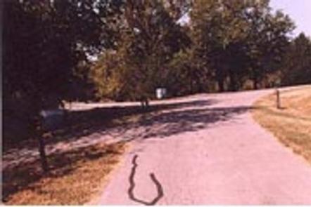
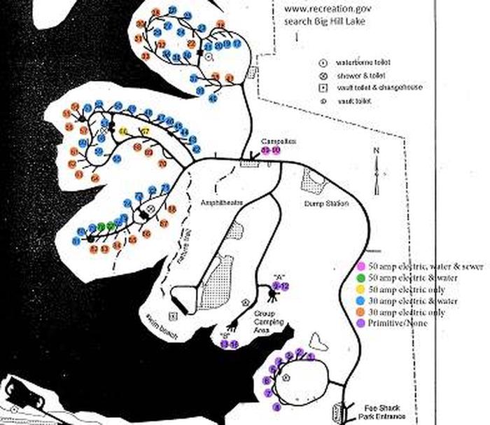
From Cherryvale, Kansas, take U.S. Highway 169 and turn east onto Main Street. Continue through the town and turn right onto Olive Street. Go 1/2 a block and turn left onto County Route 5000. Proceed 4.5 miles to Big Hill Lake and follow signs to Mound Valley.
Latitude 37° 16′ 9.9998″ N
Longitude 95° 27′ 29.9999″ W