Categories
Uncategorized

SANTA FE TRAIL

Overview

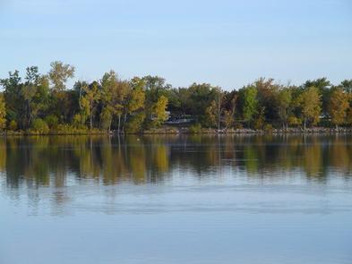
Santa Fe Trail Campground is located on the 3,310-acre Council Grove Lake in the green expanses of eastern Kansas.

Recreation

Boating is a popular pastime at the lake, and a boat ramp is located in the campground for visitors’ convenience.

The lake is known for its fishing opportunities, with crappie and catfish being the most abundant. Council Grove was also the first lake in Kansas to receive stocking of Saugeye.

Hunters will find populations of quail, prairie chicken, wild turkey and deer on the nearly 2,700 acres of hunting lands surrounding the lake.

Hiking trails wind along the lake shore and into the forest. Pioneer Nature Trail is known as the most scenic trail, with plenty of wildlife, greenery and wildflowers creating a beautiful background.

Council Grove is also a starting point for the Flint Hills National Scenic Byway. This byway travels through the best of the remaining remnants of the Tallgrass Prairie Ecosystem in North America.

Along the byway and 25 miles south is the National Tallgrass Prairie Preserve, where visitors can spot colorful wildflowers in the spring and array of autumn colors in the fall.

Facilities

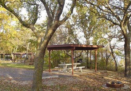
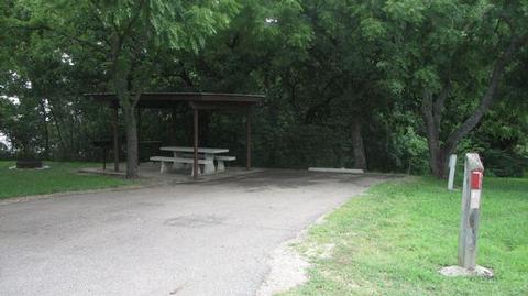
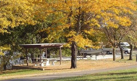
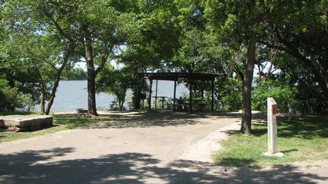
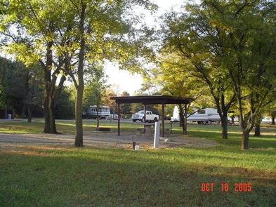
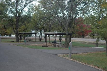
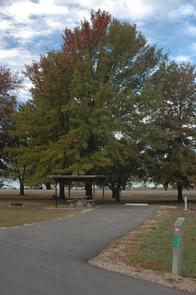
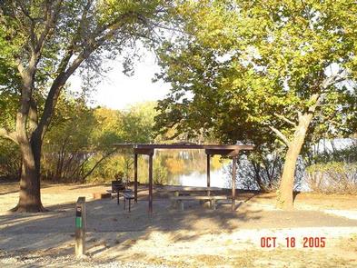
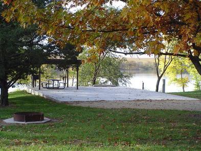
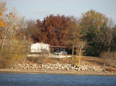
Santa Fe Trail Campground offers 35 reservable campsites, including one group camping area that can accommodate up to 75 guests. Electric hookups, flush toilets and other modern amenities are provided.

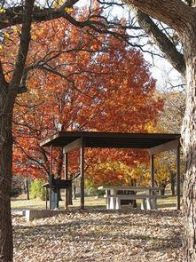
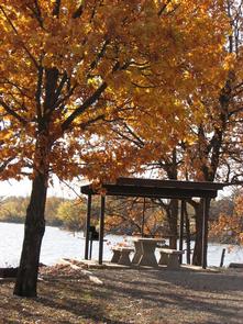
The campground has plenty of shade, along with open grassy areas for games and recreation.

Natural Features

Council Grove Lake sits in the rolling, grassy Flint Hills. The lake was created by a dam built in 1964, and now offers recreational opportunities to hundreds of thousands of visitors every year.

Historically this area is where the Osage Indians signed a treaty to establish the Old Santa Fe Trail. A marker in the town of Council Grove indicates the place where the treaty was signed.

Nearby Attractions

The town of Council Grove, located about 2 miles southeast of the lake, is a National Historic District, with seven Santa Fe National Historic Trail sites in the community.

Nearby Activities

  • Boating
  • Camping
  • Fishing
  • Hiking
  • Hunting

Gallery

Directions

From I-70, take Highway 177 south for 30 miles. Continue west across the dam road, then right onto City Lake Road. After a mile turn right into the campground entrance.

GPS Coordinates

Latitude 38° 40′ 54.8000″ N

Longitude 96° 31′ 29.5000″ W

Categories
Uncategorized

RICHEY COVE

Overview

Richey Cove Campground is located on the 3,310-acre Council Grove Lake in the green expanses of eastern Kansas.

Recreation

Boating is a popular pastime at the lake, and a boat ramp is located in the campground for visitors’ convenience.

The lake is known for its fishing opportunities, with crappie and catfish being the most abundant. Council Grove was also the first lake in Kansas to receive stocking of Saugeye.

Hunters will find populations of quail, prairie chicken, wild turkey and deer on the nearly 2,700 acres of public hunting lands surrounding the lake.

Hiking trails wind along the lake shore and into the forest. Pioneer Nature Trail is known as the most scenic trail, with plenty of wildlife, greenery and wildflowers creating a beautiful background.

Council Grove is also a starting point for the Flint Hills National Scenic Byway. This byway travels through the best of the remaining remnants of the Tallgrass Prairie Ecosystem in North America.

Along the byway and 25 miles south is the National Tallgrass Prairie Preserve, where visitors can spot colorful wildflowers in the spring and array of autumn colors in the fall.

Facilities

Richey Cove Campground offers 43 reservable campsites, including one group camping area that can accommodate up to 40 guests. Electric hookups, flush toilets and other modern amenities are provided.

The campground has plenty of shade, along with open grassy areas for games and recreation.

Natural Features

Council Grove Lake sits in the rolling, grassy Flint Hills. The lake is created by a dam built in 1964, and now offers recreational opportunities to hundreds of thousands of visitors every year.

Historically this area is where the Osage Indians signed a treaty to establish the Old Santa Fe Trail. A marker in the town of Council Grove indicates the place where the treaty was signed.

Nearby Attractions

The town of Council Grove, located about 2 miles southeast of the lake, is a National Historic District, with seven Santa Fe National Historic Trail sites in the community.

Nearby Activities

  • Boating
  • Camping
  • Fishing
  • Hiking
  • Hunting
  • Swimming site

Gallery

Directions

From I-70, take Highway 177 south for 30 miles. Richey Cove entrance is located on the west side of the highway at the dam road.

GPS Coordinates

Latitude 38° 42′ 4.2998″ N

Longitude 96° 29′ 51.2002″ W

Categories
Uncategorized

CANNING CREEK

Overview

Canning Creek Cove Park is located on the 3,310-acre Council Grove Lake in the green expanses of eastern Kansas.

Recreation

Boating is a popular pastime at the lake, and two boat ramps are located in the campground for visitors’ convenience.

The lake is known for its fishing opportunities, with crappie and catfish being the most abundant. Council Grove was also the first lake in Kansas to receive stocking of Saugeye.

Hunters will find populations of quail, prairie chicken, wild turkey and deer on the nearly 2,700 acres of public hunting land surrounding the lake.

Hiking trails wind along the lakeshore and into the forest. Pioneer Nature Trail is known as the most scenic trail, with plenty of wildlife, greenery and wildflowers creating a beautiful background.

Council Grove is also a starting point for the Flint Hills National Scenic Byway. This byway travels through the best of the remaining remnants of the Tallgrass Prairie Ecosystem in North America.

Along the byway and 25 miles south is the National Tallgrass Prairie Preserve, where visitors can spot colorful wildflowers in the spring and array of autumn colors in the fall.

Facilities

Canning Creek Campground offers 43 reservable campsites, including three group sites that can accommodate 40, 75 and 100 guests. Electric hookups, flush toilets and other modern amenities are provided.

The campground has plenty of shade, along with open grassy areas for games and recreation.

Natural Features

Council Grove Lake sits in the rolling, grassy prairie of east Kansas, known as the Flint Hills. The lake was created by a dam built in 1964, and now offers recreational opportunities to hundreds of thousands of visitors every year.

Historically this area is where the Osage Indians signed a treaty to establish the Old Santa Fe Trail. A marker in the town of Council Grove indicates the place where the treaty was signed.

Nearby Attractions

The town of Council Grove, located about 2 miles southeast of the lake, is a National Historic District, with seven Santa Fe National Historic Trail sites in the community.

Nearby Activities

  • Boating
  • Camping
  • Fishing
  • Hiking
  • Hunting

Gallery

Directions

From I-70, take Highway 177 south for 30 miles. Turn west across Dam Road, then turn right on to City Lake Road and continue for 2 miles. Campground entrance road is on the right.

GPS Coordinates

Latitude 38° 41′ 32.8999″ N

Longitude 96° 32′ 14.3002″ W

Categories
Uncategorized

Blaine Park

This recreation area is part of Canton Lake

Directions

GPS Coordinates

Latitude 36° 4′ 56.9344″ N

Longitude 98° 35′ 55.6204″ W

Categories
Uncategorized

SANDY COVE

Overview

Sandy Cove Campground is located on the north end of Canton Dam in northwest Oklahoma on the North Canadian River, just 5 miles from the town of Canton.
Canton Lake hosts a large number of campers, picnickers, boaters, fishermen and hunters every year, as one of few places in western Oklahoma to offer all of these activities.

Recreation

Canton Lake is known for its fishing opportunities, especially walleye fishing. The Walleye Rodeo fishing derby is held annually in mid-May and draws thousands of visitors to the area for the 4 day event.

Personal watercraft use, tubing and water skiing are popular on the broad expanse of water paralleling the dam where winds are subdued and gently sloping sandy beaches are inviting for swimmers and sunbathers.

Facilities

Though none of the campsites are adjacent to the lake, Sandy Cove is a very popular destination. It offers 35 family sites and one day-use group picnic shelter, all with electrical hookups. Amenities include flush and pit toilets, showers, drinking water and a large swim beach.

Natural Features

The campground is nestled in a woodland of blackjack oak and post oak trees, providing abundant shade for the camping environment.

Nearby Attractions

A major attraction for hunters is the 14,862-acre Canton Wildlife Management Area. This area, operated by the Oklahoma Department of Wildlife Conservation, is home to whitetail deer, wild turkey, bobwhite quail, rabbits, squirrel, dove and a variety of waterfowl.

There are several resturants located within 3 miles of the lake and also a casino and 9 hole golf course. Roman Nose State Park and Glass Mountains State Park are only about a half hour or so drive from the lake.

Nearby Activities

  • Camping
  • Fishing
  • Hunting
  • Water sports
  • Swimming site

Directions

From Canton, OK: Go .5 miles west on Highway 51, turn right (north) on Highway 58A and travel 2.3 miles. Turn right at the 3-way Stop intersection and continue on Highway 58A to the north end of the dam. The swimming area and campground are on the left.

GPS Coordinates

Latitude 36° 6′ 15.0001″ N

Longitude 98° 34′ 9.9998″ W

Categories
Uncategorized

LONGDALE

Overview

Longdale Campground is located on Canton Lake in northwest Oklahoma on the North Canadian River, about 6 miles from the town of Canton and 2.5 miles from the town of Longdale.
Canton Lake hosts a large number of campers, picnickers, boaters, fishermen, and hunters every year, as one of the few places in western Oklahoma to offer such a huge variety of activities.

Recreation

Canton Lake is known for its fishing opportunities, especially walleye fishing. The Walleye Rodeo fishing derby is held annually in mid-May and draws thousands of visitors to the area for the 4 day event.

Personal watercraft use, tubing and water skiing are popular on the broad expanse of water parelling the dam where the winds are subdued and the lake’s gently sloping sandy beaches are inviting for swimmers and sunbathers.

Facilities

This year-round campground offers 35 primitive campsites and one day-use group picnic shelter with electrical outlets. All campsites are nonelectric. Water hydrants are scattered throughout the campground. Drinking water is unavailable from November through March but during this time, camping is free.

Natural Features

The shores of Canton Lake and the North Canadian River are covered with eastern cottonwood, post and blackjack oak, black willow, buttonbush and roughleaf dogwood. The campground offers some shade trees among its open grassy areas.

Nearby Attractions

A major attraction for hunters is the 14,862-acre Canton Wildlife Management Area. This area, operated by the Oklahoma Department of Wildlife Conservation is home to whitetail deer, wild turkey, bobwhite quail, squirrel, rabbits, dove and several varieties of waterfowl.

There are several resturants located within 3 miles of the lake and also a casino and 9 hole golf course. There is a Disc Golf Course about 8 miles from the campground in the Big Bend Recreation Area. Roman Nose State Park and Glass Mountains State Park are only about a half hour or so drive from the lake.

Nearby Activities

  • Boating
  • Camping
  • Fishing
  • Hunting
  • Picnicking

Directions

From Canton, OK, east on HWY 51 for .2 miles to the Hwy 51/Hwy 58 intersection. Curve to the left, staying on Hwy 58 and continue north on HWY 58 for 6 miles to the south city limits of the town of Longdale. Turn left on a paved county road and continue for 2 miles to the campground entrance.

GPS Coordinates

Latitude 36° 7′ 45.0001″ N

Longitude 98° 34′ 53.0000″ W

Categories
Uncategorized

FAIRVIEW

Overview

Fairview Campground is located at Canton Lake in northwest Oklahoma on the North Canadian River, 11 miles from the town of Canton.

Canton Lake hosts a large number of campers, picnickers, boaters, fishermen, and hunters every year, as one of the few places in western Oklahoma to offer all of these activities.

Recreation

Canton Lake is known for its fishing opportunities, especially walleye fishing. The Walleye Rodeo fishing derby is held annually in mid-May and draws thousands of visitors to the area for the 4 day event.

The lake’s gently sloping sandy beaches are inviting for swimmers and sunbathers. Personal watercraft use, tubing and water skiing are popular on the broad expanse of water parelling the dam where winds are subdued.

Facilities

Fairview is a group campsite that’s a popular destination for family reunions and other groups looking for a large secluded camping area. It can accommodate up to 100 people, four RVs and several tents. Amenities include a large picnic shelter, pit toilets and drinking water.

Natural Features

The shores of Canton Lake and the North Canadian River are covered with eastern cottonwood, post and blackjack oak, black willow, buttonbush and roughleaf dogwood.

Nearby Attractions

A major attraction for hunters is the 14,862-acre Canton Wildlife Management Area. This area, operated by the Oklahoma Department of Wildlife Conservation, is home for whitetail deer, wild turkey, dove, bobwhite quail, squirrel rabbits and several varieties of waterfowl.

There are several resturants located within 3 miles of the lake and also a casino and 9 hole golf course. Roman Nose and Glass Mountains State Park are only about a half hour or so drive from the lake. There is also a Disc Golf Course about 12 miles away in the Big Bend Recreation Area

Nearby Activities

  • Camping
  • Fishing
  • Hunting
  • Swimming site

Directions

From Canton, OK: Go .2 miles west on HWY 51, turn north HWY 58A. Continue 2 miles north to a 3-way Stop intersection. Continue straight (west) through the intersection, curving right to a 4-way stop. Continue straight for a short distance, then take the right fork to the Canadian campground gate house where you will pick up the key to the Fairview Group Campground gate.

After getting the key, return to the second Stop sign and turn left, traveling north over the dam on HWY 58A. Where the road forks, continue to the right on 58A until it intersects with HWY 58. Turn left on HWY 58 to the town of Longdale. Continue through the town 1 mile north (keeping left), and turning west on the secondary road. Continue west for 3 miles to the campground.

GPS Coordinates

Latitude 36° 8′ 42.0000″ N

Longitude 98° 35′ 57.0001″ W

Categories
Uncategorized

CANADIAN

Overview

Canadian Campground is located at Canton Lake in northwest Oklahoma on the North Canadian River, just 2.5 miles from the town of Canton.

Canton Lake hosts a large number of campers, picnickers, boaters, fishermen, and hunters every year, as one of the few places in western Oklahoma to offer all of these activities.

Recreation

Canton Lake is known for its fishing opportunities, especially walleye fishing. The Walleye Rodeo fishing derby is held annually in mid-May and draws thousands of visitors to the area for the 4 day event. Use of personal watercraft,. tubing and water skiing are popular on the broad expanse of water paralleling the dam where winds are subdued and the lake’s gently sloping sandy beaches are inviting for swimmers and sunbathers.

Facilities

This campground’s central location, scenic setting, and excellent facilities make it a very popular destination. It offers 120 family sites and one day-use group picnic shelter, all with electrical hookups. Amenities include flush and pit toilets, showers, drinking water, 2 dump stations, three boat ramps and a playground.

Natural Features

The shores of Canton Lake and the North Canadian River have several varieties of trees natural to the area which include eastern cottonwood, post and blackjack oak and black willow. The campground has these species and also has been suplimented with other shade tree species including american and lacebark elm, sycamore and silver maple.

Nearby Attractions

A major attraction for hunters is the 14,862-acre Canton Wildlife Management Area. This area, operated by the Oklahoma Department of Wildlife Conservation, is home to whitetail der, wild turkey, bobwhite quail, squirrel, rabbits, dove and several varieties of waterfowl.

There are several resturants located within 3 miles of the lake and also a casino and 9 hole golf course. Roman Nose State Park and Glass Mountains State Park are only about a half hour or so drive from the lake. There is also a Disc Golf Course about 4 miles away in the Big Bend Recreation Area.

Nearby Activities

  • Camping
  • Fishing
  • Hunting
  • Picnicking
  • Water sports
  • Day use area
  • Jet skiing
  • Disc golf

Directions

From Canton, OK: Go .5 miles west on HWY 51, turn north on HWY 58A. Travel for 2.3 miles to a 3-way Stop. Continue straight (west) curving right to a 4 way Stop. Continue north a short distance, taking the right fork to the campground entrance.

GPS Coordinates

Latitude 36° 5′ 26.0002″ N

Longitude 98° 36′ 20.9999″ W

Categories
Uncategorized

BIG BEND (OK)

Overview

Big Bend Park is located on Canton Lake in northwest Oklahoma on the North Canadian River. The area hosts a large number of campers, picnickers, boaters, fishermen and hunters every year as one of the few places in western Oklahoma to offer so many activities.

Recreation

Canton Lake is known for its fishing opportunities, especially walleye fishing. The Walleye Rodeo fishing derby is held annually in mid-May and draws thousands of visitors to the area for the 4 day event. Personal watercraft use, tubing and water skiing are popular on the broad expanse of water paralleling the dam where winds are subdued. Gently sloping beaches on the northern side of the lake are an inviation to swimmers and sunbathers. A Disc Golf Course is located in the Big Bend Day Use Area.

Facilities

The campground offers 102 campsites with electricity and water hookups and 12 non-electric campsites. Many of the campsites feature panoramic views of the lake. There is also a day-use group picnic shelter, 4 boat ramps and a disc golf course.

Natural Features

The shores of Canton Lake have several varieties of trees natural to the area which include eastern cottonwood, post and blackjack oak and black willow. Other trees planted in the campground to subliment the shade for campsites include american elm, sycamore, lacebark elm and silver maple.

Nearby Attractions

A major attraction for hunters is the 14,862 acre Canton Wildlife Managent. This area, operated by the Oklahoma Department of Wildlife Conservation is home to whitetail deer, wild turkey, bobwhite quail, squirrel, rabbits, dove and several varieties of waterfowl.

There a several resturants located within 3 miles of the lake and also a casino and 9 hole golf course. Roman Nose State Park and Glass Mountains State Park are only about a 30 minute or so drive drive from the lake.

Nearby Activities

  • Boating
  • Camping
  • Hunting
  • Picnicking
  • Star gazing
  • Disc golf
  • Tubing

Directions

From Canton, OK, travel 1.8 miles west on HWY 51, then continue 4 miles north on the paved county road.

GPS Coordinates

Latitude 36° 7′ 5.9999″ N

Longitude 98° 36′ 51.9998″ W

Categories
Uncategorized

Holly Creek

This recreation area is part of Broken Bow Lake

Directions

GPS Coordinates

Latitude 34° 17′ 0.6684″ N

Longitude 94° 41′ 17.5920″ W