Categories
Uncategorized

Wildwood (OK)

Overview

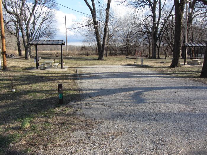
Wildwood is located on the east side of Fort Gibson Lake in northeastern Oklahoma. Most of the campsites back up to the water’s edge and offer easy access to moor boats overnight. The campsites are well laid out and offer plenty of space for camping equipment.  

Recreation

Wildwood is a prime location for camping, boating, fishing and swimming. Playground equipment, horseshoe pit and grass volleyball court offer a change of pace from the normal water related activities. The park offers a boat ramp and courtesy dock. Anglers enjoy fishing for bass, crappie and several varieties of catfish.  

Natural Features

Wildwood is surrounded by a mixed hardwood forest and offers a popular scenic drive along State Highway 80 North. Take your time and enjoy the many twists and turns as you meander through the wooded hills. The lake’s 225 miles of shoreline and thousands of acres of public hunting lands are abundant with wildlife.  

Directions

From Muskogee, OK travel north on State Highway 16 for 6 miles to the town of Okay, OK. Continue straight on State Highway 251A and travel northeast for approximately 6 miles. On the east side of the Fort Gibson dam, turn left on State Highway 80 North and travel approximately 2 miles through the community of Norwood. Turn left to continue on State Highway 80 North and travel 6 miles. The campground will be on the left hand side of the road.

GPS Coordinates

Latitude 0° 0′ 0.0000″ S

Longitude 0° 0′ 0.0000″ W

Categories
Uncategorized

Quarry Bay State Park

This recreation area is part of Fall River Lake

Directions

GPS Coordinates

Latitude 37° 39′ 22.2464″ N

Longitude 96° 3′ 15.1457″ W

Categories
Uncategorized

Fredonia Bay State Park

This recreation area is part of Fall River Lake

Directions

GPS Coordinates

Latitude 37° 39′ 11.4368″ N

Longitude 96° 5′ 49.9886″ W

Categories
Uncategorized

Rock Ridge Cove North

This recreation area is part of Fall River Lake

Directions

GPS Coordinates

Latitude 37° 39′ 45.1764″ N

Longitude 96° 6′ 41.6664″ W

Categories
Uncategorized

DAMSITE – FALL RIVER LAKE

Overview

Fall River Dam is located on Fall River, a tributary of the Verdigris River, in Greenwood County, Kansas. Opportunities for outdoor family fun and recreation include swimming, boating, water skiing, camping, picnicking and sightseeing.

Recreation

Fall River and Lake provide visitors with endless boating, water skiing, jet skiing and swimming opportunities. Anglers will find white bass, bluegill, crappie, green sunfish and channel catfish, to be plentiful.

For birdwatchers and nature lovers, there is an 8,000 acre public wildlife area, where prairie chickens, waterfowl of all kinds, rabbits, wild turkeys, white tail deer, doves and quail are commonly seen.

Facilities

This campground straddles the Fall River at the dam site. A group site with electric hookups is available, as are 31 family sites, 27 of which have electric hookups. Additional amenities include flush and vault toilets, drinking water, showers, a playground and dump station.

Natural Features

Rolling prairies and tree-dotted valleys sheltered by limestone-capped ridges surround Fall Lake. The lake is about a mile wide at the damsite and stretches up the picturesque Fall River for 15 miles. This scenic area has a wealth of native wildlife and vegetation.

Nearby Attractions

Fall River State Park is nearby, offering great fishing and birding along the river. Canoeing is also a popular activity in the park.

Nearby Activities

  • Boating
  • Camping
  • Interpretive programs
  • Fishing
  • Hiking
  • Hunting
  • Water sports
  • Wildlife viewing
  • Swimming site

Gallery

Directions

From US HWY 400, turn left (north) at mile marker 344 (Z 50 Rd) 0.09 miles, turn right (east) 2.4 miles, turn right (south) at entrance to park.

GPS Coordinates

Latitude 37° 38′ 41.7599″ N

Longitude 96° 4′ 9.3601″ W

Categories
Uncategorized

WHITEHALL BAY

Overview

Whitehall Bay Campground is located on the shores of Fall River Lake in Greenwood County, Kansas. Opportunities for outdoor family fun and recreation include swimming, boating, water skiing, camping, picnicking and sightseeing.

Recreation

For birdwatchers and nature lovers, there is an 8,000 acre Fall River wildlife area, where prairie chickens, waterfowl, rabbits, wild turkeys, white tail deer, doves and quail are commonly seen. Over 400 species of birds are protected in this area.

Hiking and biking opportunities near Fredonia Bay include the 1.5-mile Casner Creek Trail, which meanders through the forest, opening onto a breathtaking display of wildflowers during spring and summer months, or the 1-mile Turkey Run Trail, which leads visitors through a wooded ravine, over a stream and into a tall grass prairie with an impressive view of the lake.

Facilities

This campground contains four group sites with electric hookups, and 20 family sites with electric. Additional amenities include flush toilets, drinking water, showers, a playground, beach, boat ramp and a dump station.

Natural Features

Rolling prairies and tree-dotted valleys sheltered by limestone-capped ridges surround Fall Lake, which stretches up the picturesque Fall River for 15 miles. This scenic area has a wealth of native wildlife and vegetation.

Nearby Attractions

Fall River State Park is nearby, offering great hiking, fishing and birding along the river. Canoeing is also a popular activity in the park.

Nearby Activities

  • Boating
  • Camping
  • Fishing
  • Hiking
  • Hunting
  • Water sports
  • Wildlife viewing
  • Swimming site

Directions

From US HWY 400, turn left (north) at mile marker 344 (Z 50 Rd.) 0.09, turn right (east) 2.8 miles across dam, turn left (north) 0.8 miles, turn left (west), 0.7 miles, turn right (north) 1.7 miles to low water crossing, straight (north) 0.1 miles, west 0.4 miles, turn left (south) 1.1 miles to entrance to park.

GPS Coordinates

Latitude 37° 40′ 1.8001″ N

Longitude 96° 4′ 21.6599″ W

Categories
Uncategorized

Duchess Creek Marina

This recreation area is part of Eufaula Lake

Directions

GPS Coordinates

Latitude 0° 0′ 0.0000″ S

Longitude 0° 0′ 0.0000″ W
Categories
Uncategorized

Crowder Point

This recreation area is part of Eufaula Lake

Directions

GPS Coordinates

Latitude 35° 6′ 21.4318″ N

Longitude 95° 41′ 20.8401″ W

Categories
Uncategorized

Juniper Point

This recreation area is part of Eufaula Lake

Directions

GPS Coordinates

Latitude 35° 2′ 27.4729″ N

Longitude 95° 40′ 2.7980″ W

Categories
Uncategorized

Evergreen Marina

This recreation area is part of Eufaula Lake

Directions

GPS Coordinates

Latitude 35° 17′ 28.4244″ N

Longitude 95° 22′ 34.0104″ W