Categories
Uncategorized

LIZ CREEK CABIN

Overview

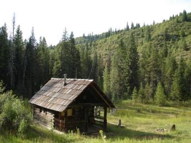
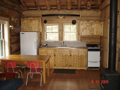
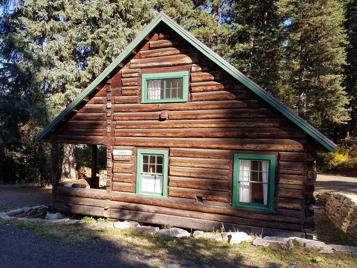
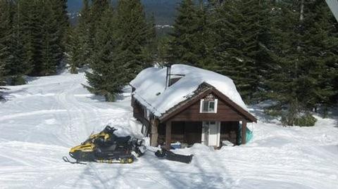
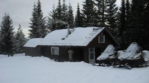
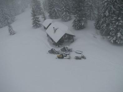
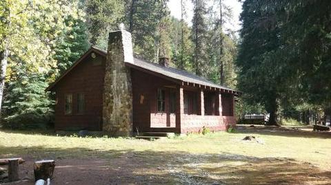
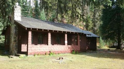
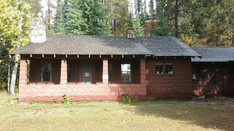
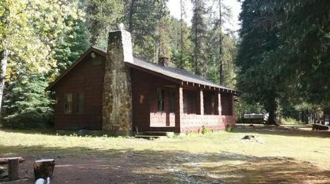
Liz Creek Cabin was built in 1929 in the remote backcountry as a Forest Service guard station and is eligible for the National Register of Historic Places. An extensive restoration that was completed in 2014 brought the cabin back to life as a rental available to the public. The small single room cabin has a loft and a covered porch. Although there are several entry points to the area, the site is only accessible by the single track multi use portion of Weitas Cr trail 20 that connects 12 mile saddle to the North Fork of the Clearwater River. Visitors are strongly advised to consult the forest website, as well as a map prior to reserving or traveling to the cabin and to call the district information desk for any questions.

Recreation

While remote, this site offers a great chance to explore both riparian habitat and mountain vistas. Along with trail 20 a multi-use motorized trail, that is also open to ATV/UTV from 12 Mile Saddle to within approximately 1.5 miles of the cabin, there are several other trails in the vicinity that offer connection to a host of recreation opportunities to the avid outdoors adventurer with berry picking, hiking, biking, sightseeing, fishing and hunting being the most popular. Recreate responsibly, be sure to check the regulations and rules to educate yourself before you recreate by visiting https://idfg.idaho.gov/ and https://www.fs.usda.gov/news/nezperceclearwater/news-events for up to date information.

Facilities

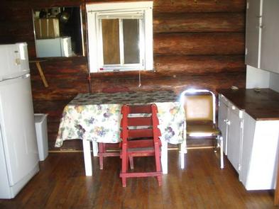
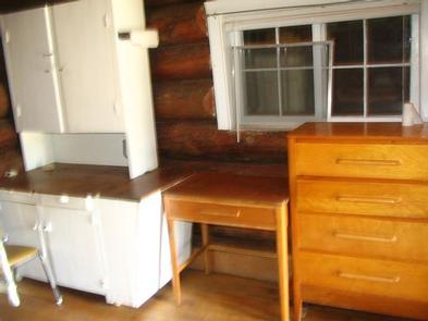
The small primitive cabin has a loft and a covered porch and can accommodate a maximum of four people. There are sleeping cots, table with chairs, wood heating stove, storage cabinet, and a fire ring outside. The remote site offers no modern amenities, an outhouse with pit toilet is located a short distance from the cabin and a stream provides water that needs to be treated before consuming. Guests must bring their own supplies and gear for a comfortable stay as there are no linens or toiletries provided. Guests are required to pick up after their pets/stock, take their trash and clean the cabin before they check-out with the provided cleaning supplies, under the “Leave it Cleaner than when you arrived” and the “Pack it in Pack it out” policies, so everyone may enjoy their stay.

Natural Features

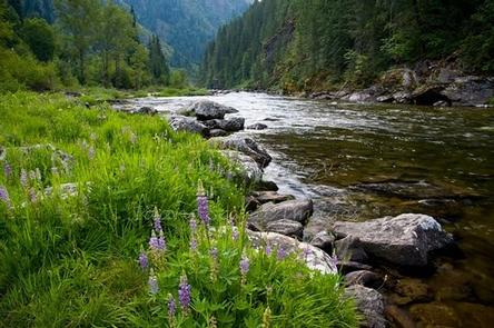
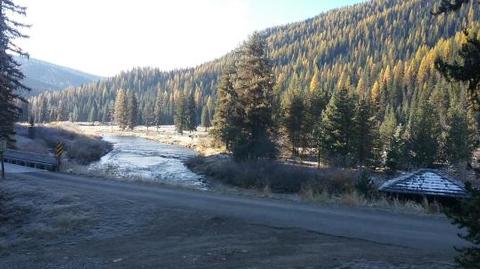
Situated at an elevation of 3,500 feet at the confluence of Liz and Weitas Creeks, the site offers a panoramic view of the diverse surroundings. The forest beyond the cabin’s meadow varies from old growth conifer trees mixed with huge cedar snags from the great 1910 fires, to steep mountain sides filled with an abundance of vegetation, including Huckleberry, Mountain Maple, Thimble berry and alder. Weitas, and to a lesser extent Liz Creek, have multiple beaver dams unique to the area providing a water abundant habitat full of native flora/fauna, so visitors are likely to have several opportunities to catch a glimpse of the many species in the area. The cabin is an ideal base camp for those looking to reconnect with nature, or as a stopover for a variety of outdoor enthusiasts as they explore the district.

Nearby Attractions

Depending on how you decide to travel into the cabin, there are many attractions along the way including: The historic Lolo Motorway that stretches 100 miles through scenic mountain landscapes with spectacular views as it parallels a portion of the Lewis and Clark and the Nez Perce trails that pass by but not limited to places such as; The Smoking Place, The Sinque Hole, and Spirit Revival Ridge. The North Fork ranger district prides itself on the diversity of world class recreational opportunities ranging from bird/wildlife watching, big game hunting, whitewater rafting, leisurely floats, secluded backpacking/equestrian trails into the high mountain backcountry, to motorized OHV/ ATV/OHV trail systems, providing unique experiences that draws visitors from around the world and of all walks of life. The historic Lolo Motorway stretches 100 miles through scenic mountain landscapes. Summer visitors can see meadows and hillsides blanketed in colorful wildflowers. Travelers should be prepared for rough, sometimes treacherous conditions. No services are located along this road, so travelers should have plenty of gas, food and water for the drive.

Nearby Activities

  • Biking
  • Historic & cultural site
  • Camping
  • Fishing
  • Hiking
  • Hunting
  • Picnicking
  • Wildlife viewing
  • Fire lookouts/cabins overnight
  • Organization site fs owned
  • Photography
  • Mountain biking
  • Berry picking
  • Star gazing
  • Scenic drive
  • Backpacking
  • Mushroom picking

Gallery

Directions

There are no “services” located on the district, so travelers should have plenty of gas, food and water for their visit, including planning for possible emergency situations. The travel route to the cabin can be quite challenging even treacherous at times, as the gravel roads on the district can be quite rough and partially blocked with debris. The preferred route into the cabin is via U.S Hwy 12 to FS Road #107 (Saddle Camp) located at mile marker 139.7 approximately 25 miles west of Powell, ID on U.S Hwy 12. Follow Rd 107 north, twelve miles to Saddle Camp Junction with roads #500 & #587. Take a hard left on the #500 Rd heading west. Follow #500 Rd 4 miles to 12 mile saddle and the trail #20 TH (Weitas Creek). From 12 mile saddle to Liz Creek Cabin is a 9.5 mile moderate hike down into the cabin on trail #20, a multi-use motorized trail open to ATV/UTV to within 1.5 miles of the cabin. Visitors are strongly advised to consult a map as well as the forest website, prior to reserving or traveling to the cabin, all mileages given are an approximation.  

GPS Coordinates

Latitude 46° 28′ 49.0001″ N

Longitude 115° 17′ 21.9998″ W

Categories
Uncategorized

KELLY FORKS CABIN

Overview

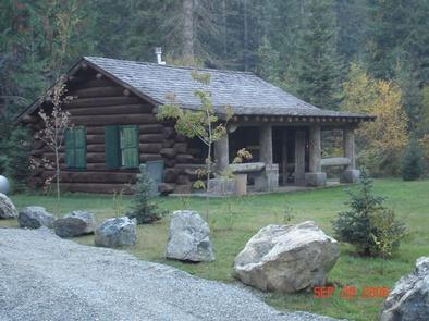
Kelly Forks cabin is located in a small clearing within an active forest service work center. It was originally built at the confluence of Moose and Kelly Creek during the mid 1930’s to be used as a stopover between the upper North Fork and the Bungalow ranger station. It was then dismantled to be floated down Kelly Cr and reassembled at its current location during the mid 1900s. Fully remodeled around 2002 with modern comforts, the cabin maintains a high demand throughout the rental season. Although assessable by car, the gravel roads on the district can be quite rough and partially blocked with debris. Visitors are strongly advised to consult a map as well as the forest website, prior to reserving or traveling to the cabin.

Recreation

There are several fishing “holes” and hiking trails located within easy walking distance of the cabin, with many more a short drive in any direction. The North Fork ranger district prides itself on the diversity of world class recreational opportunities ranging from bird/wildlife watching, big game hunting, whitewater rafting, leisurely floats, secluded backpacking/equestrian trails into the high mountain backcountry, to motorized OHV/ ATV/OHV trail systems, providing unique experiences that draws visitors from around the world of all walks of life. Be sure to check the regulations and rules to educate yourself before you recreate by visiting https://idfg.idaho.gov/ and https://www.fs.usda.gov/news/nezperceclearwater/news-events for up to date information.

Facilities

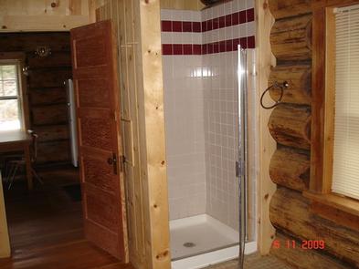
The 3 room cabin can accommodate up to six people and is furnished with electricity, lights, running water, “on demand” propane hot water, individual electric radiant heaters for each room. The bedroom contains 1 twin and 1 full size mattresses, and a dresser w/mirror. The spacious bathroom is equipped with a shower stall, flush toilet. sink and mirror. The kitchen is equipped with an electric range w/oven, microwave, refrigerator/ freezer, sink, drip coffee pot, toaster with an odd assortment of pots, pans, plates, bowls, utensils, silverware, cups, glasses and the vaulted living area provides 2 full sized futons, and table with 4 chairs. The cabin also has a large covered porch with camp chairs and a picnic area that has a table and fire ring (guests provide their own fire wood). The cabin can be reserved for a single night or up to 6 consecutive nights by the same individual or group. Guests are required to bring their own bedding, pick up after their pets and clean the cabin before they check out with the provided cleaning supplies, under the “leave it cleaner than when you arrived” policy.

Natural Features

 The cabin is situated in a small, semi secluded clearing surrounded by evergreens, cottonwood, alder mixed with huckleberries at the confluence of Kelly Creek and the North Fork of the Clearwater River. The area is known worldwide as a blue ribbon fishery for West Slope Cutthroat Trout, and the beautiful crystal clear waters are just a stone’s throw from the cabin. A wide variety of wildlife including elk, white-tailed and mule deer, black bear, wolf, cougar, bobcat, mountain goat, moose, eagle, otter, marten, fisher, osprey, raven, king fisher, dippers and many more call the steep, densely vegetated river valleys home. Seasonal changes can be particularly enjoyable from the swift moving whitewater in the spring to the extraordinary fall colors pursued by the crisp white snow line.   

Nearby Activities

  • Biking
  • Climbing
  • Historic & cultural site
  • Camping
  • Fishing
  • Hiking
  • Horseback riding
  • Hunting
  • Picnicking
  • Visitor center
  • Water sports
  • Wildlife viewing
  • Information site
  • Photography
  • Swimming
  • Mountain biking
  • Ranger station
  • Kayaking
  • Berry picking
  • Star gazing
  • Birding
  • Water access
  • Scenic drive
  • Rafting
  • Backpacking
  • Mushroom picking
  • Tubing
  • Off highway vehicle trails

Gallery

Directions

The cabin is approximately 48 miles northeast of the community of Pierce, Idaho. The last 31 miles to the cabin from Pierce are narrow, have a gravel surface and may be peppered with large potholes and rocks, so travel can be slow-going. Kelly Forks Cabin is also situated about 54 miles southwest of Superior, Montana consisting mostly of gravel surface that can be rough and partially blocked. Visitors are advised to consult a map, and the forest web site in advance of making reservations as well as prior to travel, to plan their trip accordingly.

 From Lewiston, Idaho: Travel 45 miles west on U.S. Highway 12 to the bridge at Orofino, Idaho. Cross the bridge – don’t deviate; you will travel on Michigan Avenue and then Grangemont Road, aka State Highway 7- and continue 30 miles north to the former Jaype Mill site. Turn right and continue 6 miles to the town of Pierce, Idaho. Drive through Pierce (approximately 3/4 mile) and turn left on French Mountain Road, also known as Forest Road 250. Remain on FR 250 for 48 miles until you reach the Kelly Forks Work Center.

From Superior, Montana: Travel 25 miles west on Forest Road 250, also known as the Trout Creek Road. You will cross the Hoodoo Pass at the Idaho-Montana stateline. Continue south on FR 250 for approximately 29 more miles until you reach the Kelly Forks Work Center. *NOTE: Hoodoo Pass rises to 6,000-ft elevation and is typically impassable due to snow from November until early July. This pass is not plowed and alternative access may be necessary until the snowpack melts through.

From Missoula, Montana: Travel 173 miles west on U.S. Highway 12 to the bridge at Orofino, Idaho. Cross the bridge – don’t deviate; you will travel on Michigan Avenue and then the Grangemont Road, aka State Highway 7- and continue 30 miles north to the former Jaype Mill site. Turn right and continue 6 miles to the town of Pierce, Idaho. Drive through Pierce (approximately 3/4 mile) and turn left on French Mountain Road, also known as Forest Road 250. Remain on FR 250 for 48 miles until you reach the Kelly Forks Work Center.

GPS Coordinates

Latitude 46° 42′ 59.0000″ N

Longitude 115° 15′ 32.0000″ W

Categories
Uncategorized

ADAMS RANGER STATION

Overview

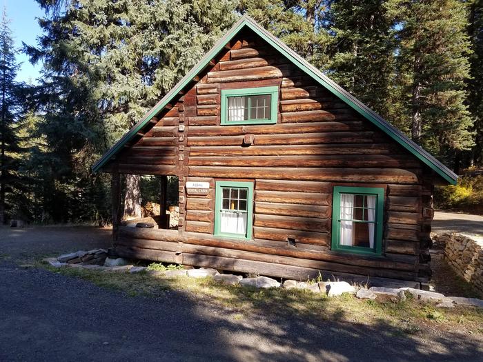
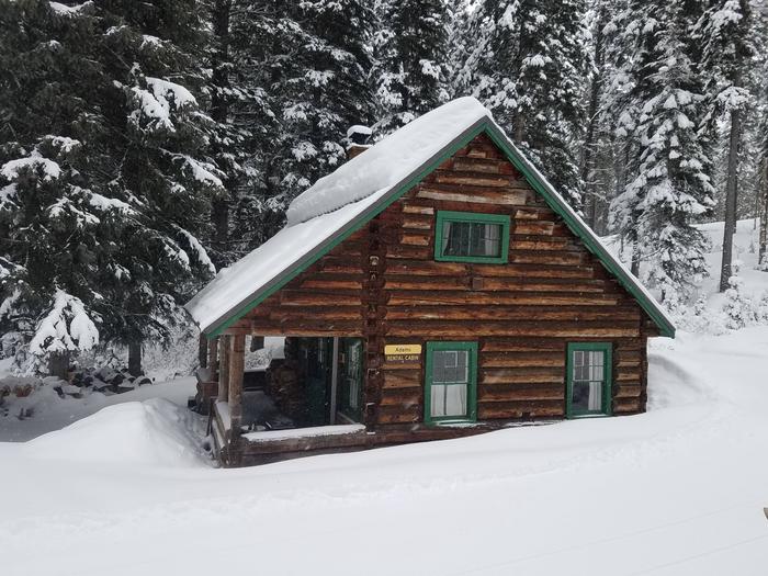
Adams Ranger Station Cabin is located in the heart of the Nez Perce National Forest at an elevation of 5,150 feet. Adams Camp served as a way station along the Milner Trail as early as 1862. The Forest Service established the area adjacent to Adams Camp as an administrative site in 1919. Adams Ranger Station was built in 1932 for the District Ranger and his family. It last served as District headquarters in 1958. Since
then, it has served as a work center, hosting a variety of summer crews.

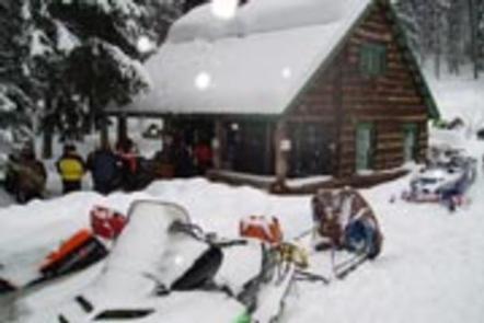
The historic cabin is available for rent year-round, except during spring melt, which typically occurs from mid-March to late May. Winter access is approximately 30 miles from Fish Creek Snow Park along a groomed snowmobile route. The cabin must be reserved in advanced; there are no walk-ups.

Recreation

Many fun activities surround Adams Ranger Station, including numerous trails. Corral Creek, a nearby stock facility and trailhead, can accommodate horses
and hikers. This trail system leads into the beautiful Gospel-Hump Wilderness.

The Milner Trail, Road #641, is open to off-road vehicles in the summer and snowmobiles in the winter.

Facilities

The cabin can accommodate up to eight people and has one futon, one double bed, two single beds and two cots. Bedding and blankets are not provided. There is a vault toilet, a propane cook stove (the oven part of the stove is not hooked up to the propane and does not work), dishes, silverware, cookware, bakeware, a table and chairs. Other amenities include propane lanterns, a broom, bucket, mop, snow shovels, axes, mauls and firewood rounds. Firewood rounds provided are for heating the cabin, not for campfires in the fire ring outside. You must provide your own firewood for the outside fire ring.

Water is not available on-site. Guests must bring their own or melt snow in the winter. It is recommended that visitors bring flashlights, extra batteries, matches,
lighters, garbage bags, candles, lantern mantles, newspapers for lighting fires, warm clothes, rain gear, boots, white gas and small propane canisters, first aid kit,
cabin shoes or slippers, maps of Nez Perce National Forest and the Gospel Hump Wilderness and lock combinations. Sleeping bags (0 to 20 degrees) may also be needed. Click here for more cabin details.

Natural Features

Adams Ranger Station is near the Gospel-Hump Wilderness and part of the Salmon River/Highway 95 Corridor. The landscape in this corridor varies from the emerald Salmon
River pouring through steep canyon walls to sapphire Moore’s Lake in the remote Gospel-Hump Wilderness.

The Gospel-Hump Wilderness has elevations ranging from 1,970 feet at the Wind River pack bridge on the Salmon River to 8,940 feet at the summit of Buffalo Hump. The northern part of the Wilderness is wetter and heavily forested; the southern part is dry and sparsely vegetated. The two parts are separated by a rugged, glaciated divide which contains the peaks for which the wilderness is named.

Wildlife in the area includes mountain lions, moose, bighorn sheep, mountain goats and wolves.

Nearby Attractions

Guests may wish to visit the historic gold-mining town of Florence. It is now a ghost town with a cemetery and a few long abandoned buildings.

Nearby Activities

  • Biking
  • Historic & cultural site
  • Camping
  • Fishing
  • Hiking
  • Horseback riding
  • Hunting
  • Winter sports
  • Wildlife viewing

Gallery

Directions

There are two ways to access this cabin in the summer:

1) From the town of Grangeville, turn south on the Grangeville-Salmon Road and follow the signs toward Gospel Hump and Salmon River. At mile marker 29, turn left (east) onto Hungry Ridge Road #309 and drive approximately 1 mile. Turn left at the signs for Adams Ranger Station/Wilson Cow Camp and climb the small hill toward the cabin with a front and side porch.

2) From Highway 14, at mile marker 17 on Highway 14, turn west up Hungry Ridge Road and look for the Adams Ranger Station and Wilson Cow Camp signs.

In winter, park at Fish Creek Snow Park and snowmobile Forest Road 221 all the way to Four Corners following the signs leading south toward the Salmon River and Gospel Hump Wilderness. Just before mile marker 29, turn left onto Hungry Ridge Road #309 and head east for approximately 1 mile. The route should be groomed all the way up to the cabin.

GPS Coordinates

Latitude 45° 39′ 17.2001″ N

Longitude 116° 2′ 22.4002″ W

Categories
Uncategorized

LOOKOUT BUTTE LOOKOUT

Overview

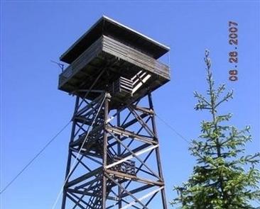
Lookout Butte has a history that spans nearly 80 years and has been home to three lookout towers. The first, built in 1923, was 45 feet tall with just a platform on which to stand. A cabin was put on the tower a couple years later. In 1935, a 50-foot tower was constructed. A new tower was built beside the old one in 1962, and this is currently available for rent.

The current 60-foot wooden tower offers panoramic views and the perfect setting for enjoying the area’s tranquility and natural beauty. Guests can enjoy the scenery from the exterior catwalk or from inside the single-room cabin.

Recreation

Several primitive roads in the area are open to mountain biking and off-road vehicles. Other activities in the area include hiking through second-growth forest and birding.

Facilities

The lookout has room for up to four people and comes with two twin beds with foam mattresses and two cots. Other amenities include a propane stove and oven, a table and chairs, a broom, a bucket and a mop.

A pit toilet sits downhill to the south of the lookout, and there’s a campfire ring near the base. Guests should be prepared to haul supplies up five flights of stairs.
Guests are required to bring their own drinking water. Other recommended supplies include food, sleeping bags or bedding, coolers, cookware and utensils, dishes, warm clothing and rain gear, flashlights, extra batteries, first aid kit, matches, toilet paper, garbage bags and the combination for the lookout and gate. Click here for more information about this lookout.

Natural Features

The lookout sits at 5,869 feet in elevation with breathtaking views of the Selway Crags in the Selway-Bitterroot Wilderness area, the Seven Devils Mountain Range, Coolwater Ridge, Pilot Knob Lookout and the Lochsa and Selway River drainages.

Nearby Attractions

Guests can take a sightseeing drive from Lowell to Selway Falls and back. This 42-mile drive offers opportunities to appreciate the pristine beauty of the Selway River, a Wild and Scenic River, as well as picturesque Selway Falls.

Nearby Activities

  • Historic & cultural site
  • Camping
  • Hiking

Gallery

Directions

Travel to Lowell, Idaho, located approximately midway between Lewiston, Idaho and Missoula, Montana on Highway 12, milepost 97. Cross the Selway Bridge, drive 3.5 miles and cross the Swiftwater Bridge on your right. Follow the signs 13 miles for about 1 hour to the lookout.

Alternative Route
From Hwy 12, cross the middle fork of the Clearwater River at the bridge above Kooskia (MP 74) turn left onto paved County Road 1842, towards the Kooskia National Fish Hatchery, pass the fish hatchery approximately, 3.5 miles stay to the left on County Route 286 for approximately 5 miles when it will convert from County Road to Forest Road 286 and turn into a gravel road. Follow Forest Road 286 for an additional 8 miles where Forest Road #470 joins from the left. Stay right on #286 for approximately 1.5 miles to the junction of Road #286 w/ Forest Road #1129 and take a left onto #1129. Travel approximately 1.3 miles and the spur road to Lookout Butte Lookout is signed and to the right. It is about 1/8th of a mile up the lookout from the main road. This last segment is a rough, outsloped, native surface road that requires high clearance to reach Lookout Butte Lookout Tower.

GPS Coordinates

Latitude 45° 29′ 21.6301″ N

Longitude 115° 52′ 28.4700″ W

Categories
Uncategorized

WALDE LOOKOUT CABIN

Overview

Walde Lookout Cabin was built in 1941 to house the employees who worked in the adjacent fire lookout, which was built in 1939. The fire lookout is still in use during
the summer and fall, so the cabin is only available for rent from approximately mid-December through late March. This charming, rustic cabin has been restored to its
original character.

Guests must reach the cabin by snowmobile, skis or snowshoes. This is a trip of around 17 miles, and guests are responsible for their own travel arrangements and
safety. The cabin provides a few conveniences, but guests will need to bring some supplies and gear to make a cozy and comfortable retreat for enjoying winter
recreation.

Recreation

Several trails crisscross the vicinity, ideal for snowmobiling, snowshoeing or cross-country skiing. There are good places to sled nearby.

Facilities

This 14×16-ft. log cabin accommodates four people with two mattresses located in a loft area and two cots. A wood stove heats the cabin, which is also equipped with a table and four chairs, a propane cook stove, propane lights, basic cooking and eating utensils, smoke alarm, mop and bucket, fire extinguisher and a snow
shovel. Click here for additional cabin details.

Firewood is available in a shed just outside. Toilet facilities consist of an outhouse with a pit toilet. Guests should be prepared to shovel a path to the cabin,
shed and outhouse, as well as remove snow from the propane tank to turn it on.

There is no electricity or running water. Guests should bring their own drinking water. Natural sources can also provide water, although it should be boiled for
culinary use. Garbage bags are also needed to pack out trash.

Bedding, flashlights or lanterns, extra batteries, matches, first aid supplies and toilet paper are not provided. Guests should remember to bring their rental permit
with them to the cabin.

Natural Features

The cabin sits at an elevation of 5,220 feet on the watershed divide between the Lochsa and Clearwater Rivers. This vantage point shows off the western slopes of the
vast Selway-Bitterroot Wilderness and the jagged peaks of the Selway Crags. The cabin is surrounded by a dense evergreen forest.

The winter landscape is blanketed in deep, pristine snow. Wildlife sightings may include mule and white-tailed deer, elk, moose, gray wolf and cougar. A variety of birds also inhabit the area.

Nearby Activities

  • Camping
  • Winter sports
  • Wildlife viewing

Gallery

Directions

From Kooskia, ID, take Highway 12 East to Kamiah. Turn left onto Woodland Road for half a mile, then take the second right onto Glenwood Road (Road 100). Stay on this paved road until you reach the junction with Yakus Creek Road (Road 519). Park here (be sure to park out of the way of traffic as there may be active logging operations throughout
the winter).

Travel by snowmobile along Road 519 about 1 mile where it turns into Road 514. Travel this road for approx. 9 miles where it intersects Road 101 at Fan Saddle. Continue on Road 101 for another 5 miles to Mystery Saddle and turn right on Road 486A. At the junction of Road 486D, stay to the right and follow Road 486A for another 2 miles to Walde Cabin.

GPS Coordinates

Latitude 46° 14′ 7.0001″ N

Longitude 115° 38′ 7.0001″ W

Categories
Uncategorized

WILDERNESS GATEWAY

Overview

Wilderness Gateway Campground provides direct access to the Wild and Scenic Lochsa River. Visitors enjoy a variety of recreational opportunities, including world famous whitewater rafting. Hiking and horseback riding trails abound in the nearby Selway-Bitterroot Wilderness area, which is the 3rd-largest in the lower 48 United States.

This large and unique campground offers respite for a variety of campers, including those with horses, horse trailers and RVs.

Recreation

The Lochsa River is world famous for its exciting whitewater rafting opportunities. Visitors do not need a permit to float the Lochsa, but technical expertise is a must. The river is also a destination fly fishing experience for cutthroat and rainbow trout, chinook salmon and steelhead. There are a number of river access points near the campground, along Highway 12.

Highway 12, also known as the Lewis and Clark Highway, winds along the narrow river canyon through evergreen trees and large rock outcroppings. Visitors to the area enjoy the scenic drive and historic sites along the way. Elk, deer, moose, bear, cougar and mountain goats make the steep canyon country their home, as well as other wildlife. A variety of birds are also active in the area.

Boulder Creek cascades down into the campground on its descent from the neighboring 1.5-million acre Selway-Bitterroot Wilderness area. Several trails head into the wilderness from the campground, including the 15-mile Lochsa Peak Trail and the 27-mile Boulder Creek Trail. A 1-mile birding trail loops around the campground and the half-mile Downriver Trail leads to a scenic river overlook. All trails are open to hiking and the wilderness trails are also open to horseback riding. The Lochsa Historical Ranger Station, a living history visitor center, is located one mile southwest of the campground.

Facilities

The campground offers dozens of accessible, single-family campsites and a large-group site, available for tent and RV camping. Utility hookups are not available and parking surfaces are paved. The group campsite can accommodate up to 208 people and 52 vehicles. If the group campsite (Loop A) is reserved, a combination code will be provided in your confirmation email to gain access to the site. Loop D hosts equestrian sites, which provide access to hitching rails, a watering and feeding station and staging area. Please only reserve Loop D if you have stock you intend to bring with you. From April until June 1 of every year, individuals with boats or campers are allowed to camp in the site. After June 1 – no other campers are allowed.

All campsites are equipped with tables and campfire rings with grills. Accessible vault toilets, flush toilets and drinking water are provided throughout the campground. Firewood is not provided, nor is it always available at the campground. Some sites are available on a first-come, first-served basis.

An adjacent, accessible group shelter is also available and can accommodate up to 200 people. If reserved, a combination code will be provided in the confirmation email. the code is needed to access the utility room which has a converter plug for the use with your personal generator. Access to the utility room is required to run the lights and electrical outlets in the pavilion. The pavilion is equipped with a stone fireplace and multiple tables. The Accessible flush toilets and a parking area are adjacent to the pavilion.

Natural Features

The campground is located in heavily wooded forest in north-central Idaho at an elevation of 2,100 feet. It is adjacent to the Lochsa River. Lochsa is a Nez Perce word meaning “rough water.” The 70-mile river and its tributaries have no dams and flow is unregulated from its headwaters near the Powell Ranger Station in the Bitterroots, to Lowell, where it joins the Selway River to form the Middle Fork of the Clearwater River. The Lochsa is one of the world’s best for continuous whitewater.

Nearby Attractions

*1 hour from access to the National Historic Lolo Trail Corridor
*1 mile from the Lochsa Historical Ranger Station and Visitor Center

Nearby Activities

  • Biking
  • Boating
  • Historic & cultural site
  • Camping
  • Fishing
  • Hiking
  • Water sports
  • Wildlife viewing
  • Day use area
  • Whitewater rafting

Gallery

Directions

From Lowell, travel east on Highway 12 for about 25 miles to the campground.

The campground is located 120 miles east of Lewiston, Idaho; and 100 miles west of Missoula, Mont. It is located at milepost 122 on Highway 12.

GPS Coordinates

Latitude 46° 20′ 24.0000″ N

Longitude 115° 18′ 24.0001″ W

Categories
Uncategorized

OHARA

Overview

O’Hara Campground sits along the Selway River amid lush vegetation and old cedar trees. This is the largest campground on the Selway, with 32 sites, and makes a great base for exploring all the recreational activities and attractions in the area.

Recreation

The Selway River is a destination fly fishing experience for cutthroat and rainbow trout and is also well-known for whitewater rafting. Several trailheads for hiking and biking can be accessed from Selway River Road and lead into the Selway-Bitterroot Wilderness area.

Facilities

The campground offers single-family sites, many of which are accessible. Each site is equipped with a picnic table, campfire ring and paved parking spur. Vault toilets, drinking water and bear-resistant dumpsters are provided.

Natural Features

In the heart of north central Idaho, rugged peaks, deep canyons, dense forests and remote wilderness comprise the Nez Perce National Forest. Due in large part to dramatic elevational differences, the forest supports a wide variety of vegetation, from cedar groves to desert ecosystems.

O’Hara is located in the Selway Wild and Scenic River Corridor, an area known for its rugged natural beauty and wildlife.

Nearby Attractions

An 11 mile sightseeing drive from Lowell to Selway Falls offers visitors opportunities to appreciate the pristine beauty of the Selway Wild and Scenic River and picturesque Selway Falls.

O’Hara is near the Fenn Ranger Station, which is on the National Register of Historic Places.

Nearby Activities

  • Boating
  • Historic & cultural site
  • Camping
  • Fishing
  • Hiking
  • Wildlife viewing

Gallery

Directions

The campground is located 7 miles off U.S. Highway 12 at Lowell, Idaho, on Selway River Road 223.

GPS Coordinates

Latitude 46° 5′ 15.0000″ N

Longitude 115° 30′ 50.0000″ W

Categories
Uncategorized

RED IVES CABIN

Overview

Red Ives Cabin is a popular location in the Idaho Panhandle National Forests. It served as the Ranger Station for the Red Ives Ranger District of the St. Joe National Forest from the 1930s to 1984. Attractions include its location on the St. Joe Wild and Scenic River. It is located 86 miles southeast of St. Maries, Idaho on Forest Road 218.  

The Cabin requires an entry key code to get in. Contact St. Joe Ranger District for instructions if you have a reservation at 208 245 2531.

Recreation

Red Ives offers several recreation opportunities from hiking and OHV use to world-class fishing and wildlife spotting. The St. Joe River also offers opportunities in floating and kayaking.

Facilities

The cabin features two bedrooms (one queen, two sets of bunkbeds and one queen size futon), kitchen, living room, bathroom and covered front porch; propane stove/oven and refrigerator; hot water, flush toilet and shower/tub. Battery lanterns are provided for lights, however visitors are recommended to bring additional battery operated lights. A gas log fireplace provides heat. Absolutely no pets.

Natural Features

The facility is set alongside the St. Joe National Wild and Scenic River. The terrain is mountainous with steep drainages and heavily forested mountain sides.

Nearby Attractions

Avery is the nearest town for conveniences.

Nearby Activities

  • Biking
  • Camping
  • Fishing
  • Hiking

Gallery

Directions

From St. Maries, Idaho: Follow paved Forest Highway 50 (St. Joe River Rd) 47 miles to Avery. Continue 29 more miles along FH-50 to the Red Ives Road #218. Turn right (south) on road #218 and travel 10 miles upstream to the Red Ives Ranger Station. The Red Ives Road is a narrow One-lane road with turn-outs.

GPS Coordinates

Latitude 47° 3′ 23.7200″ N

Longitude 115° 21′ 5.5001″ W

Categories
Uncategorized

Outfitters in St. Joe River Area

There a several professional outfitters permitted in the St. Joe River area providing guided opportunities for hunting, fishing, whitewater rafting and trail riding. 


Crooked Arrow Outfitting

Upland hunting guides


Bitteroot Mountain Outfitters

Upland hunting guides


Flat Iron Outfitting

Upland hunting guides


J&V Big Game Outfitters

Upland hunting guides


River Odesseys West (ROW)

St. Joe River rafting and guided fishing trips


Rocky Run Outfitters

St. Joe River guided fishing trips


Russel Pond Outfitters

Upland hunting guides


St. Joe Outfitters & Guides

Lodge located in the upper “Wild” segment of the St. Joe Wild & Scenic River, providing guided fishing trips


Directions

GPS Coordinates

Latitude 0° 0′ 0.0000″ S

Longitude 0° 0′ 0.0000″ W

Categories
Uncategorized

Groomed Snow Routes in the St. Joe Area

Several miles of roads are groomed on the St. Joe Ranger District in partnership with the Shoshone and Benewah County Groomer Boards.  Many of these routes connect to adjacent areas such as the Silver Valley or Elk River.  Conditions and grooming schedules vary depending on weather, road plowing and timing of snowmobile events.  Roundtop snow hut is a great stop to warm up on your ride!

Additional information on grooming conditions can be found at:  http://www.idahosnow.org/

Directions

GPS Coordinates

Latitude 0° 0′ 0.0000″ S

Longitude 0° 0′ 0.0000″ W