Categories
Uncategorized

COLD SPRINGS PEAK CABIN

Overview

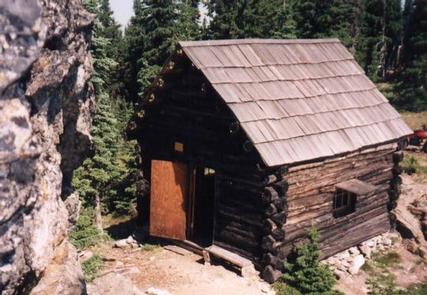
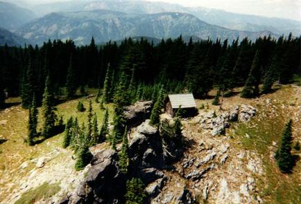
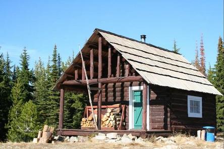
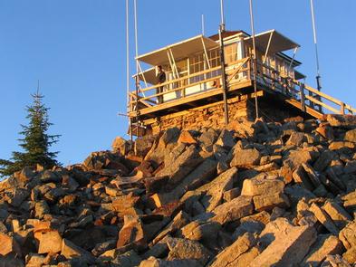
As a qualifying inclusion to the National Register of Historic Places, the primitive 12×14 log cabin was originally constructed to shelter firefighters and other work crews in 1931. Although Forest Service personnel and volunteers shored up the cabins foundation, re-shingled the roof and installed a wood heating stove, guests must bring their own supplies and gear for a comfortable stay as there are no linens or toiletries provided. The popular cabin is perched on a ridge line just off Pot Mountain trail #169 overlooking the Elizabeth Creek drainage and Ice Lake. The trailhead to the cabin is not assessable with low clearance vehicles, and the 2+ miles of trail from the trailhead to the cabin is a moderately difficult, multi-use trail with several steep grades. Although assessable by ATVs/UTVs the roads and trails leading to the cabin can be partially or fully blocked by debris or snow pack in the early season, and off trail/road motorized travel is prohibited. Visitors are strongly advised to consult the forest website, as well as a map prior to reserving or traveling to the cabin and to call the district information desk with any questions.

Recreation

Due to the unique location, the cabin is an ideal base camp for those looking to reconnect with nature, or as a stopover for a variety of outdoor enthusiasts as they explore the district. Multiple mountain lakes in the vicinity provides a welcome challenge for the avid adventurer looking to find the many secluded fishing holes. There are also several other trails in the vicinity that offer connection to a host of recreation opportunities including; berry picking, hiking, biking, sightseeing, and birding being the most popular. Recreate responsibly, be sure to check the regulations and rules to educate yourself before you recreate by visiting https://idfg.idaho.gov/ and https://www.fs.usda.gov/news/nezperceclearwater/news-events for up to date information.

Facilities

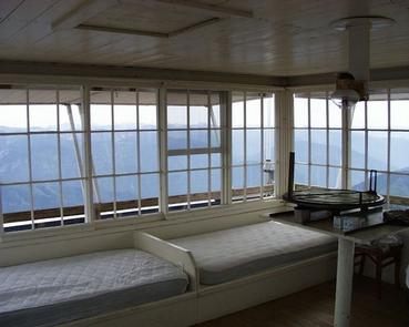
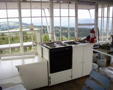
The cabin is a 1930’s primitive structure, only providing a shelter from the elements. Two spring beds, a small table with a couple chairs, a modern wood stove, and a pit toilet outhouse are the only amenities provided. There is only one stream as a reasonable water source approximately 1 mile from the cabin on trail #169 that requires treatment before consumption. Guests are required to pick up after their pets/stock, take their trash, and clean the cabin before they check-out with the provided cleaning supplies under the “Leave it Cleaner than when you arrived” and the “Pack it in Pack it out” policies so everyone may enjoy their stay. 

Natural Features

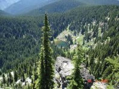
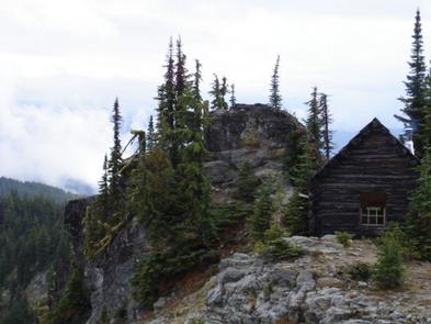
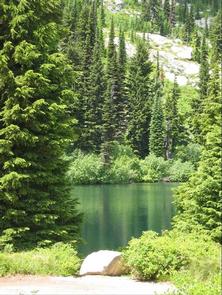
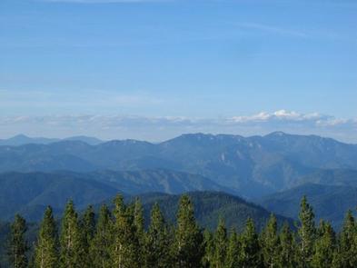
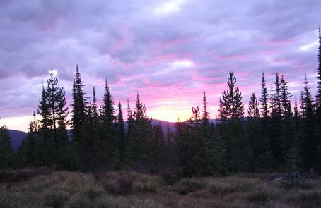
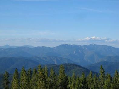
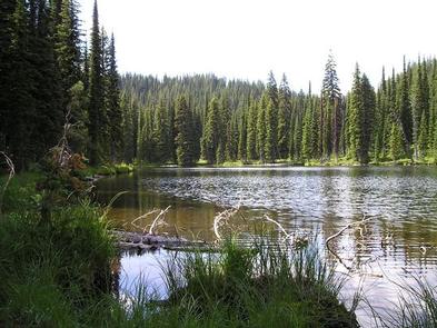
The cabin is tucked into a narrow and rocky saddle atop steep, nearly vertical cliffs directly adjacent to Cold Springs Peak. At 6,731 feet, guests enjoy open views of the Bitterroot Mountains to the east as well as a bird’s eye view of the Elizabeth Creek valley, Ice Lake, and a small meadow directly below the cabin. The area boasts a wide diversity of wildlife and birds so visitors never know what to expect while enjoying the scenery, but mule deer, mountain lion, black bear, elk, Mountain Bluebird, Mountain Jay, Raven, and Tanager are the most common. Seasonal changes can be particularly enjoyable as the storms blow through the saddle, or the extraordinary fall colors back dropped with mountains capped by advancing snow late in the season. 

Nearby Attractions

The North Fork ranger district prides itself on the diversity of world class recreational opportunities ranging from bird/wildlife watching, big game hunting, whitewater rafting, leisurely floats, secluded backpacking/equestrian trails into the high mountain backcountry, to motorized ATV/OHV trail systems providing unique experiences that draws visitors from around the world and of all walks of life. 

Nearby Activities

  • Biking
  • Historic & cultural site
  • Camping
  • Fishing
  • Hiking
  • Horseback riding
  • Hunting
  • Wildlife viewing
  • Fire lookouts/cabins overnight
  • Organization site fs owned
  • Mountain biking
  • Berry picking
  • Star gazing
  • Birding
  • Scenic drive
  • Backpacking
  • Mushroom picking

Gallery

Directions

From Missoula, Montana, drive to Greer, Idaho. Follow State Highway 11 to Weippe. Continue on toward Pierce. Turn right onto French Mountain Road 250. Follow Road 250 (paved for 17 miles, gravel thereafter) to the Bungalow Bridge, which spans the North Fork Clearwater River. Turn right and remain on Road 250. Continue to the junction with Mush Saddle Road 711, about 16 miles; turn left onto Road 711.

ORV riders can drive further on 2 miles to the junction with Cool Creek Road 5295 and turn right. This is a single-lane, dirt-surface road rarely graded or cleared and is slippery when wet. Watch for falling rocks. Climb steeply to the junction with Road 5295A. Make a sharp turn right. Two miles later, park and follow Flat Mountain Trail 176 for 2 miles to the cabin. About 1 mile in, Elizabeth Mountain
Trail 445 forks to the right. Stay left. About one-quarter mile before you get to the cabin, Pot Mountain Trail 169 forks left. Stay right and travel to the cabin.

From Lewiston, Idaho, follow U.S. Highway 12 east to Greer, Idaho. Turn left onto Highway 11 and proceed as described above.

GPS Coordinates

Latitude 46° 47′ 13.9999″ N

Longitude 115° 18′ 11.9999″ W

Categories
Uncategorized

South Fork Group Use Site #5

Overview

South Fork Campground is nestled along the South Fork of Clearwater River. All standard sites are first-come, first-served, but a group site that can accommodate up to 25 people is available for reservations.

South Fork Campground is well-suited to moderately-sized RVs. An abundance of recreational activities and scenic attractions are in the area.

Recreation

Anglers can fish for trout, steelhead and salmon in the Clearwater River. Berry picking is popular in season.

Facilities

Each campsite has a picnic table, grill, tent pad and paved parking spur. Vault toilets are provided. Drinking water is available during the peak season only. A camp host may be on-site during the summer.

Natural Features

In the heart of north central Idaho, rugged peaks, deep canyons, dense forests and remote wilderness comprise the Nez Perce National Forest. Due in large part to dramatic elevational differences, the forest supports a wide variety of vegetation, from cedar groves to desert ecosystems.

South Fork Campground is located in the Highway 14 Corridor. This area features forested canyons with sections of rugged granite outcroppings, as well as gently sloping lodgepole pine-covered uplands and lush wildflower meadows.

Nearby Attractions

The campground’s proximity to Highway 14 makes it easy to do a scenic drive. This picturesque route winds through changing landscapes and historic areas.

Nearby Activities

  • Camping
  • Fishing
  • Wildlife viewing

Directions

From the Forest Service offices in Grangeville, head south on Grangeville-Salmon Road. Turn left at the drive-in theater toward the small town Mt. Idaho. Continue on the Mt. Idaho Grade toward Elk City on Highway 14. South Fork Campground is located at milepost 14 on Highway 14.

GPS Coordinates

Latitude 45° 49′ 49.0001″ N

Longitude 115° 58′ 18.9998″ W

Categories
Uncategorized

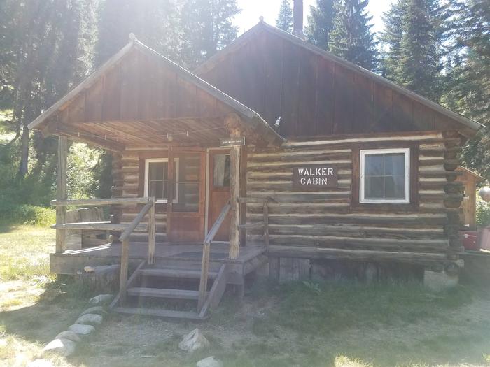
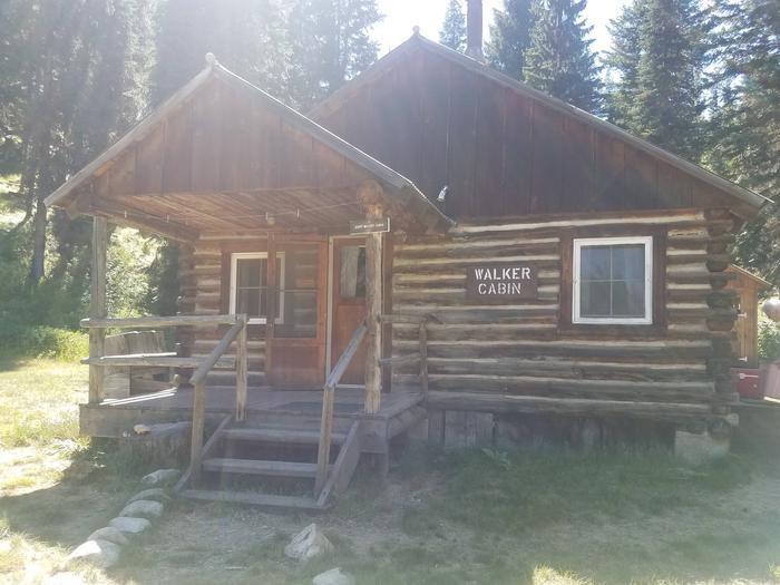
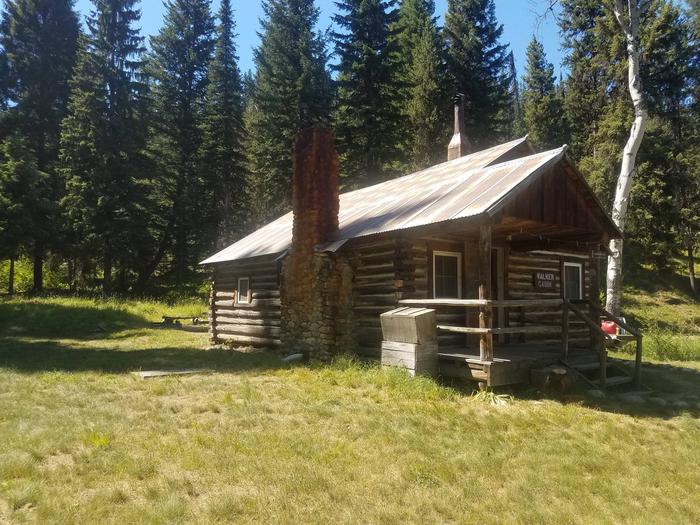
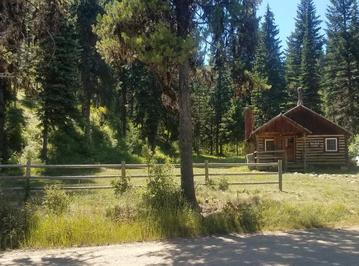
WALKER CABIN

Overview

Walker Cabin is nestled among trees just off Crooked River Road #233, which leads into the Gospel-Hump Wilderness Area, in the Nez Perce National Forest.

The cabin was originally built around 1930 as a summer home. Jerry and Helen Walker purchased the cabin in 1967, then donated it to the U.S. Forest Service in the 1980s. It is now available for public recreational use. The cabin must be reserved in advanced; there are no walk-ups.

Recreation

Crooked River is a popular area for many recreational opportunities, including hiking, trout fishing, hunting, snowmobiling and cross-country skiing. A nice hiking trail
is located behind the cabin.

Nearby trails lead to the Orogrande Summit, Buffalo Hump and Gospel Hump. Snowshoes may be required on the trails in winter. There are several lakes within a 3-mile
radius that are easily accessible by foot or off-road vehicle.

Facilities

The rustic cabin has two bedrooms with two single beds each, a living room with a wood insert in the fireplace, several chairs, a table, a broom
and a kitchen with a wood cook stove. A vault toilet is located in a separate building. Guests can find firewood in a shed behind the cabin.

Running water and electricity are not available. Guests should bring their own water supply and garbage bags to pack out their trash. Cookware, kitchen utensils,
bedding and blankets are not provided. A lantern or flashlight and extra batteries are recommended
(click here for more details about this cabin).

Natural Features

Walker Cabin sits at an elevation of 4,500 feet near the northern part of Gospel-Hump Wilderness, an area that is moist and densely forested. Big game species like
elk, mule and whitetail deer, black bear, cougar, moose, mountain goat and mountain sheep live within the Wilderness. Chukar, grouse, squirrels and songbirds make
their home here as well.

Nearby Attractions

The cabin is less than a mile from Orogrande, a historic mining site that is now a ghost town. The closest town, Elk City, Idaho, is a remote community with
limited facilities that include a grocery store, restaurant, bar, laundromat, convenience store and gas stations.

Nearby Activities

  • Biking
  • Camping
  • Fishing
  • Hiking
  • Hunting
  • Wildlife viewing

Gallery

Directions

From State Highway 14, turn south on Crooked River Road #233 and proceed approximately 8 miles to the cabin on the right.

GPS Coordinates

Latitude 45° 43′ 36.0001″ N

Longitude 115° 31′ 54.9998″ W

Categories
Uncategorized

MEADOW CREEK CABIN

Overview

Meadow Creek Cabin was originally built in the early 1920s and used as a guard station, which consists of five buildings. The main cabin contains the office, a sleeping area and the kitchen. The bunkhouse contains a main room and loft. There is also a tack shed, woodshed and outhouse. Since 1932, Meadow Creek has served as a workstation, with field crews occasionally utilizing the bunkhouse.

The cabin is nestled among the pines on a steep-sided canyon along Meadow Creek. Plan on a 15-mile hike or horseback ride to this remote backcountry cabin, which is typically available from May 1 to September 15.

Recreation

Several trails are available in the area to explore by foot or horseback, including the Meadow Creek National Recreation Trail and the Butte Creek Trail. Anglers can enjoy fly fishing for trout in Meadow Creek after July 1st each year.

Facilities

The rustic cabin has six beds with mattresses, a living room with wood heat, and kitchen facilities with a wood cook stove. A propane refrigerator, dishes, cookware, kitchen utensils, Coleman lantern (no fuel provided), mop, bucket, broom, fire extinguisher and lights are provided.

Modern bathroom facilities and electricity are not available. An outhouse is located near the cabin. An indoor but untested water system is available; all water should be filtered or boiled for five minutes. The propane tank is located on the back porch.

A corral is provided for stock use and any grazing should take place beyond the grassy area in front of the cabins. Visitors must being weed-free feed for their stock.

Visitors should bring garbage bags for packing out trash. The cabin does not have matches, bedding, flashlights, first aid supplies or Coleman fuel.
Click here for more information about this cabin.

Natural Features

Meadow Creek is a major tributary of the Selway River and is known for its clean, cold water and unspoiled beauty. Big game species found in the area include black bear, elk, moose, mule deer, whitetail deer and cougar. Visitors may also spot the Coeur d’Alene Salamander, which is only found in areas near the Selway River and Meadow Creek. Beaver, mink and otter may also be seen.

Nearby Attractions

Indian Hill Lookout is near the cabin and just outside the Selway-Bitterroot Wilderness. The present tower was built in 1951 and the cabin is occupied by staff during the summer months.

Nearby Activities

  • Camping
  • Fishing
  • Hiking
  • Horseback riding
  • Hunting
  • Wildlife viewing
  • Swimming site

Directions

Travel to Lowell, Idaho, located approximately midway between Lewiston, Idaho and Missoula, Montana on Highway 12, milepost 97 at the confluence of the Lochsa and Selway Rivers. Cross the bridge and drive 20 miles up the Selway River. Cross the Selway Falls Bridge on the right. Travel about a mile to the trailhead at Slim’s Camp. It’s a 15-mile hike or horseback ride on National Recreation Trail #726 to Meadow Creek Cabin.

Another route is from Elk City by way of Kirk’s Fork Trail #830 to Anderson Butte, then Butte Creek Trail #809 to the Meadow Creek Trail #726. Take a right on this trail approximately 1/4 mile to the Meadow Creek Cabin. This route is open to motorcycles the whole way. This route is a total of approximately 14 miles to the cabin.

GPS Coordinates

Latitude 46° 8′ 41.6198″ N

Longitude 115° 58′ 40.5001″ W

Categories
Uncategorized

FISH CREEK GROUP USE

Overview

Fish Creek Group Camp is located a few miles from the developed Fish Creek Campground. The primitive group site is a horse-friendly camp that can accommodate up to 75 people. It is also known as "Eagle’s Nest," "Girl Scout Camp" and "Fish Creek Dispersed Site."

Recreation

The Fish Creek Cross Country Trail begins at nearby Fish Creek Campground. This 7-mile multi-use loop is open to hikers, mountain bikers, horseback riders and off-road vehicle enthusiasts, and offers scenic views of Gospel Mountain, Pilot Rock and Buffalo Hump.

Facilities

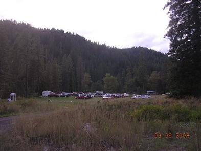
The group site can accommodate up to 75 people and 20 vehicles. Tent pads and two vault toilets are provided.

Natural Features

The group site is laid out in a large, flat area beneath tall pines within the Nez Perce National Forest in the heart of north central Idaho. The forest is comprised of rugged peaks, deep canyons, dense forests and remote wilderness. Due in large part to dramatic elevational differences, the forest supports a wide variety of vegetation, from cedar groves to desert ecosystems.

Fish Creek Group Camp is located in the Salmon River/Highway 95 Corridor. The landscape here varies from the emerald-colored Salmon River pouring through steep canyon walls to sapphire-hued Moore’s Lake in the remote Gospel-Hump Wilderness.

Nearby Attractions

Grangeville is the closest town. It offers camping supplies and a historical museum. The surrounding area offers a wealth of recreational activities, including whitewater rafting on the Salmon and Snake Rivers, golfing and fishing.

Nearby Activities

  • Biking
  • Camping
  • Horseback riding
  • Visitor center

Directions

Drive 8 miles south of the Forest Service offices on Grangeville Salmon Road (Forest Road 221). Drive past Fish Creek Campground and
take the first right onto Forest Road 2000. Drive about 1/2 mile and take
the first left.

GPS Coordinates

Latitude 45° 50′ 35.0002″ N

Longitude 116° 4′ 59.9999″ W

Categories
Uncategorized

JOHNSON BAR GROUP SITE

Overview

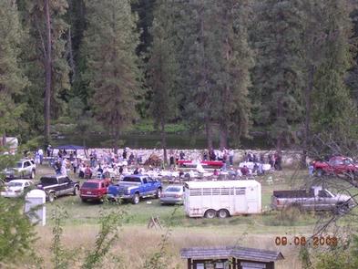
Johnson Bar Group Site is situated in a large, open field along the Selway River. The site is perfect for gatherings of up to 100 people, with room for tents and RVs. The site offers access to many recreational activities and sightseeing opportunities.

Recreation

The Selway River is a destination fly fishing experience for cutthroat and rainbow trout and is also well-known for whitewater rafting. Several trailheads for hiking and biking are accessible from Selway River Road and lead into the Selway-Bitterroot Wilderness area. Johnson Bar offers beach and boating access.

Facilities

The accessible group site can accommodate a maximum of 100 people. It is equipped with a campfire circle, two smaller campfire rings, picnic tables and drinking water. Vault toilets are adjacent to the site, and groups of 25 or more are required to rent 1-3 portable toilets.

Individual campsites are located on either side of the group site on a first-come, first served basis.

Natural Features

In the heart of north central Idaho, rugged peaks, deep canyons, dense forests and remote wilderness comprise the Nez Perce National Forest. Due in large part to dramatic elevational differences, the forest supports a wide variety of vegetation, from cedar groves to desert ecosystems.

Johnson Bar is located in the Selway Wild and Scenic River Corridor, an area known for its rugged natural beauty and wildlife.

Nearby Attractions

An 11-mile sightseeing drive from Lowell to Selway Falls offers visitors opportunities to appreciate the pristine beauty of the Selway Wild and Scenic River and picturesque Selway Falls.

Johnson Bar is near the Fenn Ranger Station, which is on the National Register of Historic Places.

Nearby Activities

  • Boating
  • Historic & cultural site
  • Camping
  • Fishing
  • Hiking
  • Wildlife viewing

Gallery

Directions

Johnson Bar Group Site is located 4.5 miles east of Lowell, ID on Forest Road 223 (Selway River Road). The group site is between the paved road and the river.

GPS Coordinates

Latitude 46° 6′ 13.0000″ N

Longitude 115° 33′ 33.0001″ W

Categories
Uncategorized

LIZ BUTTE CABIN

Overview

This facility is no longer reservable.

Recreation

Facilities

Natural Features

Nearby Attractions

Nearby Activities

  • Biking
  • Historic & cultural site
  • Camping
  • Hiking
  • Horseback riding
  • Wildlife viewing

Gallery

Directions

GPS Coordinates

Latitude 46° 26′ 53.9999″ N

Longitude 115° 19′ 53.0000″ W

Categories
Uncategorized

CASTLE BUTTE LOOKOUT

Overview

Castle Butte Lookout is a unique cabin perched on a rocky point, 6,659 feet above sea level. It offers breathtaking, 360-degree views of the Selway-Bitterroot Wilderness, the Seven Devils Mountains, the Great Burn area and the deep canyons of the North Fork Clearwater River’s upper drainages.

A cabin was first constructed on this site in 1916 and was replaced in 1928 with a log cabin featuring a cupola. The current lookout was built in 1950.

Access to the lookout is via the Lolo Motorway, a primitive, single-lane road constructed by the Civilian Conservation Corps in the early 1930s. It is not recommended for large RVs, vehicles with low ground clearance or trailers. Guests should be prepared to walk about 100 feet up steep, rocky terrain to reach the lookout.

Castle Butte Lookout is equipped with a few creature comforts, but guests will need to bring some gear and supplies to help make their stay enjoyable. The panoramic view guarantees a memorable stay.

Recreation

Hikers can follow the paths of the Nez Perce and Lewis and Clark on the historic Lolo Trail. The Lolo Motorway is popular with off-road vehicle enthusiasts. Click here for an Idaho OHV safety message.

Huckleberries are abundant in the summer, offering good berry picking opportunities.

Facilities

Castle Butte Lookout can accommodate four people and comes equipped with two twin beds with foam mattresses, two cots, a table with two chairs, mop & bucket, a propane cook stove, propane lights, propane heater and propane. A pit toilet is located in a separate building outside. Click here for additional cabin details.

The cabin does not have electricity or water. Guests should bring their own water supply as there is no close water source. Guests must provide their own emergency lighting, garbage bags, bedding, matches, toilet paper, cookware and cooking utensils. The cabin should be cleaned before departure.

Natural Features

The lookout is surrounded by a rocky landscape that quickly gives way to dense forests of lodgepole and ponderosa pines.

This unique facility offers an ideal vantage point to watch sunrises and sunsets, and gaze at the stars. Wildlife enthusiasts may spot eagles, bears, moose, elk, deer and mountain goats.

Nearby Attractions

The Lolo Motorway stretches for 100 miles through scenic mountain landscapes. Summer visitors can see meadows and hillsides blanketed in colorful wildflowers. Travelers should be prepared for rough, sometimes treacherous conditions. No services are located along this road, so travelers should have plenty of gas, food and water for the drive.

Nearby Activities

  • Historic & cultural site
  • Camping
  • Hiking

Gallery

Directions

From Missoula, MT: Take US Highway 12 West for about 65 miles. All roads from this point are gravel or dirt and a vehicle with high clearance is suggested. Turn right onto Forest Service Road 108 (Waw’aalamnime Rd), go about .5 miles, turn left onto Forest Service Road #566 (Doe Creek) which is a very narrow and winding road. Travel approximately 1 mile to an intersection with Forest Service Road #500 (Lolo Motorway), turn left onto the Lolo Motorway. Travel west approximately 18 miles. Turn left onto Forest Service Road #561 (Castle Butte Rd) and travel south about 1.5 miles to the Castle Butte Lookout. Estimated driving time from Missoula is 3 hours.

From Kooskia, ID: Take US Highway 12 East for approximately 17 miles and turn left onto Forest Service Road 101 (Smith Creek Rd). All roads from this point are gravel or dirt and a vehicle with high clearance is suggested. Travel approximately 21 miles, then take a slight right onto Forest Service Road 500 (Lolo Motorway) at the Mex Mountain junction. Travel approximately 33 miles, turn right onto Forest Service Road 561. Turn right onto Forest Service Road #561 (Castle Butte Rd) and travel south about 1.5 miles to the Castle Butte Lookout. Estimated driving time from Kooskia is 5 hours.

From Kamiah, ID: Take US Highway 12 East for about 1 mile and turn left at the end of the bridge over the Clearwater River onto Woodland Road. Drive about 1 mile and turn right onto Glenwood Road (Forest Service Road 100). Drive for about 23 miles to Road 103 at the Musselshell junction. All roads from this point are gravel or dirt and a vehcile with high clearance is suggested. Turn right onto Forest Service Road 103 (Gravey Creek Road) and travel 11 miles to Beaver Dam Saddle. Turn right onto Forest Service Road 104, travel for 1 mile. Take a left onto Road 500 (Lolo Motorway) travel approximately 20 miles to Forest Service Road 561 (Castle Butte Road). Turn right onto Forest Service Road #561 (Castle Butte Rd) and travel south about 1.5 miles to the Castle Butte Lookout. Estimated driving time from Kamiah is 4 hours.

GPS Coordinates

Latitude 46° 26′ 3.0001″ N

Longitude 115° 13′ 9.0001″ W

Categories
Uncategorized

POWELL CAMPGROUND

Overview

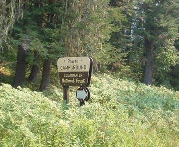
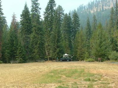
Powell Campground provides direct access to the Lochsa Wild and Scenic River, one of Idaho’s most scenic waterways. The Selway-Bitterroot Wilderness lies on the opposite side of the river. The campground is within walking distance of a small general store, fuel, lodging and a restaurant. The Powell Ranger Station is nearby as well, but all visitor services have moved to Lolo Pass Visitor Center.

Recreation

The Lochsa River provides visitors with opportunities for fishing and other water-related recreation. Cutthroat and rainbow trout, Chinook salmon and steelhead swim in the clear waters. The Lochsa is world-famous for its exciting whitewater rafting opportunities. A permit is not necessary to float the river, but technical expertise is a must.

A variety of hiking and horseback riding trails are available in the wilderness area. The 1.5-mile Powell Complex Trail begins near the campground and leads west through cool, shady cedar and larch trees, making for a relaxing day trip. Hunting is also a popular activity in the rugged and primitive landscape.

Highway 12, also known as the Lewis and Clark Highway, winds along the narrow river canyon through evergreen trees and past large rock outcroppings. Visitors enjoy the scenic drive and historic sites along the way.

Facilities

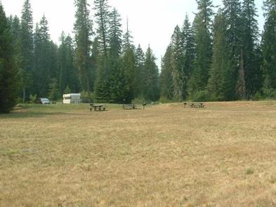
The campground offers single-family sites for tent and RV camping. Some sites offer electrical hookups (50 amps) and parking surfaces are paved throughout the campground. Additional sites are available on a first-come, first-served basis.

Each site is equipped with a table and campfire ring with grill. Accessible vault toilets and drinking water are provided throughout the campground. An accessible flush toilet is adjacent to the day use area. Firewood is not provided and it is often not available.

Natural Features

Lochsa is a Nez Perce word meaning “rough water.” The 70-mile river and its tributaries have no dams and the flow is unregulated from its headwaters near the Powell Ranger Station in the Bitterroots, to Lowell, where it joins the Selway River to form the Middle Fork of the Clearwater River. The Lochsa is one of the world’s best for continuous whitewater.

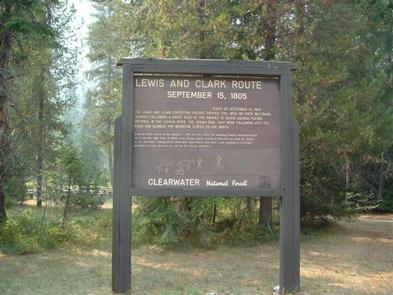
The campground is situated in a dense forest in north-central Idaho at an elevation of 3,400 feet. It is across the river from the border of the 1.5-million acre Selway-Bitterroot Wilderness. Famed explorers Lewis and Clark passed through on their way to the Pacific Ocean in September of 1805.

Elk, deer, moose, bear, cougar and mountain goats make the steep canyon country their home.

Nearby Attractions

A variety of services are available in the rustic resort area near the campground including a general store, lodging, food and fuel. Fishing licenses are also available for purchase.

The nearest free dump station is 40 miles west on Highway 12, at the Wilderness Gateway Campground.

Nearby Activities

  • Camping
  • Fishing
  • Hiking
  • Hunting
  • Wildlife viewing
  • Day use area

Gallery

Directions

The campground is located 160 miles east of Lewiston, Idaho, and 60 miles southwest of Missoula, Montana. From Lowell, travel east on Highway 12 for about 65 miles, to milepost 162.

GPS Coordinates

Latitude 46° 30′ 6.9998″ N

Longitude 114° 43′ 1.9999″ W
Categories
Uncategorized

FISH CREEK PAVILION

Overview

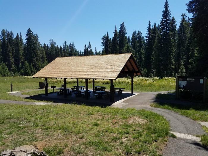
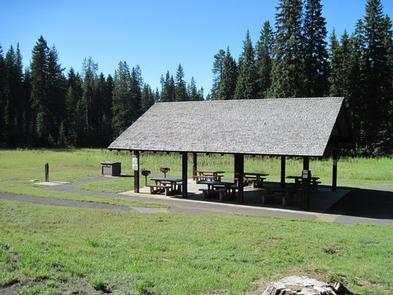
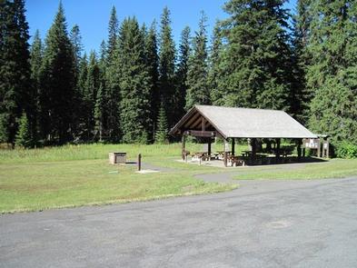
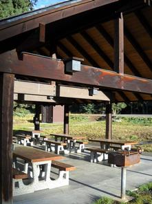
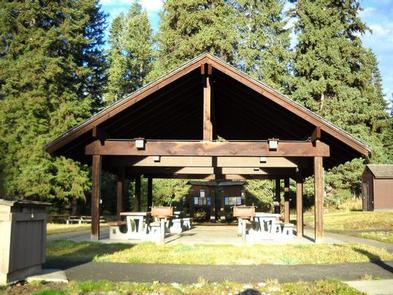
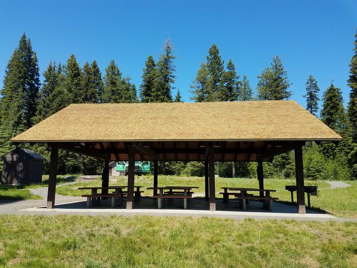
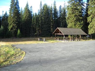
Fish Creek Pavilion is a day-use picnic area adjacent to Fish Creek Campground. It’s situated in a meadow surrounded by conifers and near a variety of recreational activities.

Recreation

The Fish Creek Cross Country Trail begins within the adjacent campground. This 7-mile multi-use loop is open to hikers, mountain bikers, horseback riders and off-road vehicle enthusiasts. Hikers will find additional foot trails as well.

Visitors who wish to camp can stay at Fish Creek Campground, which has first-come, first-served sites. Groups can reserve the Fish Creek Group Site about 2 miles down the road.

Facilities

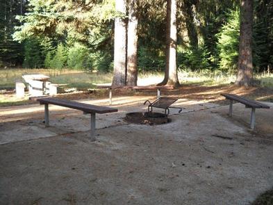
The accessible pavilion can accommodate up to 75 people. Eight picnic tables, two barbecue grills, electricity and lights are provided. Drinking water is available from June 15 to September 15. A short paved path leads to additional picnic tables and campfire circle with benches.

Natural Features

In the heart of north central Idaho, rugged peaks, deep canyons, dense forests and remote wilderness comprise the Nez Perce National Forest. Due in large part to dramatic elevational differences, the forest supports a wide variety of vegetation, from cedar groves to desert ecosystems.

Fish Creek Pavilion is located in the Salmon River/Highway 95 Corridor. The landscape here varies from the emerald Salmon River pouring through steep canyon walls to sapphire Moore’s Lake in the remote Gospel-Hump Wilderness.

Nearby Attractions

Grangeville is the nearest town. It offers camping supplies and a historical museum.

Nearby Activities

  • Camping
  • Hiking
  • Horseback riding

Gallery

Directions

From Grangeville, head south on Grangeville-Salmon Road for approximately 7 miles to the Fish Creek Meadows area. Turn right onto Forest Road 4600. The entrance to Fish Creek Pavilion is located 300 feet ahead on the left.

GPS Coordinates

Latitude 45° 51′ 28.0001″ N

Longitude 116° 4′ 54.0001″ W