Categories
Uncategorized

ELK CREEK PAVILION (CLEARWATER NF)

Overview

Elk Creek Pavilion offers visitors a little bit of everything. From scenic views and vistas, to attractive waterfalls and foliage, the pavilion provides a great place to host group events in the mountains of north central Idaho. Recreational opportunities abound in the area and a variety of services are located nearby.

Recreation

Elk Creek and nearby Elk River Reservoir provide visitors with opportunities for fishing and other water-related recreation. Cutthroat and rainbow trout, chinook salmon and steelhead swim in the clear waters. Fishing or hunting are popular activities in the rugged and primitive landscape.

Hiking, mountain biking and horseback riding are available on the area’s many trails and forest roads. The Elk Creek Falls Trail takes hikers 3.5 miles to the tallest waterfall in the state.

Facilities

The pavilion measures 42 feet wide by 80 feet wide and has a large stone fireplace situated towards the rear of the structure. The pavilion offers an ideal location to host group events such as weddings and reunions. Additional parking arrangements are required for groups greater than 50 people. Arrangements must be made by contacting the Palouse Ranger District office at (208) 875-1131.

The campground offers single-family sites for tent and RV camping, most of which are available on a first-come, first-served basis. Electrical hookups are available at six reservation sites and 17 first-come, first-served sites.

Each site is equipped with a table and campfire ring with grill. Accessible vault toilets and drinking water are provided. A more rustic overflow section offers additional campsites.

Natural Features

The pavilion is situated alongside Elk Creek Campground in a mature pine forest in the Nez Perce-Clearwater National Forests, next to Elk Creek, at an elevation of about 3,000 feet. The surrounding area is home to the tallest waterfall in Idaho, as well as the largest cedar tree east of the Cascade Range.

Elk, deer, moose, bear and cougar make the steep forested country their home.

Nearby Attractions

The town of Elk River is less than a mile from the campground and offers a variety of basic services, including gas, groceries, showers and fishing equipment.

Nearby Activities

  • Biking
  • Camping
  • Fishing
  • Hiking
  • Horseback riding
  • Wildlife viewing

Directions

From Moscow, Idaho, travel northeast on State Road 8 to Elk River. Turn north onto Forest Road 382 and then east onto Forest Road 1705. The campground is about 45 minutes from Moscow.

GPS Coordinates

Latitude 46° 47′ 30.9998″ N

Longitude 116° 10′ 23.0002″ W

Categories
Uncategorized

Apgar Campground

Located along the Lochsa River and accessed by U.S. Highway 12, Apgar lies between the highway and on a river terrace filled with giant western red cedar and fir trees. Apgar is a quiet, rustic campground with aggregate surfaced roads, vault toilets, tables, and campfire rings.


The Campground will accomodate 24-ft. RV's.

Nearby Activities

  • Camping
  • Water sports

Directions

GPS Coordinates

Latitude 46° 12′ 52.8696″ N

Longitude 115° 32′ 8.4300″ W

Categories
Uncategorized

Main Salmon River (Powerboat)

Overview:

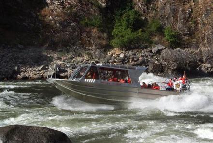
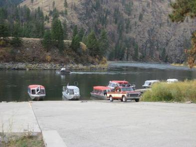
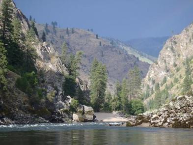
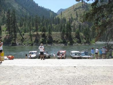
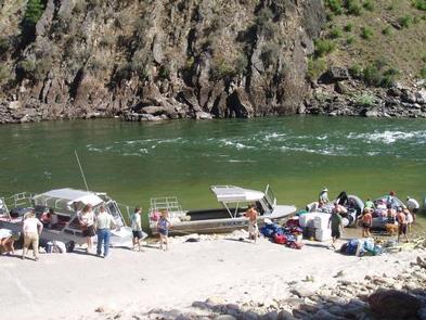
The Main Salmon Wild and Scenic River (Long Tom Bar to Corn Creek) offers powerboat users a fun, challenging and beautiful trip through a deep and rugged canyon. The Main Salmon River travels east to west for over 80 miles bisecting both the Frank Church River of No Return and Selway Bitterroot Wilderness areas. This undammed, free flowing river contains many class III and some class IV rapids, depending on water level, and its whitewater characteristics change greatly over the course of the year as flows fluctuate. The Main Salmon not only offers river users the opportunity to seek solitude, but also provides a unique glimpse into the past, from prehistoric pictographs to old homesteads.

There are two primary seasons on the Main Salmon, control and non-control. The control season lasts from June 20 through September 7 each year, and during that period a limit has been set at six powerboats on the river per day, with no more than three powerboats traveling together as a group. The maximum stay is limited to six nights and seven days during this season with a maximum group size of 30. All power boaters are required to pay the fee of $4.00 per person per day and carry a valid permit. In addition, each powerboat must have a shovel, bucket, strainer, portable toilet and a fire pan at all times.

For those heading out during the non-control season between September 8 and June 19, the maximum stay is 10 days and nine nights. There is no limit on the number of power boats allowed on the river during this time, and all campsites are first-come-first-served. The group size and equipment requirements remain the same year round. It is prohibited to leave your camp or equipment unattended for over 24 hours without prior approval.

Gallery

Directions

.

GPS Coordinates

Latitude 45° 38′ 15.0000″ N

Longitude 116° 16′ 57.0000″ W

Categories
Uncategorized

White Pine River Access

White Pine River Access, also known as Indian Grave Creek, is a great place for kayakers and canoers to access the Lochsa River. Located at milepost 138 on highway 12, visitors will find a primitive gravel drive leading to the put-in/take-out area where there is room to unload one group at a time.  Parking enough for 4 vehicles is provided above the river access area, along the highway. 

Directions

GPS Coordinates

Latitude 0° 0′ 0.0000″ S

Longitude 0° 0′ 0.0000″ W

Categories
Uncategorized

Wild Goose Campground

Situated along the middle fork of the Clearwater River at milepost 98 on scenic Highway 12, Wild Goose Campground offers a superb location to feel the sand between your toes while deciding on which river adventure you want to enjoy. Tubing, swimming and whitewater kayaking are just a few of the water sports you and your family can choose from, and guided trips and equipment rental are available in the nearby towns of Syringa and Lowel, Idaho. With eight campsites, two toilets and gravel parking, this site could be the perfect spot for your next outdoor water sport adventure.

The Campground will accomodate 24-ft. RV’s.

Nearby Activities

  • Auto touring
  • Biking
  • Camping
  • Picnicking
  • Swimming

Directions

GPS Coordinates

Latitude 46° 8′ 9.1284″ N

Longitude 115° 37′ 19.1100″ W

Categories
Uncategorized

Three Devils Picnic Area

Take a break from your scenic drive on the lovely "long and winding road," Highway 12, and enjoy a picnic on the Middlefork of the Clearwatwer River at Three Devils Picnic Area.  With 7 picnic table sites (2 with 16' long tables–great for groups!), a large sandy swimming beach and accessible paved parking area leading to two accessible restrooms, the Three Devils Picnic area makes for a great spot for a sunny day on the river.

Picnic area is located at milepost 95 along Highway 12, only 3 miles east of downtown Kooskia, ID.

Directions

GPS Coordinates

Latitude 46° 9′ 10.2600″ N

Longitude 115° 56′ 16.8612″ W

Categories
Uncategorized

Split Creek Trailhead and River Access

Stop at the Split Creek Trailhead and take a break from your drive on the Northwest Passage Scenic Byway and enjoy a picnic while taking in views of the Lochsa River. The Split Creek Trailhead and river access area is located off US Highway 12 at milepost 112 on the Lochsa River—actually; one can hardly miss it due to the gorgeous wooden pack bridge spanning the Lochsa River which provides access to the 1.34 million acre Selway-Bitterroot Wilderness! The trailhead is equipped with a gravel parking area, hitch rails, and is a popular take-out for boaters.

Directions

GPS Coordinates

Latitude 46° 13′ 57.3312″ N

Longitude 115° 24′ 12.6360″ W

Categories
Uncategorized

Lolo Creek Campground

Lolo Creek Campground consists of 9 camping units and is located 21 miles northeast of Kamiah, Idaho along the shores of Lolo and Eldorado Creek. This campground is a fantastic location for a rustic camping trip if you enjoy hiking, ohv trail riding, fishing, huckleberry picking or just watching the scenery while relaxing to the sounds of running water. With 9 camping units situated alongside both the Lolo and Eldorado Creeks, and only minutes from the Lewis & Clark Trail (#25) and the Musselshell OHV Trail System, the Lolo Creek Campground offers a wide variety of unique recreation opportunities for all! 

Nearby Activities

  • Auto touring
  • Biking
  • Camping
  • Hiking
  • Horseback riding
  • Off highway vehicle
  • Picnicking
  • Swimming

Directions

GPS Coordinates

Latitude 46° 17′ 40.2504″ N

Longitude 115° 45′ 5.1588″ W

Categories
Uncategorized

Fog Mountain Trailhead

Fog Mountain Trailhead, located at the end of Forest Service road 319 (Fog Mountain Road) and Big Fog Saddle, provides visitors with access to three trails which lead to the Selway Bitterroot Wilderness: Cove Lakes Trail #3, South Tree Links Lake Trail #693, and Fog Mountain Trail #343.  A four-wheel drive vehicle is required to reach the trailhead (no trailers) or one must hike or ride in on horseback. The road is extremely steep and rocky, so visitors should proceed with caution. Once at the trailhead there is ample parking and a few dispersed campsites. From here, the Fog Mountain Trail treats hikers to backcountry trails passing along the banks of the designated Wild and Scenic Selway River and up and out of the river canyon, ascending the steep slopes of Fog Mountain.

Directions

GPS Coordinates

Latitude 46° 6′ 52.7796″ N

Longitude 115° 12′ 18.7884″ W

Categories
Uncategorized

Kooskooskia Meadows Trailhead

Just 15 miles off of the Northwest Passage Scenic Byway and All American Road (US Highway 12), is one of the forest's more obscure trails, but also one of the more beautiful: trail #45, the Wind Lakes Trail. Accessed from the Kooskookia Meadows Trailhead on FS Road 358, this trail guides visitors into the Selway Bitterroot Wilderness.

Directions

GPS Coordinates

Latitude 46° 22′ 40.4292″ N

Longitude 114° 40′ 49.0728″ W