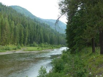
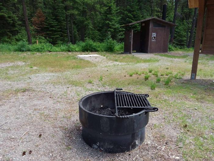
Red Top Campground is located northwest of Troy on Highway 508. The campground has 3 sites with tables and fire rings. Amenties include a vault toilet.
Recreational opportunities abound in the Bull Lake area from camping and boating on Bull Lake to Wilderness hikes in the Cabinet Mountains. There are several fully developed campgrounds with full service and campground hosts. The beautiful Ross Creek Cedars area with interpretive trail and picnicking is a popular destination. There are hiking and horseback trails, dispersed camping and lots of opportunities for a variety of activities. The scenery is spectacular along the Bull River Road and the area is home to bears, deer, elk, small mammals and birds. Recreation is year round in the area with snowmobiling, cross country skiing, snowshoeing, and ice fishing in the winter. The landscape in the area is very diverse from low elevation timber and lakes to the outstanding peaks in the Cabinet Mountains and Scotchman Peak area.
The Gateway Boat Camp is located approximately 8.5 air miles from Eureka, and 0.18 miles from the Canadian Border. The campground has 5 sites with tables and fire rings. Amenities include a pit toilet and hitching rack. The most popular way to gain access to this campground is by boat (boat must be beached) although access by trail is available too.
The Swisher Lake Campground is located 8 miles northwest of Eureka on Sophie Bay road 7160. The campground has 4 sites with tables and fire rings. Amenities include a vault toilet, hitching rack and easy access to the lake. The access road to the campground is 0.42 miles long and closed to all motorized traffic. This campground is popular with horsemen and hikers.
The Tobacco Plains picnic area is located approximately 9 miles northwest of Eureka on Lake Koocanusa. Amenities include a vault toilet and boat ramp that accomodates smaller boats.
The Tobacco River Campground is located approximately 5 miles west of Eureka off Pidgeon Bridge Road 7277. The campground has 6 sites, tables and fire rings. The access road is able to accomodate up to a 20' rv. Access and campground roads are gravel. Amenities include a vault toilet and an undeveloped boat ramp for small packable boats.
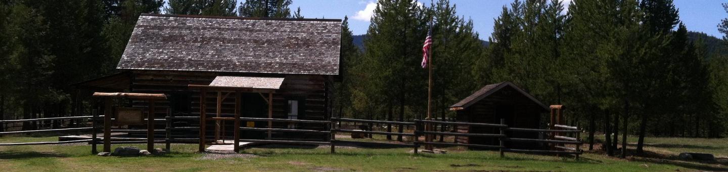
This remote cabin was built in 1908 and served as an administration building for the Wolf Creek District of the Blackfeet National Forest. The Blackfeet NF was dissolved in 1935 becoming part of the Kootenai & Flathead NF. Fairview was used as a remote work station until 1980. In 2011 major work was done to restore the cabin and put it on the rental system. The cabin is open year-round and is accessible by car.
Recreation
Opportunities abound from this location. Hiking, fishing, floating, hunting, scenic and historical driving tours are just some of the activities to be enjoyed.
Facilities
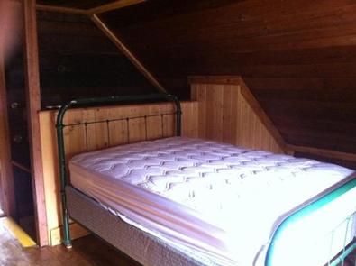
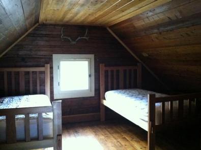
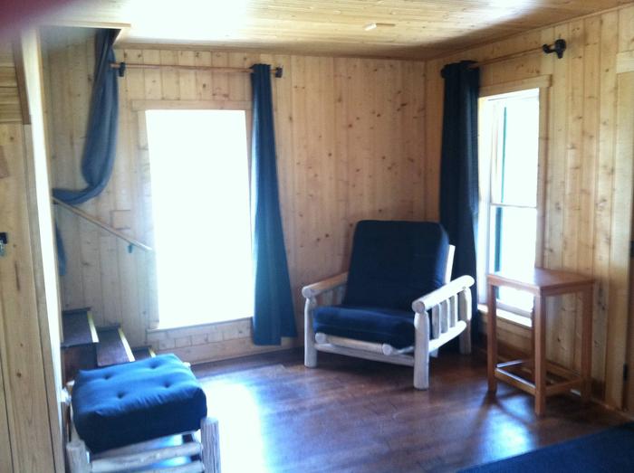
This 900 square foot cabin can sleep up to 6 people and comes furnished with one double bed and two twin beds with mattresses upstairs and one double futon and twin futon with mattresses downstairs.
Other amenities include a propane stove, refrigerator, heater and lights, table and chairs, table settings for eight, kitchen tools, pots and pans and cleaning gear. A vault toilet is located nearby.
Electricity and potable water are not available. Guests must bring enough water for drinking, cooking and washing. Items such as bedding, lanterns or flashlights, matches, first aid supplies, garbage bags, dish soap, dish towels and dish cloths are not available. Guests are expected to pack out all trash and clean the cabin before leaving.
Natural Features
The Fairview Ranger Station is situated near Wolf Creek at an elevation of 2,995 feet within the Salish Mountain Range of the Rocky Mountains in the Kootenai National Forest. Wolf Creek and its many tributaries provide habitat for a variety of trout and big game animals. Wolf Creek has been an important route through history as a trail for the Kootenai Indians, early prospectors and railroads.
Nearby Activities
Camping
Fishing
Hiking
Hunting
Wildlife viewing
Gallery
Directions
From Libby Montana follow Hwy 37 N for 14 miles to Fisher River Road 763. Turn right and follow for 10 miles; continue straight merging onto Wolf Cr/Fortine Cr road 36 and follow for another 17 miles. The cabin will be on the left.
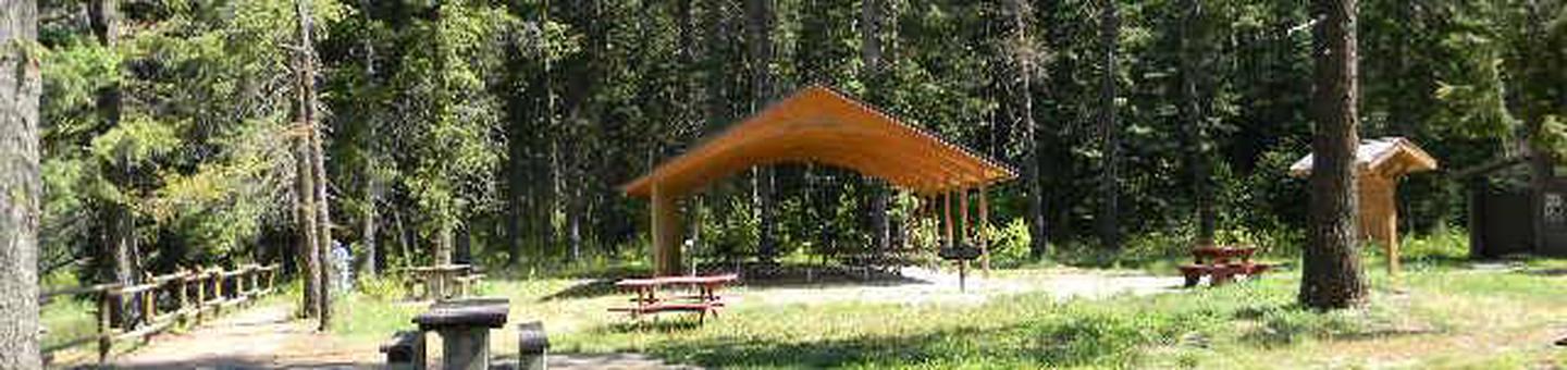
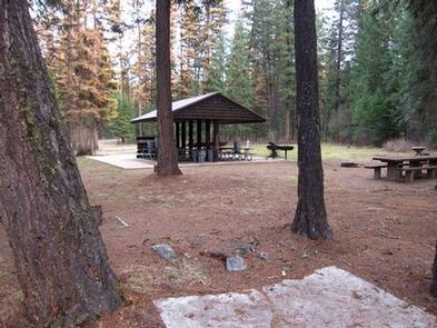
Bull River Pavilion offers an excellent view of the Bull River and surrounding forest. It’s located right in the thick of a variety of recreational opportunities and provides a large group with the perfect place to picnic in northwestern Montana.
Recreation
The rivers give visitors ample opportunity for fishing, swimming and boating. Large and smallmouth bass, perch, rainbow and brown trout and squawfish can be found in the clear, cool waters. Boating, sailing and water skiing are also popular activities on the reservoir.
Visitors enjoy tours of the Noxon Rapids Dam, which is located less than 10 miles southeast of the pavilion. It is an earthen, gravity-type, hydroelectric dam that has been in operation for more than 50 years.
Facilities
The accessible pavilion can accommodate up to 200 people and 20 vehicles. Electricity is available within the structure. It is also equipped with picnic tables, campfire rings and grills. Accessible vault toilet and drinking water are provided.
The adjacent campground offers over a dozen accessible sites for tent and RV camping. A boat ramp, fishing dock and access to the reservoir are available within the campground. All parking surfaces are gravel.
Natural Features
The pavilion is located in a wooded area at the confluence of the Bull River and the Clark Fork River. The rivers empty into 3,200-acre Cabinet Gorge Reservoir, at an elevation of about 2,200 feet. A variety of trees forest the area, including cedar and Douglas fir.
Nearby Attractions
Nearby Activities
Boating
Camping
Fishing
Water sports
Wildlife viewing
Gallery
Directions
From Noxon, travel 6 miles northwest on Highway 200. Bull River Pavilion is located at the back of Bull River Campground.
Timberlane Campground group site is located along a forest creek and in an area thick with towering trees. Several hiking trails exist in the area. The group pavilion accommodates up to 100 people and is set up for reunions and receptions. Its a great place to enjoy the Kootenai National Forest.
Recreation
Horseshoe pits, a volleyball court and a large, grassy play field are available at the campground. Pipe Creek allows visitors to enjoy fishing and swimming in the clear mountain water. The campground and picnic area are surrounded by a 1-mile hiking trail.
Visitors also enjoy scenic drives, biking and watching for wildlife along any of the roadways in the area. Pipe Creek Road heads deep into the surrounding forest.
Facilities
The Timberlane group stie has a 20′ x 20′ shelter, with picnic tables, a grill, and one 15 amp electric plug in. If you need to power anything in excess of 15 amps, you will need to bring a generator. The site provides vault toilets.
Natural Features
The Timberlane campground and group site is located along Pipe Creek in the Kootenai National Forest of northwestern Montana. It lies in a mixed conifer forest at an elevation of about 2,600 feet. A variety of wildlife make its home in the area.
The area is historically significant, once a former habitat and hunting ground for the Kootenai Tribe. Certain parts of the forest remain sacred to the tribe, including a location on Pipe Creek that contains soft, multicolored stone, which was used to carve bowls for tobacco pipes used in ceremonies. Pipe Creek used to produce stones of several different colors.
Nearby Attractions
Timberlane Campground is near the David Thompson Historic Route, the 67-mile Lake Koocanusa Scenic Byway and the Scenic Tour of the Kootenai River bike route.
The town of Libby is nearby, making the campground a perfect location for overnight stays during the wildly popular Logger Days, various car club events and Nordicfest.
Nearby Activities
Biking
Camping
Fishing
Hiking
Wildlife viewing
Gallery
Directions
From Libby, Montana, cross the Kootenai River Bridge on Highway 37, go approximatley 1 mile and turn north onto Pipe Creek Road 68, which leads to the town of Yaak and Turner Mountain Ski Area. Travel 8 miles to the gate, which is approximately 1 mile past the community of Pipe Creek.
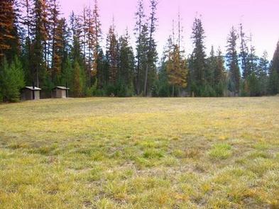
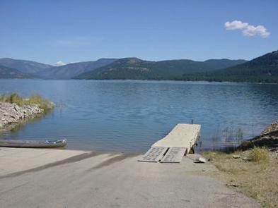
McGillivray Campground has 33 total campsites and provides reservation opportunities for two group sites within the campground loops and a large group shelter located within the facility . The two smaller group sites in the campground will accommodate up to 25 people each. The group shelter will accommodate up to 200 people making it great for reunions and receptions. A high and low water boat ramp, swim beach and picnic area are also available at McGillivray Campground
Recreation
Fishing derbies are held multiple times each year and anglers can expect kokanee salmon, whitefish and a variety of trout.
Facilities
The large group shelter (site 1) is equipped with a rock fireplace and multiple tables. Two Accessible vault toilets and drinking water are provided nearby. Two large cooking grills, horseshoe pits, path to beach area, fire ring and a 1-acre meadow adjoin the site. A large paved parking lot is available for large parties. The site is gated for security of rental parties and it is recommended that the gate is swung closed. Electrical outlets are available within the shelter, however reservationists must provide their own generator. Firewood is provided for the shelter.
The two group sites (site 7 and site 23) within the campground provide parking for up to five RVs. Each site has three tent pads, three picnic tables, fire ring, and a large cooking grill are within the sites. All sites at this campground have no electricity and firewood is not provided.
Natural Features
The McGillivary is located on the western shore of Lake Koocanusa in northwest Montana, at an elevation of about 2,520 feet. It is nestled in a heavily forested area with dense vegetation on the forest floor.
The adjacent 46,500-acre reservoir has over 127 miles of shoreline and is formed by the 422′ tall Libby Dam on the Kootenai River, which stretches about 90 miles and into Canada.
Osprey often fish around Libby Dam at sunset, making for enjoyable viewing opportunities. Bald eagles can be seen hunting kokanee in the river and lake during the fall. A variety of wildlife also makes its home in the area.
Nearby Attractions
The Kootenai River, below Libby Dam, is a blue ribbon fishery. Guided tours of the dam and powerhouse are offered at the visitor center throughout the summer season.
Visitors enjoy driving the 100-mile loop around the reservoir. Several trails, including some that lead to scenic waterfalls, are located along the route.
Nearby Activities
Biking
Boating
Camping
Fishing
Water sports
Wildlife viewing
Swimming site
Gallery
Directions
From Libby, travel 15 miles northeast on State Highway 37. Turn west on Forest Development Road 228 and continue for about 10 miles to the site.