Sims Creek Trail #881 is a short trail that connects into Libby Ranger District Himes/Walovine Trail #293. There are no stream crossings.
Directions
GPS Coordinates
Latitude 47° 55′ 19.2000″ N
Longitude 115° 25′ 19.2000″ W
Sims Creek Trail #881 is a short trail that connects into Libby Ranger District Himes/Walovine Trail #293. There are no stream crossings.
Latitude 47° 55′ 19.2000″ N
Longitude 115° 25′ 19.2000″ W
The Jackpine Flats campground is located 20 miles south of Trout Creek on Beaver Creek road 152. The campground has 1 site with table and fire ring. This campsite is best suited for tents or a pop up trailer as there is limited space to maneuver an RV. Amenities include a vault toilet.
From Hwy 200 follow Beaver Creek road 152 for approximately 9 miles to the campground.
Latitude 47° 41′ 8.0160″ N
Longitude 115° 38′ 45.9960″ W
Kilbrennen Lake Campground is located northwest of Troy on Kilbrennen Lake road 2394. The Campground 7 sites with tables and fire rings. Campground roads and parking spurs are of native soil. Amenities include vault toilets and a boat ramp developed for smaller boats.
Latitude 48° 35′ 46.9644″ N
Longitude 115° 53′ 17.3184″ W
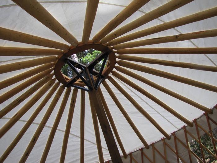
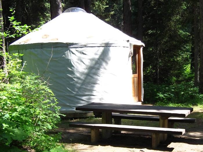
The Whitetail Yurt is nestled among the pine trees along the Yaak River within Whitetail Campground. Enjoy the comforts of a domed tent with a locking door, windows and wooden floor in this 16′ yurt.
Opportunities abound from this location. Hiking, fishing, floating, hunting, scenic and historical driving tours are just some of the activities to be enjoyed.
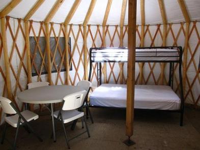
This rustic yurt sleeps three with floor room for a couple more. The provided bunk bed with mattresses has a twin as the top bunk and a full-size bed as the bottom bunk. There is also a table and four chairs.
A vault toilet, firewood and potable water are available within the campground.
Guests must bring cooking, cleaning and sleeping supplies. There is no heat source supplied. Guests are expected to pack out all trash and clean the yurt before leaving.
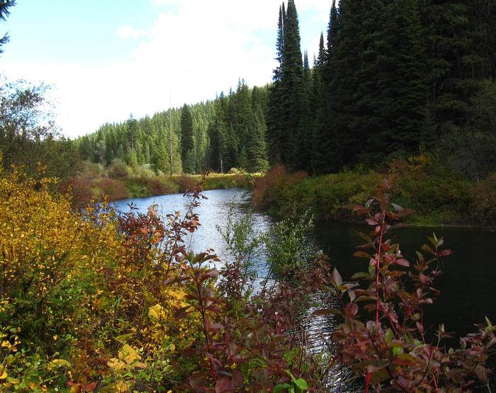
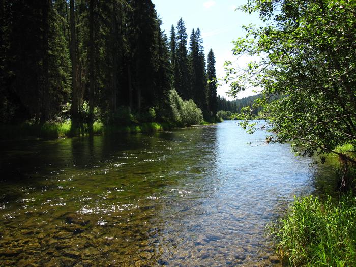
The yurt is situated adjacent to the Yaak River at an elevation of 2,918 feet within the Salish Mountain Range of the Rocky Mountains in the Kootenai National Forest. Yaak River and its many tributaries provide habitat for a variety of trout and big game animals. The Yaak Valley has been an important route through history as a trail for the Kootenai Indians, early prospectors and loggers.
The town of Yaak is located approximately 5.3 miles northeast where you can grab a bite to eat or attend a community event.
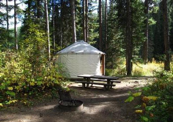
From Troy, Montana, follow Highway 2 west for 9.5 miles to Yaak Highway 508. Follow Yaak Highway 508 for 24 miles to Whitetail Campground. The yurt is in site 9.
Latitude 48° 49′ 39.7402″ N
Longitude 115° 48′ 52.1100″ W
The Pleasant Valley Campground is located approximately 32 miles southwest of Libby on Highway 2. The campground has 7 sites tables and fire rings and able to accommodate up to a 32′ rv. There is also 2 stock campsites with feed bins and a corrals. Campground roads and parking spurs are gravel or native material. Amenities include vault toilets.
Latitude 48° 2′ 31.0416″ N
Longitude 115° 17′ 27.4704″ W
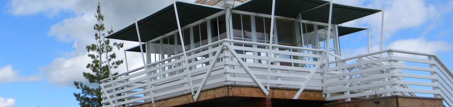
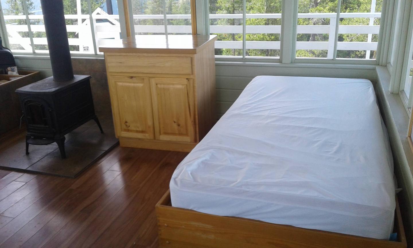
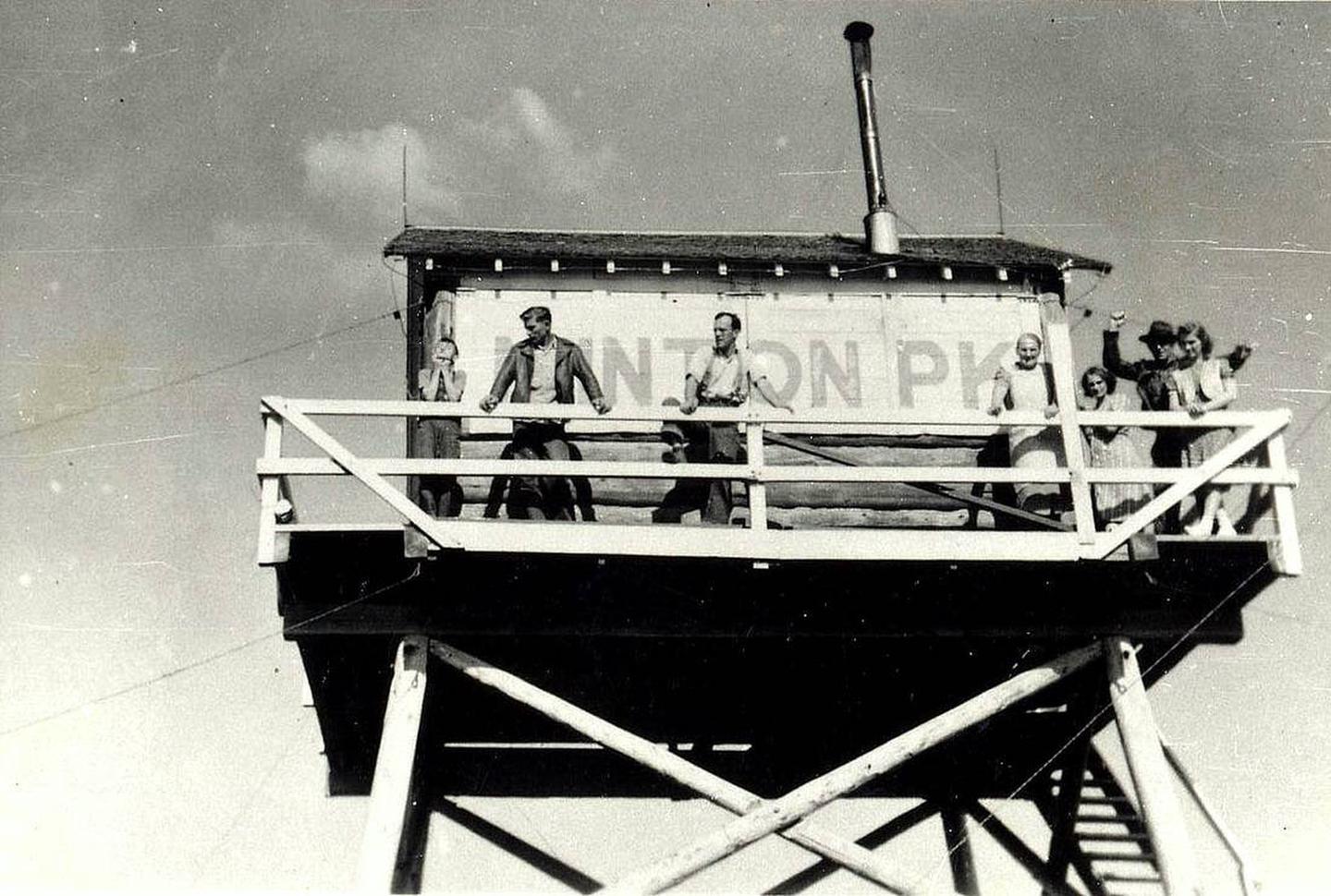
Minton Peak Lookout is situated in the Rocky Mountains at an elevation of 5,351 feet in the Kootenai National Forest. The original lookout was constructed in 1932, replaced in 1968, and completely rebuilt in 2011. The mountain was named after Col. David Minton, an Ohio cavalryman who homesteaded (and is buried) near the mouth of Minton Creek. The lookout is typically open from late June through mid-October and is accessible by car. This rustic retreat offers a few amenities, but guests should pack in most of their own supplies and gear.
Mountain roads and scenic trails provide access to explore the area.
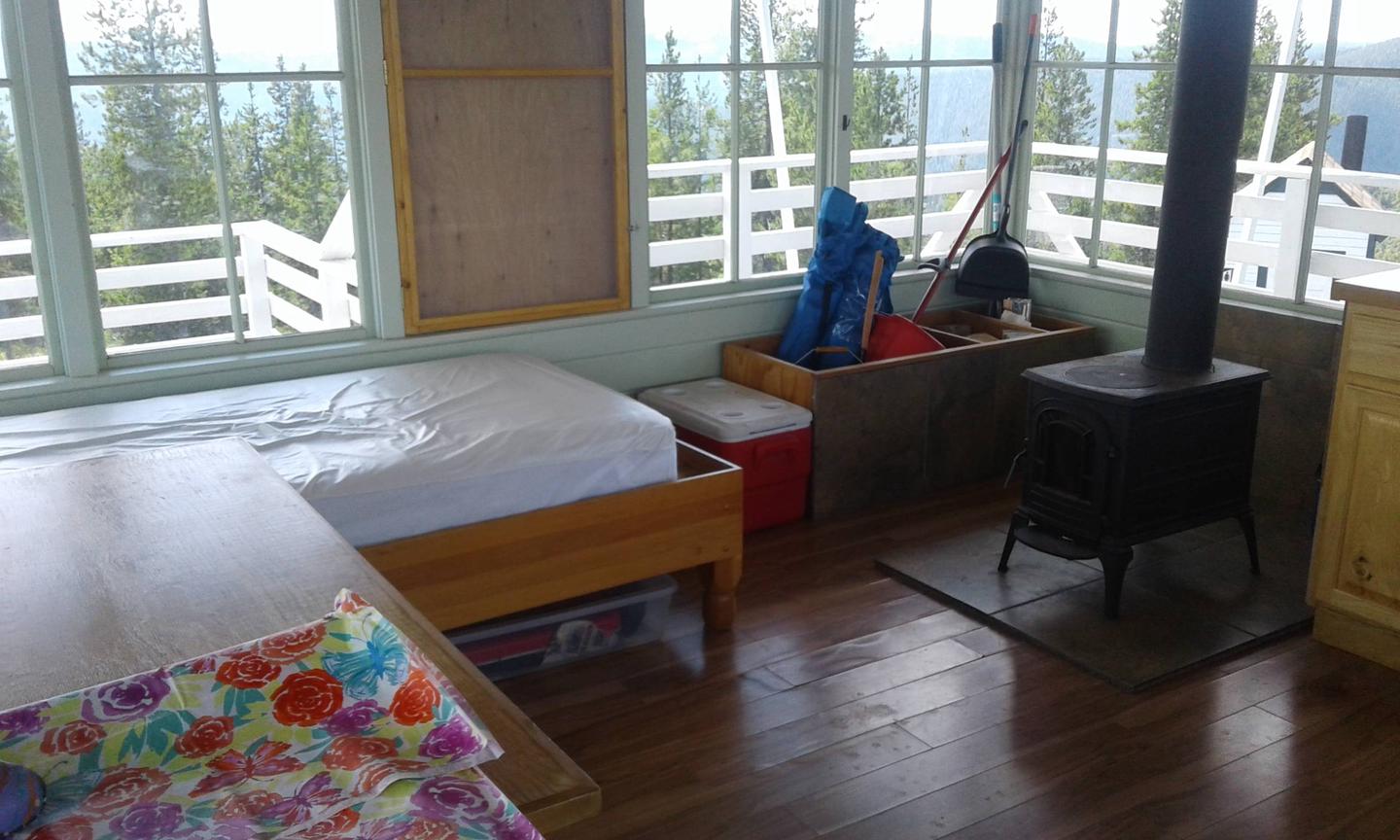
The 14×14 foot cabin sits on a five foot tower. The lookout has windows on all sides and is encircled by a catwalk. The cabin sleeps four people and is equipped with two twin size beds with mattresses. Other amenities include a table and chairs, wood stove for heat, two-burner cooktop (propane not provided), broom and dustpan. Firewood is provided. An outhouse with a vault toilet and a campfire ring are located outside. The lookout does not have electricity or water. Guests should bring enough water for drinking, cooking and cleaning. Items such as cooking gear, bedding, lanterns, matches, extra toilet paper, trash bags, dish soap and towels are not available.
The lookout sits five feet off the ground and is surrounded by an evergreen forest. It offers panoramic views of the Clark Fork Valley, the Bitterroot Mountains to the west and the Cabinet Range to the east. This is an ideal vantage point to enjoy sunrises and sunsets and gaze out at starry skies on clear nights.

From Trout Creek, take Cedar Street to Pine Street. Turn right and follow for 5.89 miles. (Pine St. turns into Marten Cr. Road). Turn left on Minton Peak Road 322 and follow for 7.9 miles to the lookout Road 322A. Follow this road for 0.62 miles to the lookout.
Latitude 47° 49′ 42.1000″ N
Longitude 115° 46′ 15.6000″ W
Along the Koocanusa Reservoir is the Stone Hill Climbing Area. Stone Hill is a unique area for climbers of all levels. The area offers a good range of easy to moderate climbs for the intermediate climber.
The Stone Hill climbing area is located at mile marker 51 on Highway 37 along Lake Koocanusa. The views of an open ponderosa pine forest and Lake Koocanusa make this undeveloped area stand out from the rest.
Stone Hill is both a sport and traditional climbing area. The majority of Stone Hill’s more than 500 climbs are challenging, rating 5.10 and up, but there are also a large number of easy and moderate climbs. Climbers can start in the shade in the morning and end in the shade in the evening by crossing the lake.
Latitude 48° 47′ 23.7768″ N
Longitude 115° 17′ 52.2600″ W
Trail Length: 1.3 miles
This is a fine hike for almost anyone, the walk is enjoyable with only a few steep sections. The trail travels through a birch glade most of the way, emerging occasionally onto a talus slope.
Latitude 48° 21′ 7.4340″ N
Longitude 115° 53′ 26.0952″ W
Logan State Park is located approximately 45miles southeast of Libby on Hwy 2, at Middle Thompson Lake. The campground has 37 sites, including one host site, with tables and fire rings, and able to accomodate a combined vehcile length of 30′. Amenities include potable water, flush toilets and shower house, a fully developed boat ramp with dock and a swimming beach. There are picnic sites with tables and fire rings near the beach for day use only.
With frontage on the north shore of Middle Thompson Lake, Logan Park is heavily forested with western larch, Douglas-fir, and ponderosa pine. This park nestles on 17 acres adjacent to 3,000 acres of recreation opportunities within the “Thompson Chain of Lakes”, connecting and containing Upper, Middle and Lower Thompson lakes. It’s a comfortable spot for swimming, boating, camping, water-skiing, and fishing.
Latitude 48° 1′ 58.8000″ N
Longitude 115° 4′ 1.2000″ W
The Camp 32 campground is located 15 miles southwest of Eureka off Pinkham Creek road 7182. The campground 8 sites with tables, fire rings. Accomodating up to a 20' rv. Amenities include potable water, vault toilets and a large open field.
Camp 32 was a logging camp established in 1924 by the Bonners Ferry Lumber Company and operated for approximately 2 years. The land was acquired from early homesteader, Margaret Durall. The site included several out buildings. A company store and several small cabins.
Latitude 48° 50′ 6.5616″ N
Longitude 115° 11′ 40.6716″ W