Categories
Uncategorized

DOUBLE ARROW LOOKOUT

Overview

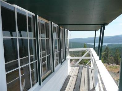
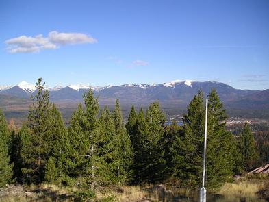
The Double Arrow Lookout offers guests a chance to see the Seeley valley and the adjacent Swan Mountains from a different and unique vantage point, high above the hillside. The tower contains a few modern amenities, including electricity, but allows guests to personalize their visits with their own supplies. A variety of recreational opportunities exist in the surrounding mountains, but the view is usually what attracts people to the tower.

Recreation

Visitors enjoy hunting and hiking. There are a variety of trails that lead from the lookout into the surrounding mountains and valleys.

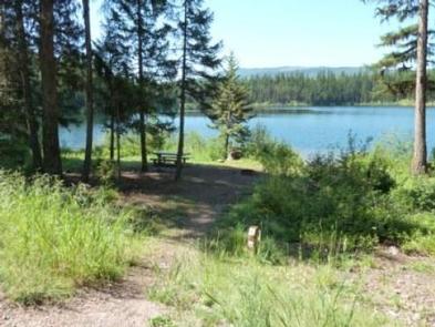
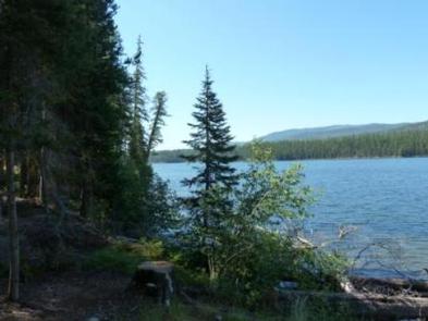
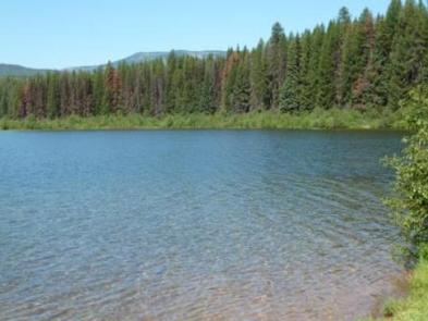
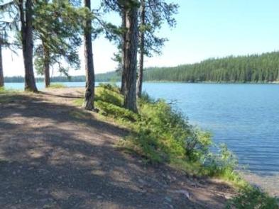
Seeley Lake is located about 2 miles east of Double Arrow and is open to fishing, boating and other water-related recreation. It has a boat ramp, as well as a sandy beach with ample shade for visitors who just want to relax and enjoy the alpine setting.

Facilities

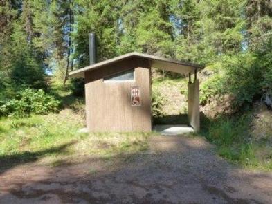
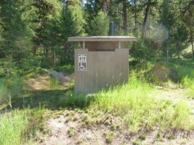
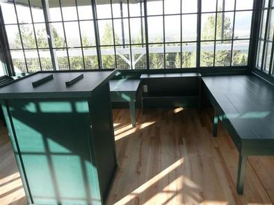
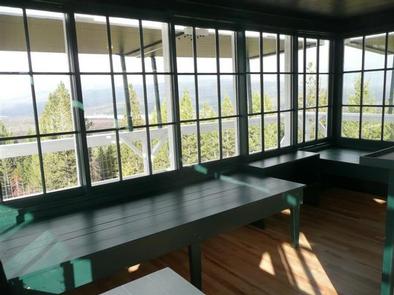
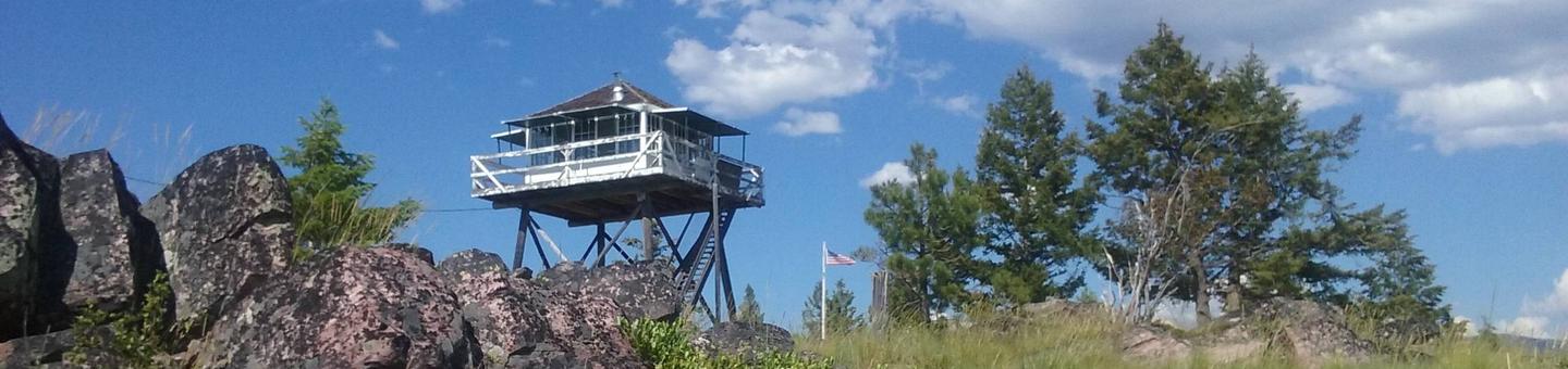
Double Arrow has an exterior stairway leading to a platform with a covered walkway all the way around the window-encased living quarters. The facility has electric lights, heat, a cook stove and a small refrigerator. An outdoor vault toilet is a short distance from the tower.

Two single beds and two portable cots are provided, able to sleep up to four people. Camping and sleeping are not allowed in the area around and below the lookout. Cell phone service is available in the area.

Guests must furnish everything they need in the way of bedding, cooking and eating equipment and cleaning supplies. Guests will also need to bring their own food, towels, soap, garbage bags and toilet paper, among other supplies deemed necessary. The cabin will need to be cleaned before leaving.

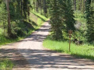
The lookout can be accessed by vehicle, however, the steep dirt and gravel road requires high-clearance vehicles. Guests are responsible for their own travel arrangements and safety.

Natural Features

The lookout is a 14-by-14 structure atop a 20 foot tower. It was built in 1933 and staffed by Forest Service employees until the mid-80s, when it was opened to the public for recreation purposes. The tower is now listed on the National Historic Lookout Register.

The forest contains a wide variety of trees, plants and wildlife, and is home to mountain goats, bighorn sheep, elk, moose, deer and grizzly and black bears (learn about bear safety). Both the bald and golden eagle reside in the forest, along with trumpeter swan, herons and dozens of varieties of ducks.

Nearby Attractions

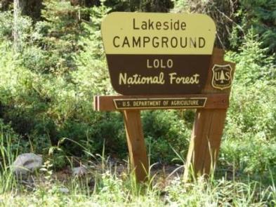
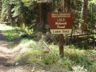
The lookout is a short distance from the Clearwater River Canoe Trail, which offers a prime location to witness the area’s spectacular birding, wildlife viewing and scenic views. The 3.5-mile trail can be completed in a couple hours and is done entirely on the water.

Nearby Activities

  • Camping
  • Hiking
  • Hunting
  • Visitor center

Gallery

Directions

In the town of Seeley Lake, turn west on Riverview Drive halfway between MM 13 & 14. Drive straight on the paved road for 0.6 mile, where you will cross over the Clearwater River. Continue on the same road another 0.6 mile where the road will split, stay straight (do not go right). The road will narrow, become more rocky and rough. Proceed almost 1 mile where you will make a right turn. After another 0.2 mile, make another right turn. Go another 0.2 mile and turn right again on Forest Road 696. Continue 1 mile where you will come to the lookout gate. Proceed through the gate (using the gate combination number) and in 0.1 mile you will be at the lookout.

GPS Coordinates

Latitude 47° 9′ 52.9999″ N

Longitude 113° 31′ 52.0000″ W

Categories
Uncategorized

LAKESIDE GROUP CAMPSITE

Overview

Lakeside Campground is located at the south end of Lake Alva, in Montana’s Lolo National Forest. The campground offers a chance to camp and enjoy recreational activities such as swimming, fishing and boating. The beautiful Mission Mountain Wilderness Area is 15 miles away.

Recreation

Lake Alva is in a great spot for boating and fishing. Anglers will find a variety of freshwater fish, including Kokanee salmon, suckers, whitefish, pike, trout and perch, among other species.

A boat ramp is available at nearby Lake Alva Campground. Motorized boating is allowed with the “No-Wake” regulation. Many non-motorized boaters find solace during early/evening morning hours on the lake. Swimming is also a popular activity.

Facilities

One large, accessible group campsite is available for reservations at Lakeside Campground. Individual sites are available on a first-come, first-served basis. The group site can accommodate up to 25 people and up to four RVs and six vehicles.

The site is equipped with tables and a campfire ring with grill. Accessible vault toilets are provided, but there is no drinking water available at the campground. Trash collection is not available. Lakeside Group is located on Lake Alva. Lake Alva is a NO-WAKE lake.

Natural Features

The campground is situated at the south end of Lake Alva, and offers shade and lake access. At an elevation of approximately 4,100 feet, temperatures are relatively cool on summer days.

The lake is home to a loon population, and has protected nesting areas during May and June. The birds’ mesmerizing calls can often be heard in the campground.

Nearby Attractions

Seeley Lake is about 10 miles south of the campground, with boating, water skiing and fishing opportunities. The town of Seeley Lake lies on the southeastern tip of the lake. A variety of services are offered there, including boat, canoe, kayak and row boat rentals.

The Mission Mountain Wilderness Area is about 15 miles northwest of the campground. The area is popular for its scenic views and abundant wildlife. Active glaciers, alpine lakes, meadows and clear, icy streams, along with vertical cliffs and jagged peaks, make up the area.

Nearby Activities

  • Biking
  • Boating
  • Camping
  • Fishing
  • Hiking
  • Water sports
  • Wildlife viewing
  • Kayaking
  • Canoeing
  • Berry picking
  • Birding
  • Jet skiing

Gallery

Directions

From the junction of Montana Highways 200 and 83 (locally referred to as Clearwater Junction), travel north on Highway 83 for approximately 15 miles to the town of Seeley Lake. Continue north on Highway 83 for 9.9 miles. The campground the entrance is on the west side of the highway.

GPS Coordinates

Latitude 47° 19′ 9.7000″ N

Longitude 113° 34′ 38.4301″ W

Categories
Uncategorized

LAKE INEZ POINT 6 (GROUP CAMP SITE)

Overview

The Lake Inez Campground Group Site is in a beautiful part of the Lake Seeley Ranger District of Montana’s Lolo National Forest. Located next to a beautiful mountain lake, the campsite is a popular place for visitors to enjoy a variety of water-related recreation opportunities.

Recreation

Lake Inez is a popular spot for boating, jet skiing and fishing; however, the available boat ramp is primitive and not paved. Non-motorized boating and swimming are also available and usually done away from high traffic watercraft use. Anglers can expect to see a variety of fish, from salmon to suckers, to pike, trout and perch.

The campground is a short distance from the Clearwater River Canoe Trail, which offers prime birding and wildlife viewing opportunities in a scenic setting. The water trail is popular with canoeists and kayakers as it stretches 3.5 miles, or a couple of hours, down the river.

Facilities

The group site is the only campsite available for reservations at the campground. Individual sites are available on a first-come, first-served basis. The site is equipped with tables and campfire rings with grills. Accessible vault toilets are provided, however drinking water and trash collection are not provided.

Natural Features

The small campground sits along the eastern shore of 314-acre Lake Inez. A dense conifer forest limits the visibility of the lake, but affords privacy between campsites. Plentiful shrubs and undergrowth give the 4,100-foot elevation campground beautiful colors during the fall.

Nearby Attractions

Seeley Lake, Montana, is the closest town and is about a 10-minute drive from the campground. A variety of services are offered there.

Nearby Activities

  • Biking
  • Boating
  • Camping
  • Fishing
  • Hiking
  • Hunting
  • Water sports
  • Wildlife viewing
  • Kayaking
  • Canoeing
  • Berry picking
  • Birding
  • Jet skiing

Gallery

Directions

From the junction of Montana Highways 200 and 83 (locally referred to as Clearwater Junction), travel north on Highway 83 for approximately 15 miles to the town of Seeley Lake. Continue north on Highway 83 for about 9 miles. The campground entrance is on the west side of the highway.

GPS Coordinates

Latitude 47° 17′ 30.0001″ N

Longitude 113° 33′ 51.8699″ W

Categories
Uncategorized

Pattee Canyon Disc Golf Course

Near the picnic area and parking lot, this basket course is wooded, fairly level, and beginner friendly.

Directions

Trail starts at the Northeast corner of the parking lot.

GPS Coordinates

Latitude 46° 49′ 42.1320″ N

Longitude 113° 55′ 30.7308″ W

Categories
Uncategorized

#1084 South Fork Pilgrim Creek

South Fork Pilgrim Creek Trail #1084 travels from the Pilgrim Creek valley bottom and ends at the head end of the South Fork of Pilgrim Creek drainage on FSR 2710. Both the lower and upper trailhead are accessible by open Forest System road. The trail crosses the South Fork Pilgrim Creek just up the trail from the lower trailhead.  This crossing can be challenging and dangerous during peak flows.

South Fork Pilgrim Creek #1084

Directions

GPS Coordinates

Latitude 47° 56′ 27.6000″ N

Longitude 115° 52′ 55.2000″ W

Categories
Uncategorized

#999 Historic Big Eddy

Historic Big Eddy Trail #999 is a short but steep non-motorized trail that ends at Big Eddy Trail #998 approximately halfway up to Star Peak.  The trail offers stunning views of the Clark Fork River Valley.

Historic Big Eddy Trail #999

Directions

GPS Coordinates

Latitude 48° 4′ 8.4000″ N

Longitude 115° 55′ 30.0000″ W

Categories
Uncategorized

#1077 Smeads Bench

Smeads Bench Trail #1077 follows Smeads Creek up to Loveland Peak Trail #1070.The trail crosses Smeads Creek but the crossing is easily negotiated.

Smeads Bench Trail #1077

Directions

GPS Coordinates

Latitude 48° 0′ 21.6000″ N

Longitude 115° 52′ 1.2000″ W

Categories
Uncategorized

#1071 Rice Draw

Rice Draw Trail #1071 traverses multiple closed roads as it climbs from the valley bottom near the town of Heron to a major ridgeline.  The trail receives very little use, with most use occurring in the hunting season.

Rice Draw #1071

Directions

GPS Coordinates

Latitude 48° 1′ 22.8000″ N

Longitude 115° 55′ 48.0000″ W

Categories
Uncategorized

#894 Roe Gulch

Roe Gulch Trail #894 departs from the 20 Odd ATV Trail #896 at approximately the 2.5 mile mark.  The trail climbs up to 20 Odd Peak (6048’).  20 Odd Peak Trail #898 and Canyon Peak Trail #903 depart from 20 Odd Peak offering loop hiking opportunities.  There are no stream crossings. (Be advised the trail departs from 20 Odd ATV Trail #896 at the 2.5 mile mark making this trail approximately 6 miles in length.)

Roe Gulch Trail #894

Directions

GPS Coordinates

Latitude 47° 51′ 46.8000″ N

Longitude 115° 33′ 18.0000″ W

Categories
Uncategorized

#892 West Fork Canyon Creek

West Fork Canyon Creek Trail #892 follows an old road bed along Canyon Creek and then the West Fork of Canyon Creek.  The trail passes an old mining claim then steeply climbs to the ridgeline and Canyon Peak Trail #903.The trail crosses West Fork Canyon Creek multiple time.  These crossings can be challenging and dangerous during peak runoff.   (Be advised the trail departs from 20 Odd ATV Trail #896 at the .5 mile mark making this trail approximately 5.5 miles in length.)

West Fork Canyon Creek Trail #892

Directions

GPS Coordinates

Latitude 47° 51′ 25.2000″ N

Longitude 115° 30′ 3.6000″ W