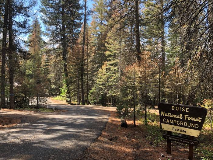
Categories
Uncategorized

HOT SPRINGS

Overview

Hot Springs Campground is located just east of Garden Valley, Idaho along the Banks-Lowman Highway at an elevation of 3169 feet.
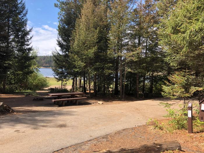
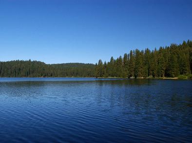
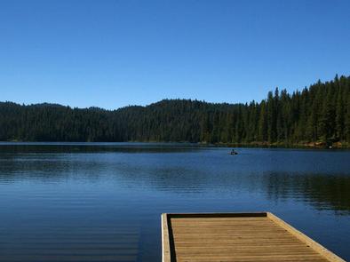
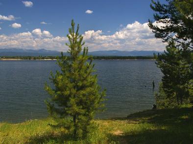
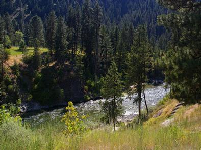
Visitors enjoy rafting, kayaking, fishing on the South Fork Payette River, and soaking in the hot springs at the river’s edge.

Recreation

The South Fork Payette River is across the road from the campground, offering fishing, whitewater rafting, and kayaking.
A natural hot springs soaking pool is located on the river directly across the road and down a staircase.

Facilities

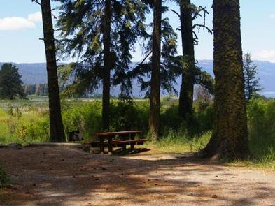
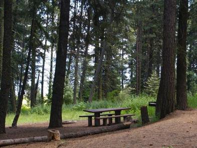
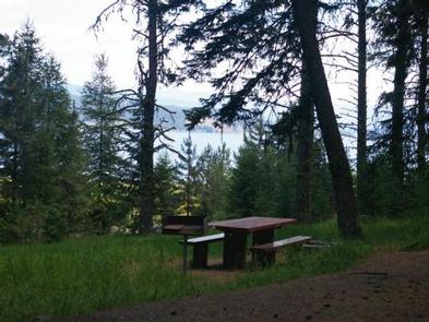
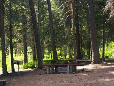
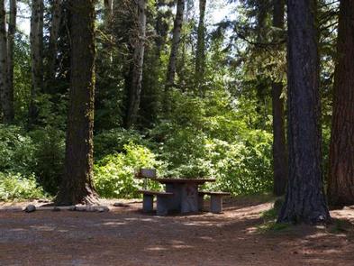
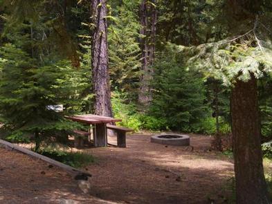
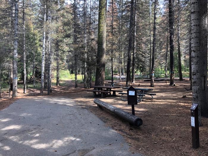
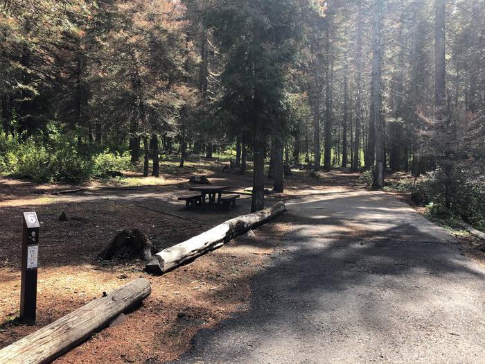
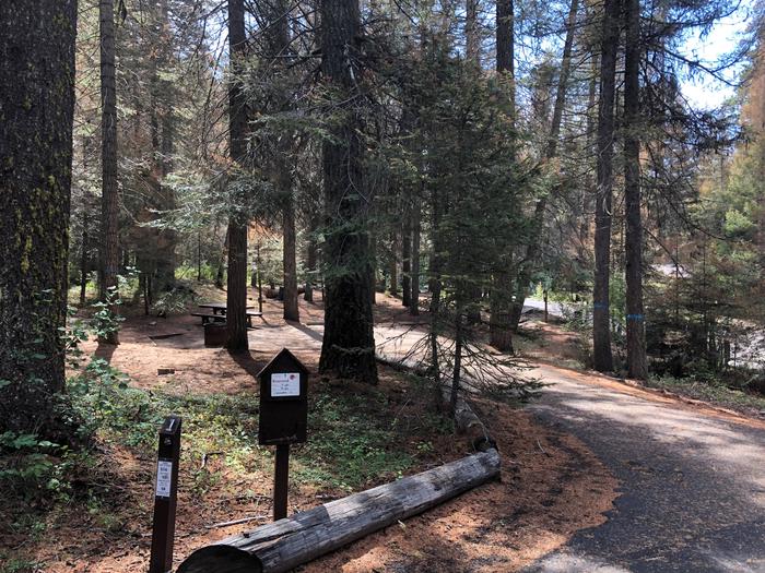
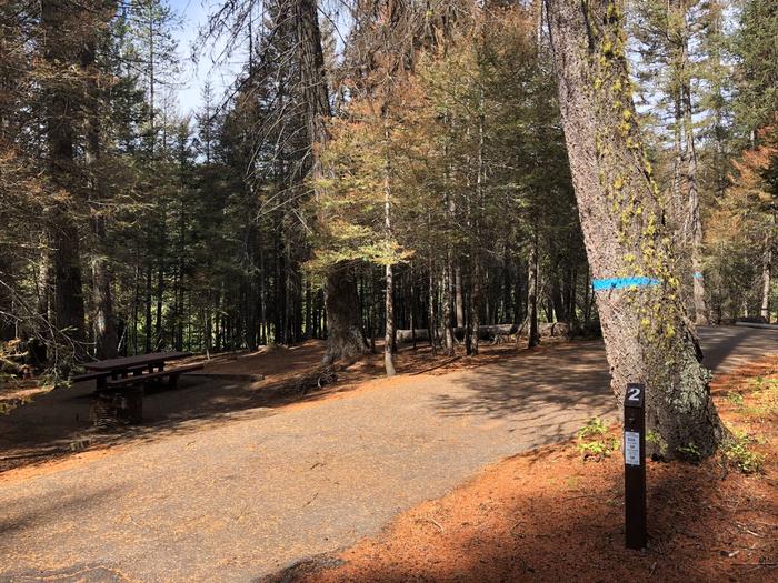
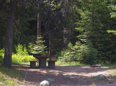
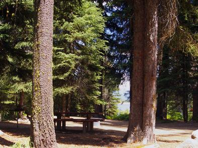
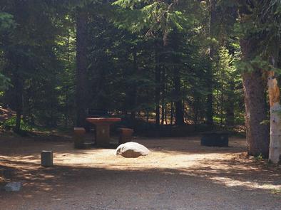
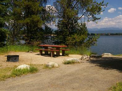
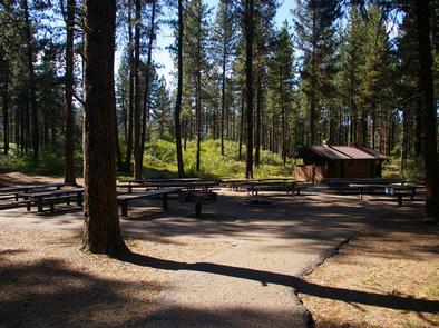
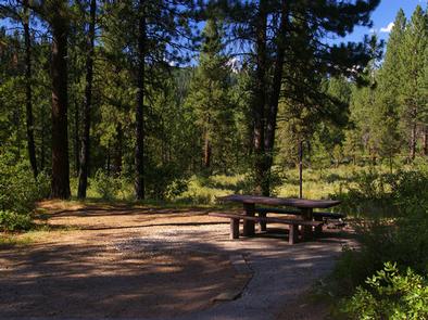
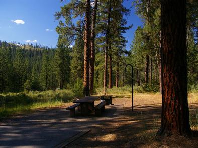
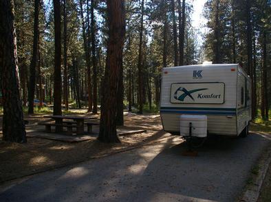
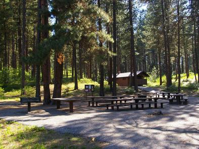
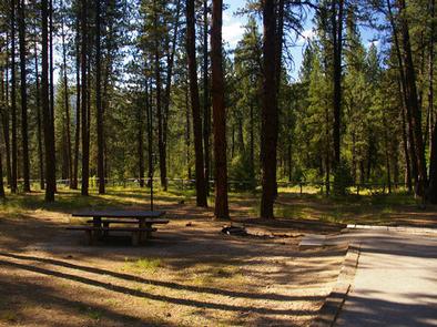
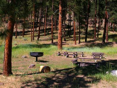
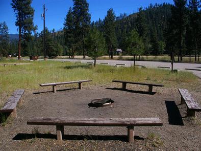
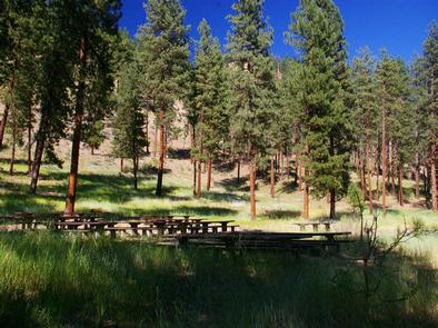
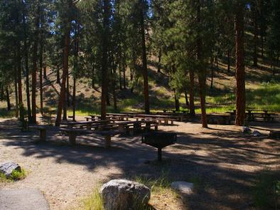
The campground contains three accessible group sites with picnic and serving tables, grills and campfire circles with benches. Sites 1 and 2 can accommodate up to 200 people each; Site 3 can accommodate up to 50 people.

Vault toilets, drinking water and trash collection are provided. Because of its proximity to the highway, some noise from passing traffic is to be expected.

Natural Features

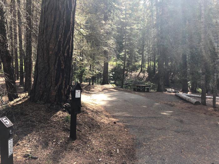
The campground is situated at the foot of a forested hillside. Towering Ponderosa pines are scattered throughout the site, offering partial shade. Summer wildflowers dot the landscape.

Nearby Attractions

Numerous natural hot springs pools can be found along the Banks-Lowman Highway, also known as the Wildlife Canyon Scenic Byway. The area offers scenic views, wildlife watching, historical information kiosks, and several hiking opportunities.

Whitewater rafting and kayaking are popular activities on the South Fork and Main Payette Rivers. Several companies in the area offer guided half and full-day trips.

Nearby Activities

  • Boating
  • Camping
  • Fishing

Gallery

Directions

From Boise, Idaho, take State Highway 55 north 35 miles to Banks. Turn east onto the Banks-Lowman Highway and go 17 miles to the campground, which is on the lefthand side of the highway.

GPS Coordinates

Latitude 44° 3′ 42.0001″ N

Longitude 115° 55′ 4.0001″ W

Categories
Uncategorized

FRENCH CREEK

Overview

French Creek Campground is located next to scenic Lake Cascade in west-central Idaho. It is near the town of Donnelly, at an elevation of 4,850 feet. Boating, fishing, swimming and hiking are popular activities in this scenic region.

Recreation

Lake Cascade offers excellent opportunities for boating, water skiing, canoeing, windsurfing and sailing. Anglers enjoy casting for rainbow trout, coho salmon, smallmouth bass and perch. Many hiking and biking trails are in the area as well.

Facilities

The campground is divided into two sections of campsites. Some are located on the east side of West Mountain Road, closer to the lakeshore and with beautiful lake views. Other sites are on the west side of the road, on a hillside above the lake. A few of these sites have partial lake views. Some also have stairs from the parking spur to the campsite.

Campsites are equipped with a table and campfire ring. Vault toilets, drinking water and trash collection are provided, but there is no electricity at the campground. Roads and parking spurs within the facility are gravel.

Natural Features

The campground is situated on the western shore of Lake Cascade and on the banks of French Creek. A forest of mixed conifers covers the campground, providing ample shade. Thimbleberry and huckleberry plants are abundant throughout the upper reaches of the campground.

A wide variety of wildlife makes its home around the lake. Waterfowl and songbirds are abundant, as well as pelicans and bald eagles.

Nearby Activities

  • Boating
  • Camping
  • Fishing
  • Hiking
  • Water sports
  • Wildlife viewing

Gallery

Directions

From Boise, Idaho, travel north on Highway 55 for 85 miles to Cascade. Turn west on Old State Highway and go a half-mile to Lakeshore Drive. Turn south and travel 3 miles to West Mountain Road. Turn west and follow the road 5 miles to the campground.

GPS Coordinates

Latitude 44° 31′ 41.9999″ N

Longitude 116° 6′ 29.9999″ W

Categories
Uncategorized

EASTSIDE

Overview

Eastside Campground is located on the shores of scenic Sagehen Reservoir at an elevation of 4,956 feet. Visitors enjoy boating, fishing and exploring the non-motorized Sagehen Reservoir Trail.

Recreation

Sagehen Reservoir offers great boating, canoeing, and rainbow trout fishing. Boat ramps and docks are located nearby at both Antelope and Sagehen Creek Campgrounds. There is a 15 mph speed limit on the reservoir.

Hiking, biking, horse, and ATV trails are abundant in the area. The non-motorized Sagehen Reservoir Trail, a 4-mile loop around the lake, offers great fishing spots, beautiful viewpoints, and wildlife watching opportunities for hikers, mountain bikers and horseback riders.

The Sagehen and KYAOTT ATV Trail Systems can be accessed near the reservoir, offering more than 35 miles of trails for ATVs and motorcycles, but hikers, mountain bikers and horseback riders can enjoy these trails as well.

Facilities

The campground is made up of several single sites or serves as one reservable, accessible group site that can accommodate up to 50 people and 10 vehicles.
Most of the campsites afford partial lake views. Picnic tables, campfire rings, a vault toilet, and hand-pumped drinking water are provided.
A campground host is located at nearby Antelope Campground, where firewood can be purchased.

Natural Features

The campground is situated in a forest of towering Ponderosa pine, Engelmann spruce, Douglas fir, and grand fir. Most sites have plentiful shade. Summer temperatures range from 80 to 90-degree days to cooler nights.

A variety of berries and mushrooms can be found throughout the area. Local wildlife includes deer, elk, black bear, goshawk, woodpeckers, and boreal owls.

Nearby Activities

  • Biking
  • Boating
  • Camping
  • Fishing
  • Hiking
  • Hunting
  • Wildlife viewing

Gallery

Directions

From Horseshoe Bend, Idaho, take Highway 52 for 9 miles west to the junction with the Sweet/Ola Highway. Turn north and travel 16 miles to Ola, Idaho. Travel north through Ola and follow 10 miles northeast on FS Rd 618, then make a right on FS Rd 626 and follow it for 7 miles. Make a left of FS Rd 614 and travel about 2 miles to Sage Hen Reservoir. Eastside Campground is on the east side of the reservoir.

GPS Coordinates

Latitude 44° 19′ 55.9999″ N

Longitude 116° 10′ 25.0000″ W

Categories
Uncategorized

ANTELOPE

Overview

Antelope Campground is located on the shores of the scenic Sagehen Reservoir in the Boise National Forest, perched at an elevation of 5031 feet. Visitors enjoy boating, fishing and exploring the non-motorized Sagehen Reservoir Trail.

Recreation

Sagehen Reservoir offers excellent boating, canoeing and rainbow trout fishing. A boat ramp and dock are located within the campground.The speed limit on the reservoir is 15 mph.

Hiking, biking, horse and off-road vehicle trails are abundant in the area. The non-motorized Sagehen Reservoir Trail, a 4-mile loop around the lake, offers great fishing spots, beautiful viewpoints and abundant wildlife watching opportunities.

The Sagehen and KYAOTT ATV Trail Systems can be accessed near the reservoir, offering more than 35 miles of trails for off-road vehicles and motorcycles, but hikers, mountain bikers and horseback riders can enjoy these trails as well.

Facilities

The campground offers a large, tent-only group site that can accommodate up to 30 people, with several picnic tables, a grill and campfire ring. Numerous single-family sites also available, equipped with picnic tables and campfire rings.

Vault toilets and hand-pumped drinking water are provided. Roads and some parking spurs throughout the campground are paved; other spurs are gravel. Firewood is available for purchase from the host.

Natural Features

The campground is situated in a forest of towering Ponderosa pine, Engelmann spruce, Douglas fir and grand fir. Most sites have plentiful shade and some have partial lake views. Summer temperatures range from 80-90 degrees during the day with crisp, cool nights.

A variety of berries and mushrooms can be found throughout the area. Local wildlife includes deer, elk, black bear, goshawk, woodpeckers and boreal owls.

Nearby Activities

  • Biking
  • Boating
  • Camping
  • Fishing
  • Hiking
  • Hunting
  • Wildlife viewing

Gallery

Directions

From Horseshoe Bend, Idaho, take State Highway 52 for 9 miles, then turn right on Sweet/Ola Highway and travel 16 miles to Ola. From Ola, continue 10 miles northeast on FS Rd 618, then make a right on FS Rd 626 and follow it for 7 miles. Make a left on FS Rd 614 and travel about 2 miles to Sage Hen Reservoir. Antelope Campground is on the north end of the reservoir.

GPS Coordinates

Latitude 44° 20′ 7.0001″ N

Longitude 116° 11′ 6.0000″ W

Categories
Uncategorized

AMANITA

Overview

Amanita Campground is located next to scenic Lake Cascade in west-central Idaho. It is near the town of Donnelly, at an elevation of 4,850 feet. Boating, fishing, swimming and hiking are popular activities in this scenic region.

Recreation

Lake Cascade offers excellent opportunities for boating, water skiing, canoeing, windsurfing and sailing. Anglers enjoy casting for rainbow trout, coho salmon, smallmouth bass and perch. A boat ramp is located at the neighboring Rainbow Point Campground. Many hiking and ATV trails are in the area as well.

Facilities

This small campground contains single-family campsites, with picnic tables, campfire rings and grills. Some sites have lake views and shoreline access.

Vault toilets, drinking water and trash collection are provided, but there is no electricity at the campground. Roads and parking spurs within the facility are gravel. A campground host can be located at Rainbow Point Campground.

Natural Features

The campground is situated on the west shore of the lake, among a mixed-growth conifer forest that towers over the campground. Summer wildflowers are abundant in the area.

A wide variety of wildlife makes its home around the lake. Waterfowl and songbirds can also be seen in the area, as well as pelicans and bald eagles.

Nearby Activities

  • Boating
  • Camping
  • Fishing
  • Water sports
  • Wildlife viewing
  • Swimming site

Gallery

Directions

From Boise, Idaho, take Highway 55 north for 95 miles to Donnelly. Turn west on West Roseberry Road and travel 1.5 miles to Norwood Road. Turn south and continue one mile to Tamarack Falls Road. From there, turn west and go just over a mile to West Mountain Road. Turn south and go a mile to the campground.

GPS Coordinates

Latitude 44° 42′ 6.9998″ N

Longitude 116° 7′ 53.0000″ W

Categories
Uncategorized

GRAYBACK

Overview

Grayback Campground is located 36 miles northeast of Boise, Idaho, just off scenic Highway 21. Historic Idaho City is just two miles north of the campground. Visitors enjoy fishing in Mores Creek and exploring the Grayback Gulch Trail.

Recreation

Mores Creek can be accessed just below the campground. Anglers fish for whitefish and rainbow trout. Grayback Loop Trail begins within the site, offering a 1-mile footpath for hikers.

Numerous trail opportunities are in the area just north of Idaho City, where hiking, biking, horseback riding and off-road vehicles can be enjoyed. During the winter, the area becomes a playground for back country skiers and snowmobiles.

Facilities

The campground contains two group sites with picnic and serving tables, grills, campfire circles and paved site pads. Site A can accommodate up to 150 people and 20 vehicles, and site B can accommodate up to 100 people and 15 vehicles. Both sites can be reserved at the same time, for even larger groups.

Several single- and double-family campsites are available as well, each equipped with a picnic table, lantern post and campfire ring with grill. Vault toilets, drinking water and trash collection are provided throughout the campground. A campground host is located directly across the road.

Natural Features

The campground is situated on a hillside about a quarter-mile above Highway 21, at an elevation of 4,200 feet. A ponderosa pine forest covers the site, offering partial shade. Wildlife and summer wildflowers are abundant in the area.

Nearby Attractions

Highway 21, also known as the Ponderosa Pine Scenic Byway, snakes along Mores Creek to Mores Creek Summit, Gold Fork and Banner Ridge, offering historic sites, hot springs pools and breathtaking views of the surrounding mountains and forest along the way to the campground.

Nearby Activities

  • Camping
  • Fishing
  • Hiking
  • Hunting
  • Visitor center
  • Wildlife viewing

Gallery

Directions

From Boise, take State Highway 21 north for 36 miles. Campground access road is located on the east side of the road, between mileposts 36 and 37. Turn right and travel a quarter-mile to the campground.

GPS Coordinates

Latitude 43° 48′ 25.9999″ N

Longitude 115° 51′ 52.9999″ W

Categories
Uncategorized

Montana Snowbowl

Montana Snowbowl is a year-round resort, offering skiing and snowboarding in the winter, and folfing, lift assisted hiking and mountain biking in the summer.

For more information visit http://www.montanasnowbowl.com/

Directions

GPS Coordinates

Latitude 47° 0′ 49.1976″ N

Longitude 113° 59′ 58.7292″ W

Categories
Uncategorized

Welcome Creek Wilderness

The Welcome Creek Wilderness lies in the Rock Creek drainage about 25 miles east of Missoula, Montana. This 28,135 acre wilderness measures about nine miles by seven miles.

The ridges are so steep and the valleys narrow and uneven that even finding a flat tent spot can be tough in much of the area. Most of the land is heavily timbered with pine, fir and larch (although the south-facing slopes have a few open but very steep grassy slopes) and is extremely rocky and rough.

Welcome Creek flows south and east, providing a home to native trout. Elk hunters, bear hunters and a few adventurous fishermen from Rock Creek are the most common visitors.

About 25 miles of steep trails provide foot and horse access, but overnight backpackers are few and far between. The main travel route is the Welcome Creek Trail, a brushy, rocky trail which crosses the area southeast to northwest for approximately seven miles, passing no lakes (this wilderness has none).

Directions

GPS Coordinates

Latitude 46° 35′ 43.2816″ N

Longitude 113° 43′ 58.6416″ W

Categories
Uncategorized

Clark Memorial Campground

This is an open, sunny site in the canyon bottom along the river. There is a forest nearby and fishing opportunities in the Thompson River.

Nearby Activities

  • Camping

Directions

5 miles north of MT 200 on the Thompson River Road.

GPS Coordinates

Latitude 47° 37′ 54.4620″ N

Longitude 115° 10′ 27.1596″ W

Categories
Uncategorized

Lookout Pass Ski and Recreaton Area

Lookout Pass Ski Area is located on the Idaho Panhandle and Lolo National Forests at the Idaho/Montana state line, roughly half-way between Spokane, WA and Missoula, MT. Access to the area is via Interstate 90, Exit 0. Lookout Pass features 540 acres of terrain, including 34 named runs and prime powder glades, and averages 400 inches of annual snowfall. The vertical drop from the summit elevation of 5,650 feet is 1,150 feet. Terrain is rated as follows: 20% Beginner, 50% Intermediate, 20% Advanced and 10% Expert. Three double chairs and one triple chair transport skiers and snowboarders up the mountain. Inside the base lodge, a cafeteria-style grill and deli, bar and gift shop serve visitors. PSIA & AASI certified instructors provide a full range of ski, snowboard and telemark lessons, and a full service ski and snowboard rental and repair shop operates next to the main lodge.

Directions: Lookout Ski Area is located on the Idaho – Montana state line adjacent to Interstate 90, and is accessed via Exit 0.

General Notes: Lookout Snow Buses provide transportation for a fee between several Idaho and Montana locations and the ski area on Saturdays during the peak season.

Parking: The ski area parking lot is located about 0.1 miles from the I-90 interchange.

Safety Information: Helmets are recommended while skiing and snowboarding.

Directions

GPS Coordinates

Latitude 47° 27′ 11.1020″ N

Longitude 115° 42′ 23.3899″ W