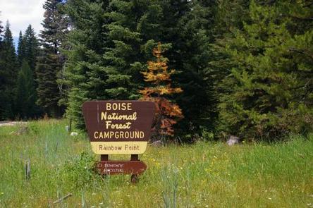
Categories
Uncategorized

BIG TRINITY CABIN

Overview

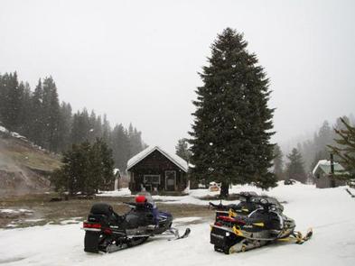
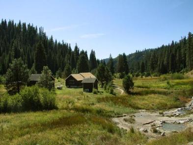
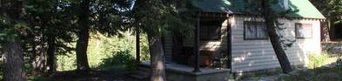
Big Trinity Cabin offers a quiet retreat in a beautiful high alpine landscape. The cabin is situated within a popular summer recreation area with many activities to enjoy.

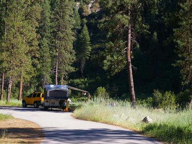
The cabin has a limited season due to late snow melt, but is accessible by vehicles with reasonable ground clearance. Many creature comforts are provided; however, guests may want to bring some supplies and gear to make their experience more comfortable and enjoyable.

Recreation

The 4- mile Rainbow Basin Trail system for pedestrain travel only, offers access to several lakes, hikers can access the trail System from the trailhead located within Big Trinity Lake campground. Other trails within the area Roaring River trail 045, and Lava Mountain trail 125, these are motorized motorcycle trails. Click here for an Idaho OHV Safety Message.

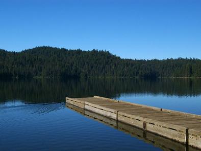
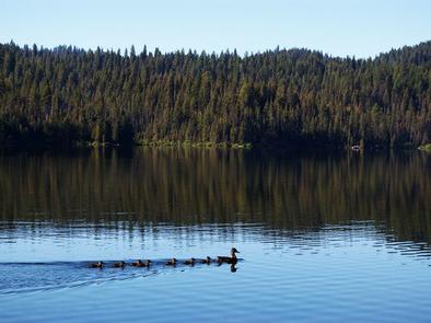
Anglers can fish in any of the nearby lakes for rainbow and cutthroat trout. The lakes are also ideal for exploring by canoe or kayak.

Facilities

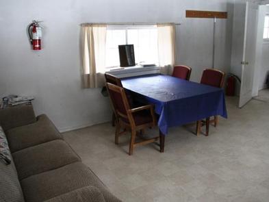
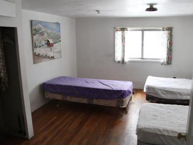
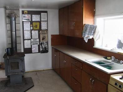
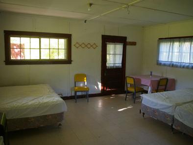
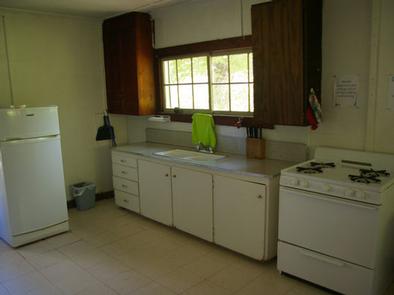
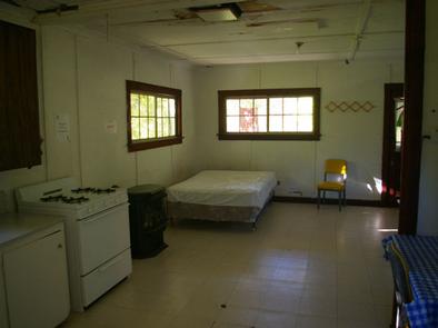
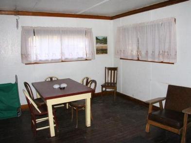
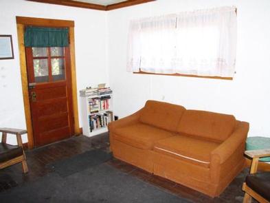
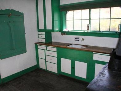
The cabin sleeps six and is equipped with one double bed, a sofa bed, side tables, a drop-down kitchen table, cleaning supplies, dishes and tableware, chairs and a dining table, cookware and a fire extinguisher. A wood stove is available for heating and cooking.

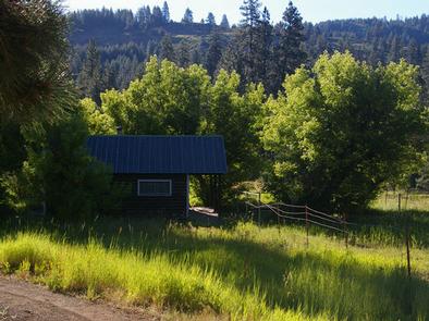
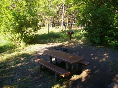
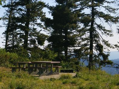
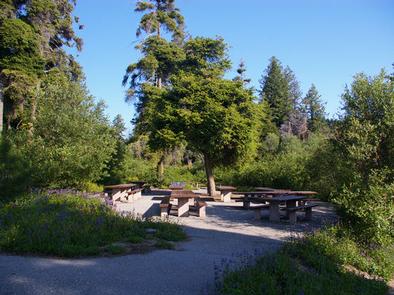
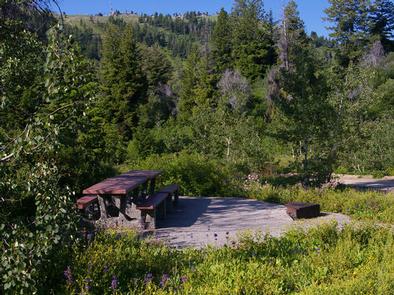
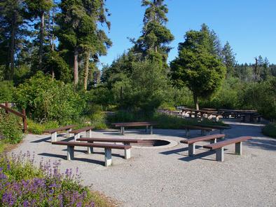
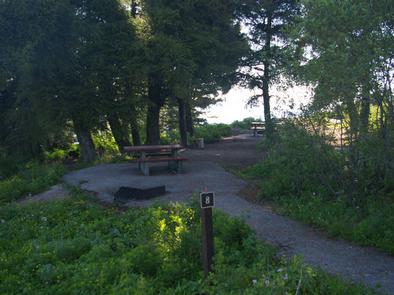
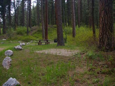
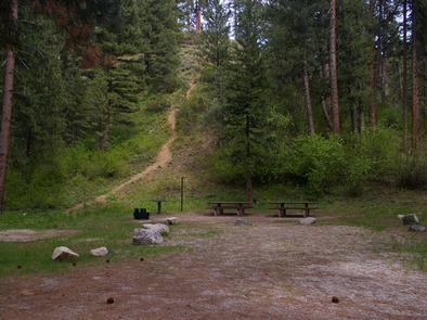
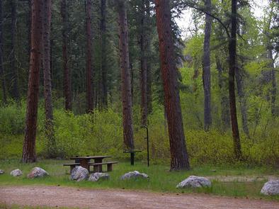
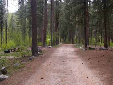
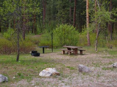
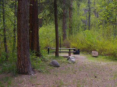
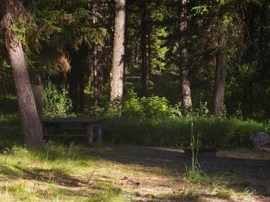
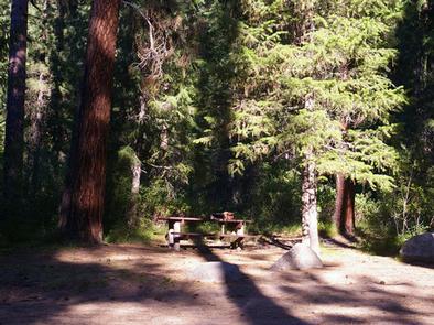
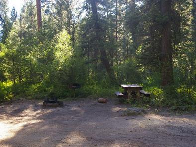
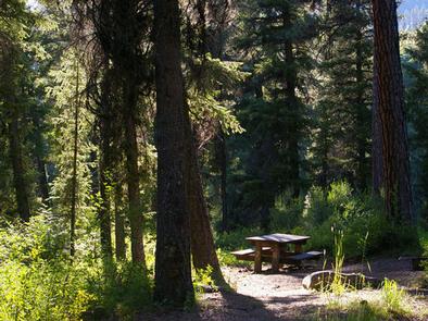
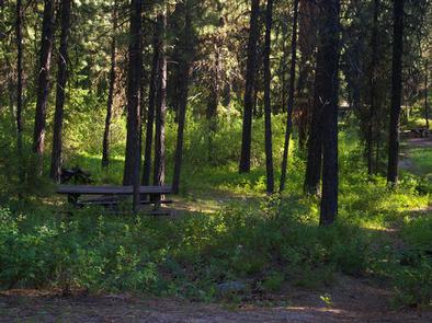
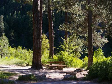
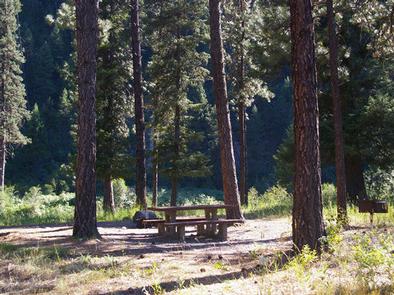
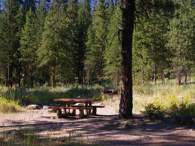
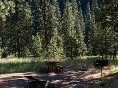
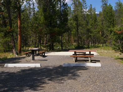
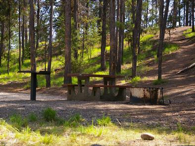
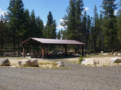
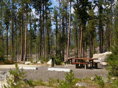
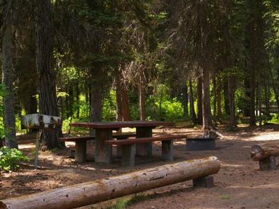
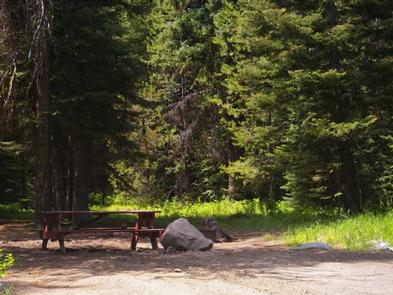
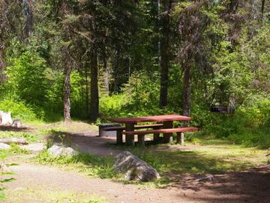
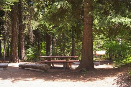
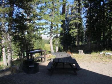
A picnic table and campfire ring with grill are provided outside. Drinking water is available from a nearby hand pump. A shed located behind the cabin is stocked with seasoned wood, a splitting maul, axe and hatchet. A vault restroom is located outside.

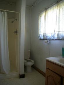
No electricity or propane is available. Guests must bring garbage bags to pack out their trash. Bedding, lighting and emergency supplies are not provided. Guests are responsible for cleaning the cabin before leaving.

Natural Features

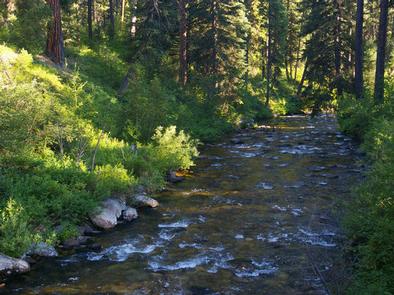
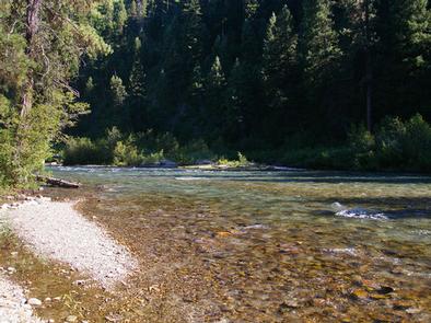
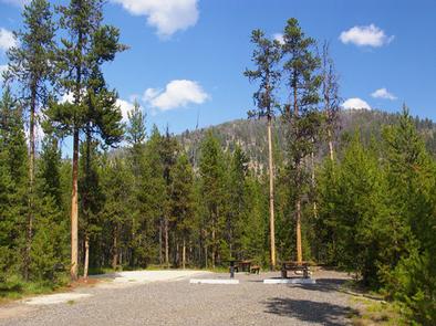
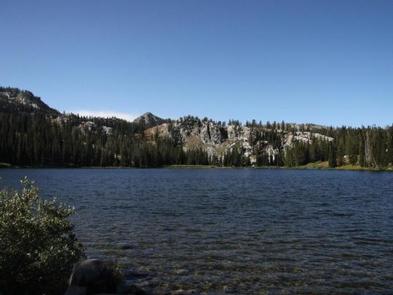
The cabin is located in a dense lodgepole pine forest close to the East Fork Roaring River at an elevation of 7,900 feet. It’s nestled among four subalpine lakes: Big Roaring River Lake, Little Roaring River Lake, Big Trinity Lake and Little Trinity Lake. The peaks of the Boise Mountains surround the cabins, and Trinity Mountain, the tallest in the range at 9,451 feet, is just to the south.

Snow can make this area inaccessible until early July, but soon afterward, the land is blanketed by colorful summer wildflowers. This area is a haven for elk and deer, but wildlife watchers may also spot an occasional black bear.

Nearby Attractions

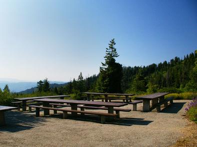
The summit of Trinity Mountain is the highest drivable point in Idaho, although the road may be blocked by snow until early July. A short, steep hike takes visitors to the lookout tower for panoramic views of several subalpine lakes and other mountains in the Boise Range.

Nearby Activities

  • Biking
  • Camping
  • Fishing
  • Hiking
  • Wildlife viewing
  • Canoeing
  • Non-motorized boating

Gallery

Directions

Travel east from Boise, Idaho on I-84 to Mountain Home. At I-84/Highway 20 junction, take Highway 20 east for 35 miles to Pine/Featherville turnoff. Travel north on Forest Highway 61 for 29 miles to Forest Road 172. Travel 15 miles northwest to Forest Road 129. Travel 3 miles to the Guard Station junction. The roadway is paved up to the junction of Forest Road 172. Forest Road 172 is native material (dirt) and trailer traffic is not recommended. There are signs noting each of the junctions.

GPS Coordinates

Latitude 43° 37′ 44.0000″ N

Longitude 115° 26′ 12.9998″ W

Categories
Uncategorized

BOILING SPRINGS CABIN

Overview

Boiling Springs Cabin is a popular destination for those who enjoy soaking in mineral hot springs that are adjacent to the cabin. Other hot springs are within the vicinity as well. Guests who stay here also have a variety of other recreational activities to enjoy, such as fishing, hiking, and off-road motor vehicle riding.

The cabin was renovated in 2012 and offers many conveniences, but guests should bring some supplies and equipment to ensure a comfortable and enjoyable stay.

The cabin is accessible by car in warmer months and by snowmobile in winter. Guests arriving in snowy conditions should be prepared to snowmobile 11 miles to the cabin from the Middle Fork snowmobile parking lot.  

Recreation

Numerous hiking, biking, horse and off-road vehicle trails are in the vicinity, including the Middle Fork Trail. Many miles of groomed snowmobile trails criss-cross the area in winter. Snowshoers and cross-country skiers can also use the trails in winter.

Sections of the Middle Fork Payette River offers opportunities for rafting, canoeing, kayaking, and swimming. Anglers can fish for rainbow and bull trout. Big game hunting is a popular activity in the surrounding mountains.

Guests can soak in the on-site hot springs during their stay, and a few other hot springs are also nearby for soaking.

Facilities

The cabin accommodates five people. Sleeping quarters consist of one bedroom with wood stove and includes three single beds (one providing a trundle bed) with mattresses. A couch, table and chairs, sink, propane cook range and refrigerator, and wood stove are located in the front room. Some dishes, pots and pans, and other kitchenware are available. Firewood is provided October 15 through December 31, but it may need to be split.

A vault toilet, picnic table and campfire ring are located outside the cabin. Camp hosts are available during the summer months at Trail Creek Campground and Boiling Springs Campground.

Potable water is available (hand pump outside) during the summer season only. Electricity is not available. Guests need to supply their own lighting and garbage bags. Guests are expected to clean the cabin before leaving. Bedding, pillows, and an axe are not provided.

Natural Features

Boiling Springs Cabin is located at an elevation of 4025 ft. in a narrow mountain valley situated between a hot springs, a stream, and the Middle Fork Payette River. The surrounding mountains are steep and densely forested with conifers, but the cabin sits in an open meadow with little shade.

Wildlife enthusiasts may spot nesting ospreys along the Middle Fork Payette River. Elk and deer are often spotted grazing along its banks. Bald eagles, hawks, quail and a variety of waterfowl also inhabit the area.

Nearby Activities

  • Biking
  • Boating
  • Camping
  • Fishing
  • Hunting
  • Winter sports
  • Swimming site

Gallery

Directions

In summer: from Crouch, take Middle Fork Road/Forest Road 698 north 24 miles to the cabin.

In winter, all access is over snow. From Crouch, take Middle Fork Road (Forest Road 698) north 13 miles to the snowmobile parking lot at the end of the plowed road on FR 698, just north of Tie Creek Campground. Distance to the cabin from the trailhead is 11 miles.

GPS Coordinates

Latitude 44° 21′ 51.0001″ N

Longitude 115° 51′ 24.0001″ W

Categories
Uncategorized

THIRD FORK CABIN

Overview

Third Fork Cabin is a former guard station, first established in 1906 as Station 10 and renamed Third Fork in 1908. A cabin was built at that time, which
existed until the site was rebuilt by the Civilian Conservation Corps in 1933. The current cabin’s exterior has changed little since that time, with the exception of a metal roof being added sometime before 1984.
The cabin is available between mid-April until late-October, and is accessible by car. Many modern comforts are provided at the cabin, but guests may need to bring some additional supplies and gear for their stay.

Recreation

Anglers can fish in adjacent Squaw Creek, and big game hunting is also a popular pastime.

Facilities

This rustic cabin sleeps four people with one double bed and two single beds with mattresses. Other amenities include a propane cook range, table with chairs, hot water heater, indoor flush toilet, shower and propane heater and refrigerator. A picnic table, campfire ring and pedestal grill sit within the fenced yard.

A camp host is located at Antelope Campground, 18 miles east in the Sagehen Reservoir area, where firewood can be purchased.

While the water at the cabin is potable, guests should bring their own supply of drinking water as a back-up. Bedding, lighting, cookware and utensils are not provided. Guests are expected to clean the cabin before leaving.

Natural Features

Third Fork Cabin sits in a steep mountain landscape heavily forested with old-growth Ponderosa pine at an approximate elevation of 4,700 feet. Tall grasses and various hardwoods grow on the site. Small mountain streams containing native fish flow nearby, and the area is marked by unusual juxtapositions of basalt and granitic rock.

Wildlife watchers may spot elk or deer wandering through the area during dawn or dusk, as well as glimpse a bear or moose. Birders can look for a wide variety of bird species.

Nearby Attractions

Sagehen Reservoir is a popular recreation area about 18 miles east of the cabin, offering numerous trails for off-road vehicles, hiking, mountain biking and horseback riding. Click here for an Idaho OHV safety message. Fishing and boating are permitted in the reservoir, and there is also a picnic area at Sagehen Dam.

Nearby Activities

  • Biking
  • Camping
  • Fishing
  • Hiking
  • Hunting
  • Wildlife viewing

Gallery

Directions

From Boise, Idaho, take Highway 55 north to Horseshoe Bend. Turn left on Highway 52 and drive west 9 miles to the junction at Sweet/Ola Highway (no road number), then
take a slight right. Take this road north 17 miles to Ola. Make a slight left and continue north through Ola on Road 618 (Third Fork Road) to the Third Fork Cabin.
This road changes from pavement to gravel a few miles north of Ola. Third Fork Cabin will be on the right-hand side of Rd. 618.

GPS Coordinates

Latitude 44° 22′ 23.0002″ N

Longitude 116° 18′ 2.9999″ W

Categories
Uncategorized

SHAFER BUTTE

Overview

Shafer Butte is located atop the scenic Boise Ridge Mountains, near Bogus Basin Mountain Recreation Area, at an elevation of 7,000 feet. Visitors enjoy hiking and biking on various trails in the surrounding area, and simply relaxing and taking in the area’s beautiful views.

Recreation

Popular activities in the area include hiking and mountain biking, the Mores Mountain Trail begins in the campground. This 2-mile interpretive nature trail is family friendly.

Facilities

Shafer Butte contains single-family tent campsites and two day-use, group picnic areas, all of which are accessible. Sites are equipped with picnic tables and campfire rings, and many of the overnight campsites have tent pads. The overnight sites are walk-in and are clustered close together, with limited vegetation screening for privacy.
Accessible vault restrooms are provided, but there is no electricity. Parking spurs and pathways within the campground are paved, and each site can be accessed via a short walking path from the parking area.

Natural Features

Shafer Butte offers scenic views of Deer Point, Mores Mountain and Shafer Butte summits, as well as the expansive valley below. The campground is situated among Douglas fir and aspen trees, which offer partial shade in most sites. Wildlife and summer wildflowers are abundant in the area.

Nearby Attractions

Bogus Basin Mountain Recreation Area is close by and offers more hiking and biking trails, as well as other summer activities, check out this link for more information http://bogusbasin.org. The Ridge to River trail system is near by as well, check out this link for more information http://www.ridgetorivers.org

Nearby Activities

  • Biking
  • Camping
  • Hiking
  • Wildlife viewing

Gallery

Directions

From Boise, Idaho, travel along Bogus Basin Road for approximately 20 miles. The last three miles are on a gravel road. Turn right (east) on the signed gravel road and travel just over a mile to the campground and picnic area.

GPS Coordinates

Latitude 43° 46′ 59.0002″ N

Longitude 116° 5′ 3.0001″ W

Categories
Uncategorized

DOG CREEK (ID)

Overview

Dog Creek Campground is located on the banks of Dog Creek, at the foot of the Trinity Mountain Range. It is four miles from the town of Pine, in south-central Idaho. Visitors enjoy fishing, swimming and exploring local trails.

Recreation

The South Fork Boise River is less than a quarter-mile away from the campground, offering rafting, swimming and fishing for rainbow trout. Paradise Hot Springs is nearby.

Green Creek Trail 270, a 4.5-mile trail for hiking, horseback riding, biking and off-road vehicles, begins a mile from the site. Cross Cut Trail 172 begins close by and is open to hiking, biking, horseback riding and off-road vehicles.

Facilities

This quiet campground sits off the main road. It offers two small group campsites that can accommodate up to 15 people each. Eleven single-family campsites are available as well. Vault toilets and drinking water are provided. Roads and parking spurs within the campground are gravel.

Natural Features

The campground is situated in a scenic ponderosa pine forest, at an elevation of 4,600 feet. Summer wildflowers are plentiful and deer and hummingbirds frequent the area.

Nearby Attractions

Baumgartner Hot Springs is approximately 16 miles away with a soaking pool and nature trail. Kelly Creek Flats Recreation Area is adjacent to Baumgartner, with several more trail opportunities.

Nearby Activities

  • Biking
  • Boating
  • Camping
  • Fishing
  • Hiking
  • Wildlife viewing
  • Swimming site

Gallery

Directions

From Mountain Home, travel east on Highway 20 for 35 miles, to the turnoff for Pine/Featherville (Forest Highway 61). Travel north on Highway 61 for 23 miles to the campground.

GPS Coordinates

Latitude 43° 31′ 45.0001″ N

Longitude 115° 18′ 15.0001″ W

Categories
Uncategorized

PARK CREEK (IDAHO)

Overview

Park Creek Campground is located 4 miles from Lowman, Idaho, off the beaten path at the confluence of Park and Clear Creeks. Visitors enjoy fishing, hunting and exploring local trails.

Recreation

Park Creek and Clear Creek both offer good trout fishing. Various hiking, biking, horseback and off-road vehicle riding trails are in the vicinity.

Facilities

The campground contains two group sites available by advanced reservations, each can accommodate up to 100 people per group site. The Rainbow Group Site are sites 1-12, and the Trout Group Site are sites 13-24. Picnic tables, campfire rings and grills are provided, as are vault toilets, drinking water and trash collection. Roads and parking spurs are dirt.

When not reserved as a group site, the sites are available on a first-come, first-served basis. If both Rainbow and Trout Group Sites are reserved there will be no first-come, first-served sites available. Prior to arrival, please check the campground status on the reservation board on the 582 road located 300 feet north of the 21 junction to see if there are any pending reservations.

Natural Features

Towering Ponderosa pine and Douglas fir trees forest the campground, offering plentiful shade. Summer wildflowers dot the landscape. A variety of wildlife lives in the area, including black bears, deer and elk.

Nearby Attractions

Beautiful Bear Valley is up the road from Park Creek, offering scenic views, wildlife watching and numerous trail opportunities for hiking, biking, horseback and off-road vehicle riding.

Several natural hot springs pools can be found along the Banks-Lowman Highway, also known as the Wildlife Canyon Scenic Byway, and Highway 21, the Ponderosa Pine Scenic Byway. Both byways also offer pretty scenery, wildlife viewing, historical information kiosks and trail opportunities.

Whitewater rafting and kayaking are popular activities on the South Fork and Main Payette Rivers; several companies in the area offer guided half and full-day trips.

Nearby Activities

  • Biking
  • Boating
  • Historic & cultural site
  • Camping
  • Fishing
  • Hiking
  • Hunting
  • Visitor center
  • Wildlife viewing

Gallery

Directions

From Boise, Idaho, take Highway 55 to Banks. Turn east and travel Forest Highway 24/Banks-Lowman Highway to Lowman. Turn left onto Highway 21 and immediately turn left onto Forest Road 582/Clear Creek Road. Proceed 3.6 miles to the campground.

GPS Coordinates

Latitude 44° 7′ 3.0000″ N

Longitude 115° 34′ 54.0001″ W

Categories
Uncategorized

MOUNTAIN VIEW

Overview

Mountain View Campground is located just east of Lowman, Idaho, along Highway 21 at an elevation of 3,900 feet. Visitors enjoy rafting, kayaking and fishing on the South Fork Payette River, and soaking in the area’s many hot springs pools.

Recreation

The South Fork Payette River offers whitewater rafting, kayaking and trout fishing. The Deadwood and Danskin River Access areas are nearby.

Popular Kirkham Hot Springs is less than 3 miles from the campground, with several soaking pools on the river’s edge.

Facilities

The campground contains several single-family sites, all of which are accessible, each with a picnic table, campfire ring and grill. Vault toilets, drinking water and trash collection are provided. A campground host is on-site. Roads and parking spurs are paved.

Natural Features

Towering Ponderosa pines cover the campground, offering partial shade in most sites. Summer wildflowers dot the landscape. Deer and elk may be seen wandering through the area on occasion.

Nearby Attractions

Numerous natural hot springs pools can be found along Highway 21, the Ponderosa Pine Scenic Byway and the Banks-Lowman Highway, also known as the Wildlife Canyon Scenic Byway. Both byways offer scenic views, wildlife watching, historical information kiosks and several trail opportunities.

Whitewater rafting and kayaking are popular activities on the South Fork and Main Payette Rivers. Several companies in the area offer guided half and full-day trips.

Nearby Activities

  • Boating
  • Camping
  • Fishing
  • Hiking

Gallery

Directions

From Boise, Idaho, take State Highway 55 to Banks. Turn east on the Banks-Lowman Highway to Lowman. Turn left on Highway 21. Campground is at milepost 73.2 along Highway 21.

GPS Coordinates

Latitude 44° 4′ 41.9999″ N

Longitude 115° 36′ 9.0000″ W

Categories
Uncategorized

SHORELINE

Overview

Shoreline Campground is located just across the road from beautiful Warm Lake, at an elevation of 5,300 feet. Visitors enjoy boating, fishing, swimming, hiking and viewing local wildlife.

Recreation

Warm Lake offers great fishing opportunities for cutthroat, rainbow, lake and bull trout. Boating, canoeing and swimming are popular activities. Billy Rice Swim Beach is nearby, offering a day-use site for picnicking and swimming. A boat ramp is located just across the road from the campground.

The surrounding area offers great hiking, mountain biking, horseback and off-road vehicle riding, and hunting. The WeWuKiye (Wa Wu Kia) Trail No. 252 is popular among hikers and mountain bikers. It was recently built and can be accessed at the campground’s entrance.

For off-road vehicle enthusiasts, Telephone Ridge Trail No. 112 offers 20 miles of trails for all riding levels, with staging areas within the campground and at Warm Lake Campground just down the road.

Facilities

The campground contains several single and double campsites, most of which are accessible. An accessible group site with picnic shelter is also available and can accommodate up to 50 people. A volleyball court and horseshoe pits are located next to the group site.

Picnic tables, campfire rings and grills are available at the campsites. Vault toilets and drinking water are also provided. There is no electricity at the campground.

Natural Features

The campground is situated in a mixed-growth lodgepole pine forest, which offers partial shade. Summer wildflowers are abundant in the area. A variety of wildlife including bears, deer, elk, fox, grouse, eagles, osprey, grosbeaks, whooping cranes and otters, lives around the lake.

Nearby Activities

  • Biking
  • Boating
  • Camping
  • Fishing
  • Hiking
  • Hunting
  • Wildlife viewing
  • Swimming site

Gallery

Directions

From Boise, Idaho, travel 85 miles north on Highway 55 to Cascade. Turn east on Warm Lake Highway and go 25 miles to Forest Road 489. Turn south and continue a half-mile to the campground.

GPS Coordinates

Latitude 44° 39′ 15.0001″ N

Longitude 115° 39′ 52.9999″ W

Categories
Uncategorized

SAGEHEN CREEK

Overview

Sagehen Creek Campground is located on the shores of the scenic Sagehen Reservoir at an elevation of 4997 feet. Visitors enjoy boating, fishing, exploring Joe’s Creek Trail, as well as utilizing the non-motorized Sagehen Reservoir Trail.

Recreation

Sagehen Reservoir offers great boating, canoeing, and rainbow trout fishing. A boat ramp and dock are located within the campground.There is a 15 mph speed limit on the reservoir.

Hiking, biking, horse, and ATV trails are abundant in the area, including Joe’s Creek Trail, which begins not far from the campground.
The Sagehen Reservoir Trail, a 4-mile loop around the lake, offers great fishing spots, beautiful viewpoints and wildlife watching opportunities for hikers, mountain bikers and horseback riders.

The Sagehen and KYAOTT ATV Trail Systems can be accessed near the reservoir, offering more than 35 miles of trails for ATVs and motorcycles, but hikers, mountain bikers and horseback riders can enjoy these trails as well.

Facilities

The campground contains several single-family sites, a few of which are accessible, all with picnic tables and campfire rings. Vault toilets and hand-pumped drinking water are provided. Firewood is available for purchase from the host.

Natural Features

The campground is situated in a forest of towering Ponderosa pine, Engelmann spruce, Douglas fir, and grand fir, which provide plentiful shade in most sites. Some sites afford lake views. Summer temperatures range from 80 to 90-degree days to cooler nights.

A variety of berries and mushrooms can be found throughout the area. Local wildlife includes deer, elk, black bear, goshawk, woodpeckers, and boreal owls.

Nearby Activities

  • Biking
  • Boating
  • Camping
  • Fishing
  • Hiking
  • Wildlife viewing

Gallery

Directions

From Horseshoe Bend, Idaho take Highway 52 for 9 miles west to the junction with the Sweet/Ola Highway. Turn north and travel 16 miles to Ola, Idaho. Travel north through Ola and follow FS Rd 618, 18 miles to Sagehen Reservoir (FS Road 626). Turn right and continue on FS Rd 626 for 7 miles. Take a left on FS Rd 614 and travel about 2 miles to Sage Hen Reservoir. Sagehen Campground is on the east side of the reservoir.

GPS Coordinates

Latitude 44° 20′ 6.0000″ N

Longitude 116° 10′ 39.0000″ W

Categories
Uncategorized

RAINBOW POINT

Overview

Rainbow Point Campground is located next to scenic Lake Cascade in west central Idaho. It is near the town of Donnelly, at an elevation of 4,850 feet. Boating, fishing, swimming and hiking are popular activities in this scenic region.

Recreation

Lake Cascade offers excellent opportunities for boating, water skiing, canoeing, windsurfing and sailing. Anglers enjoy casting for rainbow trout, coho salmon, smallmouth bass and perch. A boat ramp is located within the campground. Many hiking and biking trails are in the area as well.

Facilities

This small campground offers single-family campsites. Each is equipped with a picnic table, campfire ring and grill. Some sites have lake views and shoreline access.

Vault toilets, drinking water and trash collection are provided, but electricity is not available at the campground. Roads and parking spurs within the facility are gravel.

Natural Features

The campground is situated on the west shore of the lake, among a mixed-growth conifer forest that towers over the campground. Summer wildflowers are abundant.

A wide variety of wildlife makes its home around the lake. Waterfowl and songbirds can also be seen in the area, as well as pelicans and bald eagles.

Nearby Activities

  • Boating
  • Camping
  • Fishing
  • Water sports
  • Wildlife viewing
  • Swimming site

Gallery

Directions

From Boise, Idaho, travel north on Highway 55 for 95 miles to Donnelly. Turn west on West Roseberry Road and go 1.5 miles to Norwood Road. Turn south and continue a mile to Tamarack Falls Road. Turn west and go just over a mile to West Mountain Road. Turn south and go a mile to the campground.

GPS Coordinates

Latitude 44° 42′ 15.0001″ N

Longitude 116° 7′ 54.9998″ W