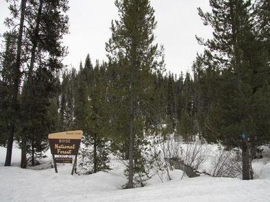
Categories
Uncategorized

SILVER CREEK CAMPGROUND

Overview

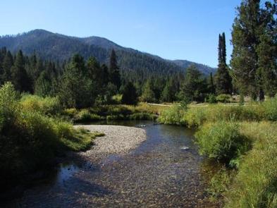
Silver Creek Campground is located 25 miles north of Garden Valley, Idaho, in beautiful Peace Valley at an elevation of 4,490 feet. Peace Valley offers a variety of great trails. Fishing and hunting are popular activities as well.

Recreation

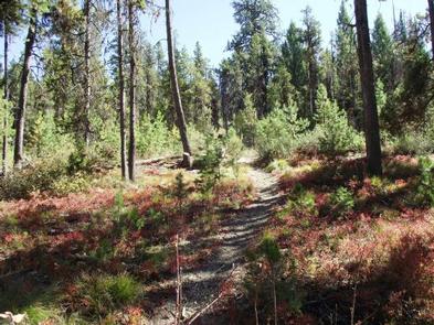
Peace Valley contains many trails for hiking, mountain biking, as well as horseback and OHV riding. Peace Creek Trail, Silver Creek Summit Trail, and Bull Creek Trail all begin nearby.

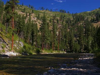
Silver Creek, Peace Creek, and the nearby Middle Fork Payette River offer good-to-excellent fishing most of the year. Anglers in the area cast for whitefish and rainbow trout.

In-season big game hunting for deer, elk and bear is a popular activity in the surrounding mountains.

Facilities

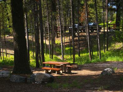
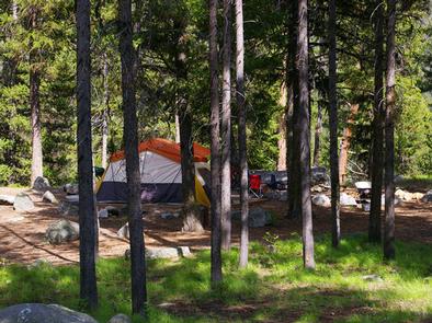
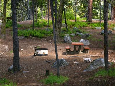
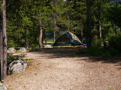
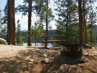
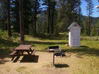
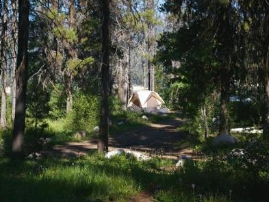
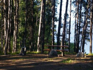
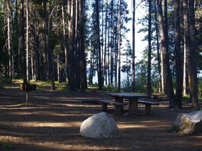
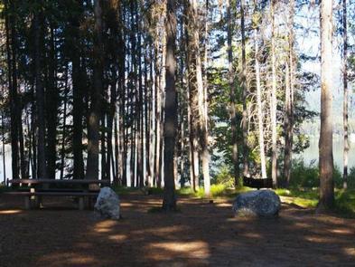
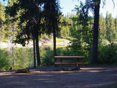
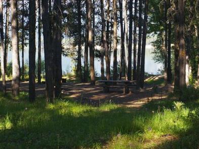
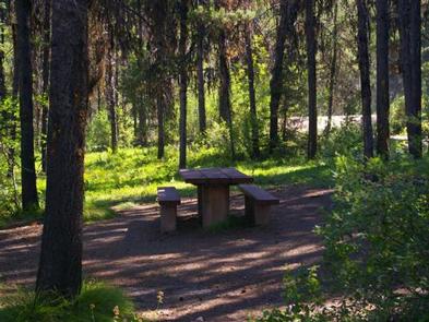
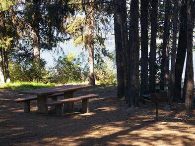
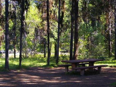
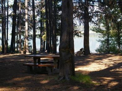
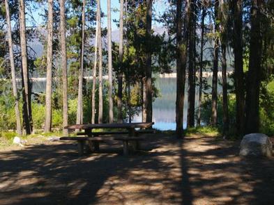
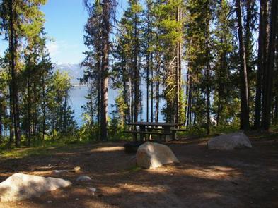
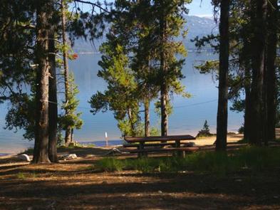
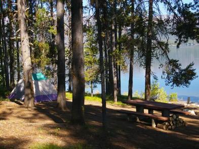
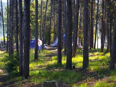
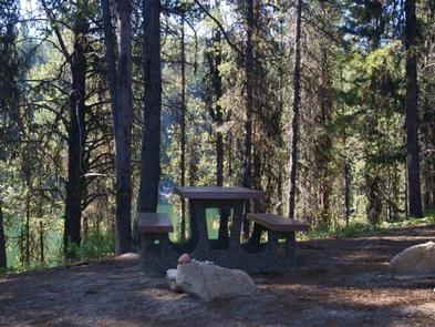
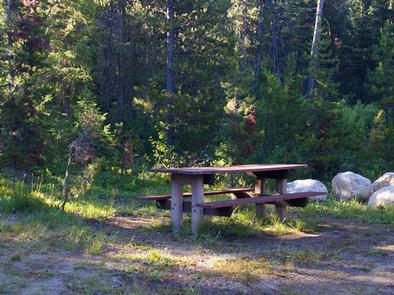
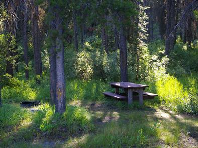
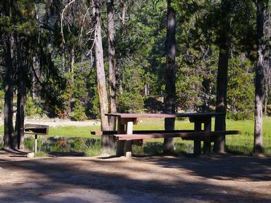
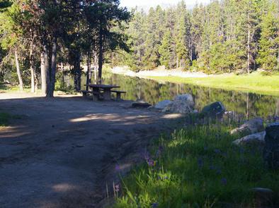
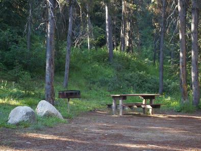
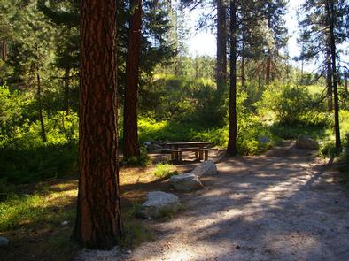
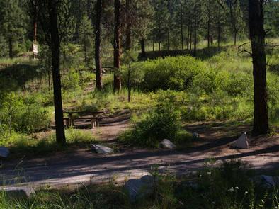
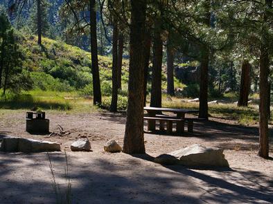
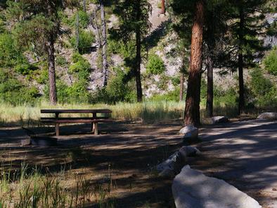
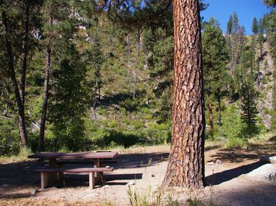
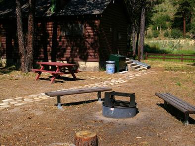
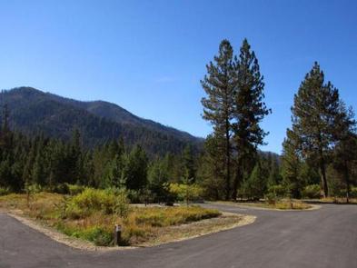
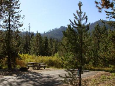
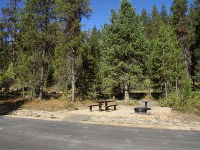
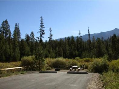
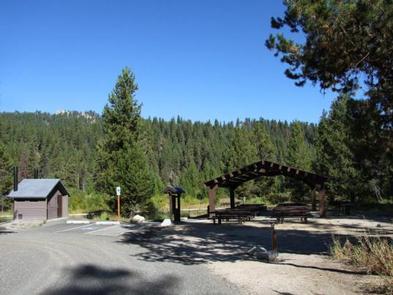
This campground offers paved roads and paved parking spurs, drinking water, and accessible vault toilets. Many single and double campsites are available, all of which are accessible. Each site is equipped with a tent pad, a fire ring, as well as picnic and utility tables.

Two accessible group campsites are available with picnic shelters, multiple tables, campfire rings, grills, and ample parking. The Lodgepole Springs group site can accommodate up to 80 people, while the Cabin Creek group site can accommodate up to 100 people.

Natural Features

The campground is situated among a mixed-growth lodgepole pine forest, which provides partial shade. Silver Creek runs alongside the campground.

A variety of wildlife makes its home in and around Peace Valley, including deer, elk, bald eagles, and red-tailed hawks.

Nearby Attractions

Silver Creek Plunge, a privately developed hot springs resort, is within a quarter-mile from the campground. It offers a hot springs pool, general store, concessions, a playground, horseshoe pits, as well as volleyball and basketball courts.

Nearby Activities

  • Biking
  • Camping
  • Fishing
  • Hiking
  • Hunting
  • Wildlife viewing
  • Other recreation concession site
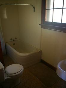
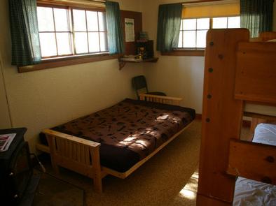
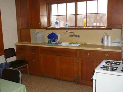
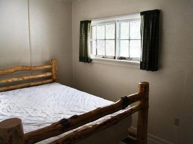
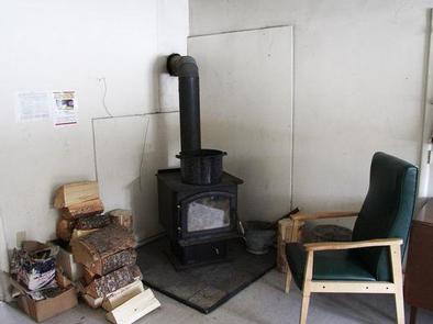
Gallery

Directions

From Boise, travel north on Highway 55 to Banks. Turn east on the Banks-Lowman Highway and continue east for 8 miles toward Garden Valley. Turn north on Middle Fork Road (Forest Road 698) and pass through Crouch, continuing north on the Middle Fork Road approximately 16 miles to Silver Creek Road (Forest Road 671). Turn northeast on Silver Creek Road and continue 8 miles to the campground.

GPS Coordinates

Latitude 44° 19′ 50.9999″ N

Longitude 115° 48′ 15.0001″ W

Categories
Uncategorized

PICNIC POINT (ID)

Overview

Picnic Point Campground is located on a bluff overlooking beautiful Warm Lake, at an elevation of 5,300 feet. Visitors enjoy boating, fishing, swimming, hiking and viewing local wildlife.

Recreation

Warm Lake offers great fishing opportunities for cutthroat, rainbow, lake and bull trout. Boating, canoeing and swimming are popular activities. A boat ramp is located at neighboring Shoreline Campground. Billy Rice Swim Beach is within walking distance, offering a day-use site for picnicking and access to a swimming beach.

The surrounding area offers great hiking, mountain biking, horseback and off-road vehicle riding and hunting. The WeWuKiye (Wa Wu Kia) Trail No. 252 was recently built and can be accessed nearby, at the entrance to Shoreline Campground. It is available for hiking and mountain biking.

For off-road vehicle enthusiasts, Telephone Ridge Trail No. 112 offers 20 miles of trails for all riding levels, with staging areas at Shoreline Campground and at Warm Lake Campground down the road.

Facilities

The campground offers tent-only campsites, which can be accessed via a 50 to 200 foot hike from the parking area. Some sites overlook the scenic lake. Stairs lead to the lakeshore from three locations within the campground.

Sites are equipped with a table, campfire ring and grill. Vault toilets, drinking water and trash collection are provided throughout the campground, but electricity is not available. The parking area is dirt, as are the pathways within the campground.

Natural Features

The campground is situated beneath towering ponderosa pines, which provide partial shade. Summer wildflowers are abundant in the area. A variety of wildlife including bears, deer, elk, fox, grouse, eagles, osprey, grosbeaks, whooping cranes and otters, lives around the lake.

Nearby Attractions

Rustic North Shore Lodge is not far from the campground, offering a small restaurant, lounge and store with limited supplies.

Nearby Activities

  • Biking
  • Boating
  • Camping
  • Fishing
  • Hiking
  • Wildlife viewing
  • Swimming site

Gallery

Directions

From Cascade, turn east on Warm Lake Highway. Travel approximately 26 miles along the paved road to Forest Road 489 and turn south. Continue about a half-mile past the Shoreline Campground and North Shore Lodge. The campground will be located just past the lodge, on the left side of the road.

GPS Coordinates

Latitude 44° 39′ 2.9999″ N

Longitude 115° 40′ 21.0000″ W

Categories
Uncategorized

ATLANTA CABIN

Overview

Atlanta Cabin is located in the old mining town of Atlanta, Idaho, at an elevation of 5,800 feet. It is part of a historic ranger station compound built by the Civilian Conservation Corps and the Forest Service in 1933. This compound, known as the Atlanta Ranger Station Historic District, is listed on the National Register of Historic Places.

The roads to the cabin are generally well-maintained, although there are some rough washboard sections. Guests can drive to the cabin, but should check local conditions prior to arrival, since inclement weather may make accessing the cabin difficult. Atlanta Cabin offers many creature comforts so guests can have an enjoyable stay.

Recreation

The Middle Fork Boise River Trail and the Powerplant Trail begin nearby, offering great opportunities for hiking and horseback riding. Off-road enthusiasts will find many trails to explore. Click here for an Idaho OHV safety message.

The Middle Fork Boise River provides excellent trout fishing. Big game hunting is another popular pastime in the area. Guests can also soak in the nearby hot springs.

Facilities

The cabin is equipped with a modern plumbing system and electricity. It can accommodate up to four people with a twin day bed with a trundle in the living room and a queen size bed in the kitchen.

The kitchen has a sink with hot water, a table with chairs, a propane stove and a refrigerator. The indoor bathroom features a flush toilet, sink and shower. A broom and dustpan are provided.

Propane wall heaters keep the cabin warm. A picnic table, fire ring and pedestal grill are located behind the cabin.

Bedding, pillows and towels are not available. Guests should be prepared to wash the dishes and tidy up the cabin before leaving.

Natural Features

The cabin is surrounded by a grassy meadow and lodgepole pines. The front porch offers great views of the edge of the Sawtooth Wilderness and 9,363′ Greylock Mountain.

The Middle Fork Boise River is about a quarter-mile away. Several natural hot springs are in the area, including Atlanta, Powerplant and Chattanooga. This area is a favorite of wildlife watchers, who may see mule deer, Rocky Mountain elk, chukars, wild turkeys, eagles and the occasional black bear or wolf.

Nearby Attractions

The town of Atlanta has a colorful history with interesting buildings and streets to explore. It was settled in the 1860s during a gold and silver rush, and visitors can still see remnants of this period. The local watering hole offers a chance to eat out and play pool or shuffleboard.

Nearby Activities

  • Biking
  • Historic & cultural site
  • Camping
  • Fishing
  • Hiking
  • Horseback riding
  • Hunting
  • Wildlife viewing

Gallery

Directions

From Idaho City, take State Highway 21 north 18 miles to Crooked River/Little Owl Road #384. Turn right and stay on #384 for 13.5 miles to the North Fork Boise River Road #327. Turn left and stay on #327 for 13 miles to Middle Fork Boise River Road #268. Turn left on #268 and drive approximately 17 miles upriver to Atlanta. When entering Atlanta, take the first left onto Road #205 and drive 1/4 mile to the Atlanta Cabin within the historic ranger station compound. It is the first cabin on the left with a "Recreation Cabin" sign out front. These roads are generally in good, yet somewhat rough conditions and can be traveled – weather permitting – by 2WD passenger cars or trucks.

GPS Coordinates

Latitude 43° 48′ 10.0001″ N

Longitude 115° 7′ 41.9999″ W

Categories
Uncategorized

BARNEYS

Overview

Barneys Campground is located on the northeast shore of scenic Deadwood Reservoir at an elevation of 5,300 feet. Boating, fishing and hiking are popular activities at this site.

Please click here for further information about the facility and recreation opportunities in the area.

Recreation

Because of its remote location, Deadwood Reservoir is quiet and unpopulated, making for great fishing for Atlantic, Chinook and Kokanee salmon, and rainbow and cutthroat trout. Boating, water skiing, canoeing and kayaking are popular on the lake. A boat ramp is located about 2 miles away at Cozy Cove Campground.

Many trails for hiking, mountain biking, horseback and ATV riding are in the area.

Facilities

This primitive campground offers waterfront sites with direct shoreline access. Vault toilets and drinking water are provided, but there is no electricity. Roads and parking spurs within the site are dirt.

Natural Features

The campground is situated in a mixed-growth pine forest, which offers plentiful shade. Summer wildflowers are abundant. The entire campground affords views of the reservoir.

Nearby Activities

  • Boating
  • Camping
  • Fishing
  • Hiking
  • Water sports

Gallery

Directions

From Boise, Idaho, take State Highway 55 north. At Banks, take Highway 17 east (Banks-Lowman Highway) to Lowman. Turn left on Highway 21. Continue along Highway 17 over Banner Summit. Turn west on Forest Road 579. Continue on FR 579 to Deadwood Reservoir.

GPS Coordinates

Latitude 44° 20′ 2.1001″ N

Longitude 115° 39′ 0.2599″ W

Categories
Uncategorized

HOWERS

Overview

Howers Campground is located on the northeast shore of the scenic Deadwood Reservoir in western Idaho. Boating, fishing and hiking are popular activities in this remote area.

Please click here for further information about the facility and recreation opportunities in the area.

Recreation

Because of its remote location, Deadwood Reservoir is quiet and unpopulated, making for great fishing for Atlantic, Chinook and Kokanee salmon, as well as rainbow and cutthroat trout.

Boating, water skiing, canoeing and kayaking are popular on the lake, and a boat ramp is located about two miles away at Cozy Cove Campground.

Several trails for hiking, mountain biking, horseback and off-road vehicle riding wind around the lake shore and surrounding landscape.

Facilities

This primitive campground offers waterfront sites with direct shoreline access. Vault toilets and drinking water are provided, but there is no electricity. Roads and parking spurs within the site are dirt.

Natural Features

The campground is situated in a mixed-growth pine forest, offering plenty of shade. Summer wildflowers are abundant, and the campground affords sweeping views of the reservoir.

Nearby Activities

  • Biking
  • Boating
  • Camping
  • Fishing
  • Hiking
  • Water sports

Gallery

Directions

From Boise, Idaho, take State Highway 55 north. At Banks, take Highway 17/Banks-Lowman Highway east to Lowman. Continue along Highway 17 over Banner Summit. Turn west on Forest Road 579 and continue into the campground.

GPS Coordinates

Latitude 44° 19′ 25.0000″ N

Longitude 115° 38′ 55.0000″ W

Categories
Uncategorized

COZY COVE

Overview

Cozy Cove Campground is located on the southeast shore of scenic Deadwood Reservoir at an elevation of 5,300 feet. Boating, fishing and hiking are popular activities.

Please click here for further information about the facility and recreation opportunities in the area.

Recreation

Because of its remote location, Deadwood Reservoir is quiet and unpopulated, making for great fishing for Atlantic, Chinook and Kokanee salmon, and rainbow and cutthroat trout. Boating, water skiing, canoeing and kayaking are popular on the lake. A boat ramp is located on-site.

Many trails for hiking, mountain biking, horseback and off-road vehicle riding are in the area.

Facilities

This primitive campground offers several campsites, many of which are on the waterfront. Vault toilets and drinking water are provided. Roads and parking spurs within the site are dirt.

Natural Features

The campground is situated on a bluff overlooking the reservoir. All sites have lake views. A mixed-growth pine forest covers the campground, offering plentiful shade. Summer wildflowers are abundant.

Nearby Activities

  • Boating
  • Camping
  • Fishing
  • Hiking
  • Water sports

Gallery

Directions

From Boise, Idaho, take State Highway 55 north. At Banks, take Highway 17/Banks-Lowman Highway east to Lowman. Turn left on Highway 21. Continue along Highway 17 over Banner Summit. Turn west on Forest Road 579. Continue on FR 579 to Deadwood Reservoir. The campground is on the southeast end.

GPS Coordinates

Latitude 44° 17′ 27.6400″ N

Longitude 115° 39′ 7.4002″ W

Categories
Uncategorized

RIVER SIDE (ID – BOISE)

Overview

River Side Campground is located along the Deadwood River at the north end of scenic Deadwood Reservoir at an elevation of 5,300 feet. Boating, fishing and hiking are popular activities.

Recreation

Because of its remote location, Deadwood Reservoir is quiet and unpopulated, making for great fishing for Atlantic, Chinook and Kokanee salmon, and rainbow and cutthroat trout. Boating, water skiing, canoeing and kayaking are popular on the lake. A boat ramp is located about 2 miles away at Cozy Cove Campground.

Many trails for hiking, mountain biking, horseback and off-road vehicle riding are in the area.

Facilities

This primitive campground offers waterfront sites with direct river access. A vault toilet is located up a hill above the campground. Drinking water is provided. Roads and parking spurs within the site are dirt.

Natural Features

The campground is situated in a mixed-growth pine forest, which offers plentiful shade. Summer wildflowers are abundant. The entire campground affords views of the river.

Nearby Activities

  • Boating
  • Camping
  • Fishing
  • Hiking
  • Water sports

Gallery

Directions

From Boise, Idaho, take State Highway 55 north. At Banks, take Highway 17/Banks-Lowman Highway east to Lowman. Turn left on Highway 21. Continue along Highway 17 over Banner Summit. Turn west on Forest Road 579. Continue on FR 579 to Deadwood Resevoir.

GPS Coordinates

Latitude 44° 20′ 51.0000″ N

Longitude 115° 39′ 47.0002″ W

Categories
Uncategorized

BLACK ROCK

Overview

Black Rock Campground is located 20 miles from Idaho City, on the North Fork Boise River, at an elevation of 4,300 feet. Visitors enjoy fishing, swimming and exploring local trails.

Recreation

The North Fork Boise River offers rainbow trout fishing in a beautiful natural setting. Many swimming holes can be found within a short distance of the campground.

Numerous trail opportunities for hiking, mountain biking, horseback riding and dirt biking can be found in the vicinity.

Facilities

The campground contains several single-family campsites, each equipped with a picnic table and campfire ring. Some sites also have grills. Vault toilets, drinking water and trash collection are provided within the campground. Roads and parking spurs are dirt.

Natural Features

The campground sits on the banks of the North Fork Boise River, where ponderosa pines tower over the area. Most campsites have partial shade, but little privacy from other campers. A variety of wildlife makes its home around the campground.

Nearby Activities

  • Biking
  • Camping
  • Fishing
  • Hiking
  • Wildlife viewing
  • Swimming site

Gallery

Directions

From Idaho City, travel north on State Highway 21 for about two miles, to the Granite Creek/Rabbit Creek Road No. 327. Turn right and travel east for 18 miles on Road No. 327, to the campground.

GPS Coordinates

Latitude 43° 47′ 43.0001″ N

Longitude 115° 35′ 13.9999″ W

Categories
Uncategorized

BARBER FLAT CABIN

Overview

The Barber Flat Cabin site was established for administrative use by the Forest Service in 1923, and was used prior to that by the Barber Lumber Company. At the time, the Forest Service used a cabin already on-site as a guard station and then built a new one in 1927. The current cabin and outbuildings were built by the Civilian Conservation Corps in 1935, and the cabin today looks much as it did back then.

Guests can drive to Barber Flat Cabin in two-wheel drive passenger cars or trucks, although the roads may occasionally be rough. The cabin provides most of the conveniences needed for a comfortable stay.

Recreation

Several multi-use trails run east and west from the cabin. Hikers and mountain bikers can access the Barber Flat Trailhead nearby, and the Hungarian/Sunset Trail is located just across the road about 200 yards north of the cabin. Other trails in the area include the Beaver Creek/Grand Mountain Trail and the Short Creek Trail, which is known as a haven for nesting ospreys.

The river offers great rainbow trout fishing and many swimming holes. Seasonal big game hunting is another popular pastime in the surrounding area.

Facilities

The cabin can sleep six people on two bunkbeds and a futon, and mattresses are provided. The kitchen is equipped with a table and chairs, cookware, dishes, utensils, a propane stove, refrigerator and sink with hot water. The bathroom has a sink, bathtub and flush toilet.

A wood stove is provided for heat and firewood may be gathered from the surrounding forest. A picnic table and campfire ring with benches are located outside. Trash and recycle bins are behind the cabin.

The cabin has no electricity. Bedding, pillows and towels are not provided. Guests should use the broom and dustpan provided to tidy up the cabin before leaving.

Natural Features

Barber Flat Cabin is situated near the North Fork Boise River among towering Ponderosa pines at an elevation of about 4,300 feet. The cabin is surrounded by the Boise Mountains and tucked beneath Hungarian Ridge.

Osprey nests are a common sight around Barber Flat. Visitors to this area may see other wildlife, such as mule deer, Rocky Mountain elk, chukars, wild turkeys, eagles and the occasional black bear or wolf.

Nearby Activities

  • Biking
  • Camping
  • Fishing
  • Hiking
  • Hunting
  • Wildlife viewing

Gallery

Directions

From Idaho City, take State Highway 21 for 2 miles to Granite Creek Road #327. Turn right and travel approximately 25 miles to the cabin. The road becomes North Fork Boise River Road. Please drive carefully as this road is heavily traveled.

GPS Coordinates

Latitude 43° 49′ 18.9998″ N

Longitude 115° 32′ 12.0001″ W

Categories
Uncategorized

BEAVER CREEK CABIN (ID)

Overview

The Beaver Creek Cabin site was established for administrative use in 1912. The current dwelling was built in the 1930s by the Civilian Conservation Corps using standard blueprints for that time.

Beaver Creek Cabin is open year-round. It’s accessible by car in the summer months and by snowshoes or cross-country skis in winter. Guests arriving in winter should park at the Whoop-Um-Up Park N’ Ski Area (permit required) and access the 1.5 mile Pilgrim Trail to reach the cabin. The trail is moderately difficult in normal conditions, and guests are responsible for their own safety.

The cabin offers many creature comforts for an enjoyable stay. However, several of the amenities are only available seasonally. Guests should be prepared to bring certain supplies or gear according to the season.

Recreation

Numerous hiking, biking, horse, off-road vehicle and motorcycle trails are in the vicinity. Click here for an Idaho OHV Safety Message. During the winter months, miles of cross-country ski and snowshoe trails are right out the front door.

The Crooked River, Beaver Creek and beaver ponds all offer good rainbow, brook and cutthroat trout fishing. The 1-mile Beaver Creek Trail leads to the Crooked River and several small swimming holes.

Good hunting can be found in this area in season.

Facilities

The cabin can accommodate a maximum of six people with two twin beds with mattresses and two futons in the living room. The kitchen is equipped with a sink, table, chairs and a propane stove. A wood stove provides heat. A picnic table and campfire ring are located outside. Be prepared to collect firewood during the summer months.

The indoor bathroom is open in the summer and equipped with a sink, flush toilet and shower. Water is only available from May 20th through September 15th. The propane refrigerator in the kitchen is only available during the summer. Garbage service is also provided in the summer months.

An outhouse with vault toilet is available for winter use. Firewood is available November- April in the woodshed. Be prepared to split your own wood.

The cabin does not have electricity, so guests must bring their own light sources along with extra batteries or propane. Bedding, towels and pillows are not available.

The cabin rental includes the group site across the driveway which has 5 picnic tables and 1 standard fire ring. RV’s and tents are allowed although there are no developed tent pads, it’s native surface. Tents are not allowed close to the cabin.

Natural Features

A mixed-growth pine forest surrounds the area, offering pretty scenery and partial shade. Several creeks and rivers flow nearby, the closest being Beaver Creek. The cabin is nestled within the Boise Mountain Range at an elevation of 5,100 feet.

Beavers are a common sight in this area, and several beaver ponds are nearby. Other wildlife includes mule deer, Rocky Mountain elk, chukars, wild turkeys, eagles and the occasional black bear or wolf.

Nearby Attractions

State Highway 21 is known as the Ponderosa Pine Scenic Byway. This 131-mile route starts in Boise and meanders through Boise, Salmon-Challis and Sawtooth National Forests with several points of interest along the way.

Nearby Activities

  • Biking
  • Camping
  • Fishing
  • Hiking
  • Hunting
  • Winter sports
  • Wildlife viewing

Gallery

Directions

In summer: from Idaho City, travel 20 miles northeast on State Highway 21. Turn right on Forest Road #362 and travel 1/2 mile to the cabin.

In winter: from Idaho City, travel approximately 18 miles northeast on State Highway 21 to the Whoop-Um-Up Parking Area. Ski or snowshoe 1.5 miles to the cabin on the Pilgrim Trail.

GPS Coordinates

Latitude 43° 58′ 1.9999″ N

Longitude 115° 36′ 47.9999″ W